Old Portage Road facts for kids

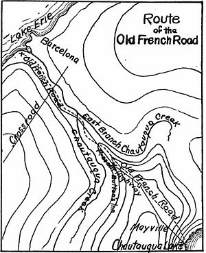
The Old Portage Road was an important path in what is now Chautauqua County, New York. It was also known as the Old French Road or French Portage Trail. This path connected Lake Erie with Chautauqua Lake. This connection was very important because it linked the Great Lakes system to the Mississippi River system. Imagine a natural highway for travel and trade! Lake Erie is about 700 feet above sea level. The highest point on this trail, which is a portage route, was about 1500 feet above sea level. A portage is a place where boats or goods are carried over land between two bodies of water.
Contents
Early History of the Portage Road
This trail was first used by Native American people for many years. It was a vital route for them to travel and trade between different areas.
First Europeans on the Trail
It is thought that a European explorer named Étienne Brûlé was the first European to use this trail. He might have traveled along it as early as 1615. This was a very long time ago, even before the United States was a country!
French Exploration and Claims
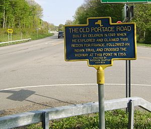
In 1749, a French expedition led by Celeron de Bienville arrived at Lake Erie. They landed near the mouth of Chautauqua Creek. Their goal was to claim the Ohio Valley region for France. To do this, they needed a way to get from Lake Erie to the Ohio River.
They decided to use the Old Portage Road. The French soldiers worked hard to clear a path through the thick forests. This path led them from Lake Erie to Chautauqua Lake. From Chautauqua Lake, they could travel down the Allegheny River and then into the Ohio River.
A Military Supply Route
Just a few years later, in 1753, the Old Portage Road became even more important. A large group of about 1,000 French soldiers turned the path into a military road. This road was used to move soldiers and supplies. These supplies were needed for the forts the French were building along the Allegheny River. Some of these forts included Fort Le Boeuf, Fort Machault, and Fort Duquesne.
However, the road fell out of use after 1754. This was when the French and Indian War began, and the main fighting moved to other areas.
British Use During the Revolution
The British briefly used the trail again in 1782. This was during the later parts of the American Revolutionary War. They planned to use Chautauqua Lake as a starting point to attack Fort Pitt. At that time, American colonists held Fort Pitt. But the British soon realized their attack would not work, so they stopped their plan.
The Old Portage Road Today
Even today, you can still find parts of the Old Portage Road. Much of New York State Route 394 between Lake Erie and Chautauqua Lake is called Portage Street. There is also a loop road off NY 394, south of the village of Westfield. This road is actually called Old Portage Road. This loop road follows the original path where the trail crossed Little Chautauqua Creek. It ends at an old, unused stone bridge.
 | Stephanie Wilson |
 | Charles Bolden |
 | Ronald McNair |
 | Frederick D. Gregory |


