Old Wadena Historic District facts for kids
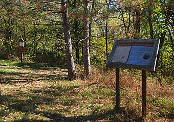
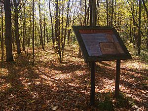
The Old Wadena Historic District is a special area in Thomastown Township, Minnesota. It's mostly found within the Old Wadena County Park. This place holds the secrets of many old historical sites.
Here, you can find the spots where four different trading posts once stood. These posts were built in 1782, 1792, 1825, and 1856. This area was also the first location of the town of Wadena. It was an important stop on the old Red River Trails. Plus, the county's very first farm was here! Later, the town of Wadena moved about 3.5 miles (5.6 km) south to where it is today.
In 1973, this historic district was added to the National Register of Historic Places. It's important because it shows us a lot about early farming, transportation, and the first European-American activities in Wadena County.
Contents
The First Trading Post: Little Round Hill
The forests and rivers in what is now Wadena County had plenty of food. They also offered good places to live and easy ways to travel by water. But when the first European-Americans arrived, this area was a disputed border. The Ojibwe and Dakota people tribes often fought over it.
A historian named William Whipple Warren wrote down Ojibwe stories. They told of a French-Canadian fur trader called Ah-wish-to-yah, which means "Blacksmith." In 1782, he led 20 people into this area. They chose a spot for a trading post where the Crow Wing and Partridge Rivers meet. They named it Wadena, which means "Little Round Hill" in the Ojibwe language.
They knew they were in a dangerous area. So, they built a strong wooden fence, called a palisade, around the post. The Ojibwe people with them built their wigwams inside this fence.
Battle of Partridge River
The Dakota people were not happy about this new post. A large group of 200 Dakota warriors attacked it. According to the stories, the traders' guns were much stronger than the Dakota's bows and arrows. The Dakota attack was quickly stopped in what became known as the Battle of Partridge River.
However, the traders left the post right away. European-Americans stayed away from this area for almost ten years after that.
Later, archaeologists dug at the site. They found pieces of pottery, an old nail, an axe, a fire striker, and parts of a kettle. These finds help us learn about what happened there.
Cadotte's Trading Post
In 1792, another fur trader named Jean Baptiste Cadotte, Jr. led a new group into Central Minnesota. His group split up. One part, led by Cadotte's brother Michel Cadotte, traveled up the Crow Wing River.
As winter began, they built their trading post on the riverbank. Another group went further and set up Réaume's Trading Post on the Leaf River. Cadotte's post had log huts and was surrounded by a palisade. He was a good trader and built a positive relationship with the Dakota people. This helped open the area for the fur trade.
People first noticed signs of Cadotte's post in 1868. They saw six dips in the ground, but thought they were old rifle pits. In 1972, archaeologists studied the site more closely. They looked at an area about 160 by 130 feet (49 by 40 m). They found seven dips: four were rectangular, two were round, and one was an odd shape. They also saw a worn path leading down to the river.
Prescott's Trading Post
Thirty years later, in 1825, Philander Prescott brought another fur trading group to the area. That year, the First Treaty of Prairie du Chien had set a border between the Ojibwe and Dakota lands.
Prescott and his group first set up camp on Leaf Lake. This was right in the middle of the disputed area. Fighting with the Dakota led to the deaths of two Ojibwe members of the group. Because of this, the survivors moved to the mouth of the Leaf River. This spot was clearly in Ojibwe territory.
The trading post had a house for Prescott, a storehouse, and a lodge for the other men. It was a very harsh winter, and many people in the area faced starvation. But the trading was successful. In the spring, Prescott returned to Fort Snelling with thirty packs of furs. Meanwhile, the Ojibwe members of his group went on to Leech Lake for their yearly maple sugar harvest.
When the Old Wadena Historic District was added to the National Register in 1973, the exact spot of Prescott's post had not yet been found again.
The Original Town of Old Wadena
In the mid-1800s, the Red River Trails were created. These trails connected Minneapolis–Saint Paul with the Red River Colony in what is now Manitoba. One route, called the Woods Trail, was made in 1844. It crossed the Crow Wing River between the mouths of the Partridge and Leaf Rivers.
In the 1850s, the U.S. government started to improve the Woods Trail. But they only finished the part up to the Crow Wing River crossing.
In 1856, a land investor named Augustus Aspinwall planned a town at this crossing. He named it Wadena. He opened a trading post, a post office, and a ferry. It became a regular stop for people traveling on the Woods Trail. Wadena was even named the county seat. Aspinwall expected many settlers to come once a railroad was built through the area.
However, the Panic of 1857 (a financial crisis) stopped railroad building for years. When the Northern Pacific Railway finally built tracks in 1871, they chose a route about 3.5 miles (5.6 km) to the south. The few people who lived in Aspinwall's town left. They built a new town of Wadena along the railway.
Around this time, Peter and Angeline Roy started Wadena County's first farm. It was near what soon became known as Old Wadena. They grew crops and raised dairy cattle.
 | Valerie Thomas |
 | Frederick McKinley Jones |
 | George Edward Alcorn Jr. |
 | Thomas Mensah |


