Organ Mountains facts for kids
Quick facts for kids Organ Mountains |
|
|---|---|
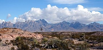
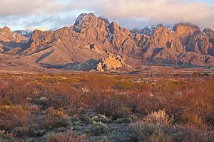
The Organ Mountains seen from the west
|
|
| Dimensions | |
| Length | 85 mi (137 km) N-S |
| Width | 42 mi (68 km) W-E |
| Geography | |
| Country | United States |
| State | New Mexico |
| Region | (northwest) Chihuahuan Desert |
| District | Doña Ana County, NM |
| Range coordinates | 32°19.6′N 106°33.35′W / 32.3267°N 106.55583°W |
| Borders on | San Andres Mountains |
| Geology | |
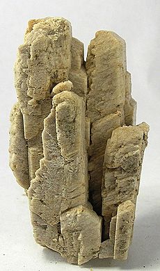
| Type of rock | granite, rhyolite |
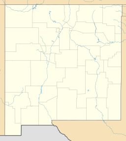
The Organ Mountains are a cool and rugged mountain range in southern New Mexico, in the Southwestern United States. They are also known as La Sierra de los Órganos. These mountains are about 10 miles (16 km) east of Las Cruces in Doña Ana County. On May 21, 2014, a large part of this area became the Organ Mountains–Desert Peaks National Monument. This means the land is protected for everyone to enjoy.
Contents
What Makes the Organ Mountains Special?
The Organ Mountains are part of a long chain of mountains. This chain runs along the east side of the Rio Grande river valley. To the north, they are close to the San Andres Mountains. To the south, they are near the Franklin Mountains. Even though they are close, the Organ Mountains are very different!
How the Mountains Formed
The San Andres and Franklin Mountains are mostly made of limestone. They formed when large blocks of rock tilted. But the Organ Mountains are mostly made of igneous rock. This means they formed from cooled lava or magma. The main rocks here are granite and rhyolite.
Why the Name "Organ Mountains"?
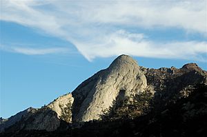
The mountains get their name because they look like the pipes of a pipe organ. This is especially true for the tall, pointy granite peaks in the highest parts of the range.
Neighboring Mountain Ranges
- The San Andres Mountains are separated from the Organ Mountains by San Augustin Pass. U.S. Highway 70 goes through this pass. It leads to places like White Sands Missile Range and White Sands National Park.
- The Franklin Mountains are about 10 miles away. The land between them is called Anthony Gap. Much of this area is part of Fort Bliss.
Rocks and How They Formed
The Organ Mountains have three main parts, each with different types of rocks:
- The Needles: This is the northern part. It has narrow ridges of granite. These are the "needles" that look like organ pipes. This area includes the highest point, Organ Needle, which is 8,990 feet (2,740 m) tall.
- Central Section: South of The Needles, this part is much wider. It's mostly made of purplish-gray rhyolite. This rock also formed from lava. This section is almost as tall as The Needles. A canyon called Soledad Canyon cuts through it.
- Bishop's Cap Hills and Rattlesnake Ridge: These are on the southwest and southeast sides. They are smaller and lower. These hills are made of limestone, similar to the San Andres and Franklin Mountains.
Amazing Plants and Nature
The Organ Mountains are home to many different kinds of plants. About 870 types of plants grow here! Some plants are very special because they only grow in these mountains.
- Unique Plants: Two examples are the Organ Mountains evening-primrose and the smooth figwort. They are found only in small areas here.
- Ferns: The mountains also have many types of ferns. Out of 56 fern species found in New Mexico, 30 of them grow in the Organ Mountains!
Different Plants in Different Areas
The types of plants change a lot depending on the rock type.
- The southern limestone areas have plants like lechuguilla. This plant is common in the Chihuahuan Desert.
- The granite and rhyolite areas have different plants. These plants are more like those found in the "sky islands" of the southwestern U.S.
Protecting the Area
The protected lands around the National Monument face some challenges. These include new buildings, energy projects, and mining. Also, plants are threatened by new species moving in and by climate change making the area drier.
Fun Activities: Hiking and Climbing
People have been climbing in the Organ Mountains since the 1890s. Many climbs were done in the 1950s by soldiers from Fort Bliss. R.L. Ingraham wrote a famous guide for climbing here.
The Bureau of Land Management takes care of the hiking trails. You can get to them from four main spots:
- Aguirre Springs Campground and Baylor Canyon Road: These spots let you reach trails in The Needles area. You can hike over Baylor Pass. The Pine Tree Trail loop is 4.5 miles long. It goes from 5,600 feet up to 6,880 feet. You'll see different plants, from small shrubs to tall ponderosa pine trees.
- Dripping Springs Natural Area: On the west side, this area has easy trails. They go around La Cueva and into the lower parts of Fillmore and Ice Canyons.
- Soledad Canyon Day Use Area: This area has a loop trail in Bar Canyon, south of Dripping Springs.
The southern limestone part of the mountains is harder to reach. Bishop's Cap can be reached by rough dirt roads, but it has no official trails. Rattlesnake Ridge is inside Fort Bliss and is not open to the public.
Organ Mountains–Desert Peaks National Monument
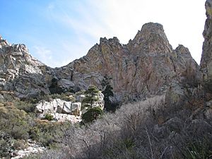
On May 21, 2014, President Obama officially made the Organ Mountains–Desert Peaks a national monument. This decision protects over 496,000 acres of land. It helps save the amazing history, science, and natural beauty of the area for everyone in the United States.
See also
 In Spanish: Sierra de los Órganos (Nuevo México) para niños
 | Calvin Brent |
 | Walter T. Bailey |
 | Martha Cassell Thompson |
 | Alberta Jeannette Cassell |


