Original Monarch Pass facts for kids
Quick facts for kids Original Monarch Pass |
|
|---|---|

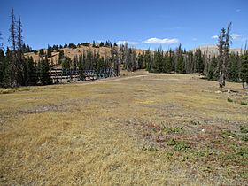
Original Monarch Pass viewed from the south
|
|
| Elevation | 11,532 ft (3,515 m) |
| Traversed by | abandoned wagon road |
| Location | Gunnison and Chaffee counties, Colorado, United States |
| Range | Sawatch Range |
| Coordinates | 38°30′41″N 106°20′49″W / 38.5113855°N 106.3469695°W |
| Topo map | USGS Garfield |
Original Monarch Pass is a high mountain pass in Colorado. It sits on the border of Gunnison and Chaffee counties. This pass is part of the Continental Divide. This means it's a high ridge where rivers flow to different oceans. Water on one side goes west, and water on the other side goes east.
The pass is about 1 mile (1.6 km) west of U.S. Route 50. It is also on the western edge of the Monarch Ski Area. The name Monarch comes from a nearby ridge and the community of Monarch. Some people also call this pass Old Old Monarch Pass.
Contents
Journey Through Time: The Story of Monarch Pass
Building the First Road
In 1880, a special road was built over Original Monarch Pass. This was a "toll road," meaning people had to pay to use it. It became a very important path for wagons and stagecoaches. These vehicles traveled from the town of South Arkansas (now called Salida) in the east. They went to busy mining towns on the west side of the divide.
The road also helped people travel to the growing city of Gunnison. It connected them to places even farther west. Later, cars and trucks also used this road. It stayed an important way to cross the mountains for many years.
New Roads and New Names
In 1922, the state highway department changed the road's path. They moved the crossing to a slightly lower spot. This new pass is about 1.1 miles (1.8 km) to the southeast. Today, we know this second pass as Old Monarch Pass.
Then, in 1939, the highway was moved again. This third crossing is about 0.6 miles (0.97 km) even farther southeast. This is where U.S. Route 50 crosses the mountains today. This newest pass is simply called Monarch Pass.
Visiting Original Monarch Pass Today
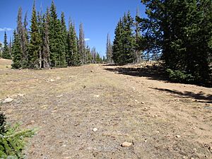
Today, Original Monarch Pass is no longer a main road. You can reach it by hiking north along the Continental Divide Trail. This trail starts from Old Monarch Pass.
You can also hike up the old toll road from the west side. The old toll road on the east side is now used by the Monarch Ski Area. It is not open to the public.
 | Delilah Pierce |
 | Gordon Parks |
 | Augusta Savage |
 | Charles Ethan Porter |


