Oso, Washington facts for kids
Quick facts for kids
Oso, Washington
|
|
|---|---|

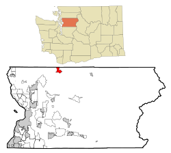
Location of Oso, Washington
|
|
| Country | United States |
| State | Washington |
| County | Snohomish |
| Area | |
| • Total | 3.7 sq mi (9.6 km2) |
| • Land | 3.6 sq mi (9.4 km2) |
| • Water | 0.1 sq mi (0.2 km2) |
| Elevation | 207 ft (63 m) |
| Population
(2020)
|
|
| • Total | 172 |
| • Density | 46.5/sq mi (17.92/km2) |
| Time zone | UTC-8 (Pacific (PST)) |
| • Summer (DST) | UTC-7 (PDT) |
| ZIP code |
98223
|
| Area code | 360 |
| FIPS code | 53-52110 |
| GNIS feature ID | 1524091 |
Oso is a small community in Snohomish County, Washington, United States. It's known as a census-designated place (CDP), which means it's a specific area identified by the government for statistics. Oso is located west of Darrington and south of the North Fork of the Stillaguamish River. It's about 50 air miles (80 km) from Seattle. In 2020, about 172 people lived there.
Oso is also known for a very large mudflow that happened in March 2014. This event was very serious and affected many people.
Contents
Geography of Oso
Oso is in a valley next to the North Fork of the Stillaguamish River. This valley is surrounded by parts of the Cascade Mountains.
You can reach Oso by State Route 530. This road goes about 12 miles (19 km) west to Arlington and 16 miles (26 km) east to Darrington.
The United States Census Bureau says the Oso CDP stretches north from the river to the Skagit County border. It covers a total area of 3.7 square miles (9.6 km2). Most of this area, 3.6 square miles (9.4 km2), is land, and a small part, 0.1 square miles (0.2 km2), is water.
History of Oso
The community was first called Allen. However, its name was changed to Oso to avoid confusion with Allyn in Mason County.
The word "Oso" means "bear" in Spanish. J. P. Britzius named the town after a place called Oso, Texas. That Texas town no longer exists; it was abandoned when a railway station was built in the nearby town of Flatonia.
The 2014 Mudslide
On Saturday, March 22, 2014, a major mudflow happened about 4 miles (6.4 km) east of Oso. A part of an unstable hill collapsed, sending a huge amount of mud and debris across the North Fork of the Stillaguamish River. This mudslide covered a rural neighborhood and an area of about 1 square mile (2.6 km2). This event was a very serious natural disaster for the community.
The 2016 Wildfire
In 2016, a wildfire started near Oso, off Washington State Route 530. By May 13, 2016, this wildfire had spread to cover over 100 acres (0.4 km2).
People of Oso
According to the 2020 census, the population of Oso was 172 people.
In 2000, there were 326 people living in Oso. The community had 96 households, and 69 of these were families. About 37.5% of households had children under 18 living with them. The average household had 2.56 people, and the average family had 3.01 people.
The median age in Oso in 2000 was 37 years old. About 28.5% of the population was under 18.
Places to Visit
- Jim Creek Naval Radio Station
See also
 In Spanish: Oso (Washington) para niños
 | Leon Lynch |
 | Milton P. Webster |
 | Ferdinand Smith |

