Ozark National Scenic Riverways facts for kids
Quick facts for kids Ozark National Scenic Riverways |
|
|---|---|
|
IUCN Category V (Protected Landscape/Seascape)
|
|

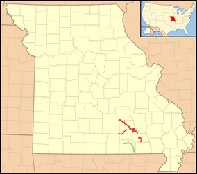
The Ozark National Scenic Riverways (red) and the nearby Eleven Point National Wild and Scenic River (green)
|
|
| Location | Shannon, Carter, Dent, and Texas Counties, Missouri |
| Nearest city | Salem, Van Buren, and Eminence |
| Area | 80,000 acres (324 km2) |
| Established | 1964-08-27 |
| Visitors | 1,789,783 (in 2007) |
| Governing body | National Park Service |
| Website | Ozark National Scenic Riverways |

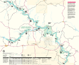
The Ozark National Scenic Riverways is a super cool outdoor place in southern Missouri, U.S.. It's part of the National Park Service. This park was created to protect two amazing rivers: the Current River and the Jacks Fork River.
The park covers about 80,000 acres (32,375 hectares). Lots of people visit each year to have fun and enjoy nature. You can find many different animals and plants here.
Contents
Fun Things to Do
People love to visit the Ozark National Scenic Riverways. It's a great place for many outdoor activities.
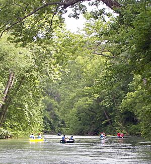
- Floating the Rivers: Canoeing is super popular here. You can also go kayaking or float on inflatable rafts and tubes. Some local people enjoy motorized boating too.
- Other Activities: Besides river fun, you can go horseback riding, hiking, fishing, and camping. It's also a great spot for watching birds, taking nature photos, and just enjoying the beautiful views.
The park says the Current River is one of the best rivers in the Midwest for floating. This is because many large springs feed into it, keeping the water clear and flowing.
Amazing Springs and Caves
The Ozark National Scenic Riverways is famous for its many natural springs. These are places where underground water flows out of the ground.
- Current River Springs: The Current River starts where Pigeon Creek meets Montauk Springs. Other big springs along the river include Welch Spring, Cave Spring, Round Spring, and Big Spring.
- First Magnitude Springs: This park has the most "first magnitude" springs in the U.S. These are super big springs that flow with more than 100 cubic feet (about 2,800 liters) of water every second!
The park also has many cool caves. You can even take a ranger-led tour of Round Spring Caverns in the summer. Other interesting caves include Devils Well sink and Jam-Up Cave.
Hiking and Wildlife
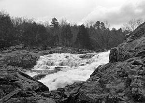
The Ozark Trail is a long hiking path that goes through the park. It passes by Rocky Falls and crosses the Current River.
You might even see some wild horses living in the park. Elk have also been brought back to nearby areas. Park rangers hope they will soon live in the riverways too.
Historic Places and Camping
The park has several interesting historic sites. These include:
- Alley Spring and the old Alley Spring Roller Mill.
- The Buttin Rock School.
- The Walter Klepzig Mill and Farm.
- The Reed Log House.
- Many buildings built by the CCC at Big Spring.
There are many places to camp along the rivers. You can find campgrounds at Alley Spring, Round Spring, Pulltite, Two Rivers, and Big Spring. There are also simpler campsites and group sites. During the summer, park rangers lead campfire programs and nature hikes. Sometimes, you can even see people demonstrating old crafts or enjoy free bluegrass concerts.
Where is the Park?
The Ozark National Scenic Riverways is mostly in Shannon County. Parts of it also reach into Carter, Dent, and Texas counties. Some towns near the park are Eminence, Salem, and Van Buren. The main offices are in Van Buren.
History of the Park
The Ozark National Scenic Riverways was created by a special law from Congress in 1964. It was officially opened in 1971. Before the park was made, there was some debate about how to protect the rivers. Two government groups, the National Park Service and the Forest Service, both wanted to manage the area.
Local people were worried that the National Park Service would take their private land to create the park. This process is called eminent domain, where the government can buy private land for public use. In the end, Congress chose the National Park Service's plan. The park has been very successful, with millions of visitors enjoying the rivers each year.
America the Beautiful Coin
In 2017, the park was featured on a special quarter coin! It was part of the America the Beautiful Quarters series from the U.S. Mint. The design on the coin shows the historic Alley Mill.
 | Janet Taylor Pickett |
 | Synthia Saint James |
 | Howardena Pindell |
 | Faith Ringgold |


