Pérez Zeledón (canton) facts for kids
Quick facts for kids
Pérez Zeledón
|
|||
|---|---|---|---|
|
|||
| Nickname(s):
Pezeta (P.Z.)
|
|||
| Anthem: Himno Municipal de Pérez Zeledón | |||
| Country | |||
| Province | San José | ||
| Creation | 9 October 1931 | ||
| Head city | San Isidro de El General | ||
| Districts | |||
| Government | |||
| • Type | Municipality | ||
| • Body | Municipalidad de Pérez Zeledón | ||
| Area | |||
| • Total | 1,901.08 km2 (734.01 sq mi) | ||
| Elevation | 690 m (2,260 ft) | ||
| Population
(2011)
|
|||
| • Total | 134,534 | ||
| • Estimate
(2022)
|
156,917 | ||
| • Density | 70.7671/km2 (183.2861/sq mi) | ||
| Time zone | UTC−06:00 | ||
| Canton code | 119 | ||
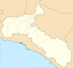
Pérez Zeledón is a canton (like a county) in the San José area of Costa Rica. It's located in the Brunca region, which is in the southern part of the country. The main city and capital of this canton is San Isidro de El General.
The canton has natural borders like the Río Savegre to the northwest and the Río Guabo to the southwest. High mountains from the Cordillera de Talamanca (Talamanca Mountain Range) are to the east. The Río General flows through the middle of the canton, giving its name to the capital city.
Contents
History of Pérez Zeledón
Pérez Zeledón was officially created on October 9, 1931. It started with four main areas called districts: Ureña, El General, Daniel Flores, and Rivas. Ureña was the first capital city.
Early Settlements
In the late 1800s, many families began living in the El General valley. Small villages, called caseríos in Spanish, like El General, Palmares, Rivas, and Ureña, grew larger after 1900.
Ureña became a much bigger settlement. By 1911, during the time Ricardo Jiménez Oreamuno was in charge, special shelters were built. These shelters were in places like Ojo de Agua, El Cerro de la Muerte, and División. They helped the area, now known as Pérez Zeledón and El General Valley, to grow even more.
Role in the Civil War
San Isidro de El General, the capital of Pérez Zeledón, was given a special title: Ciudad Mártir. This means "Martyr City." It received this honor because of its important role in the Costa Rican Civil War of 1948. A special rule, Decree Nº274, officially recognized the city's brave actions.
This decree explained that the leaders of the new government wanted to publicly thank San Isidro de El General for its great effort. They wanted to make sure the city's important actions were never forgotten.
Pérez Zeledón was also where some big battles happened during the war. One of the most famous was the Battle of San Isidro de El General. About 200 government soldiers fought against revolutionary forces in the city's main square. José Figueres Ferrer and his revolutionary army won this battle. This victory helped them control the southern Pacific part of Costa Rica.
Geography
Pérez Zeledón covers an area of about 1,901 square kilometers. Its average height above sea level is 690 meters.
Districts
The canton of Pérez Zeledón is divided into these districts:
- San Isidro de El General
- El General
- Daniel Flores
- Rivas
- San Pedro
- Platanares
- Pejibaye
- Cajón
- Barú
- Río Nuevo
- Páramo
- La Amistad
Population Data
| Historical population | |||
|---|---|---|---|
| Census | Pop. | %± | |
|
Instituto Nacional de Estadística y Censos |
|||
In 2022, Pérez Zeledón had an estimated population of 156,917 people. This is more than the 134,534 people counted in the 2011 census.
A report by the United Nations Development Programme showed that Pérez Zeledón has a Human Development Index of 0.746. This index measures things like how long people live, how much education they get, and their income. A higher number means better development.
Economy
The economy of Pérez Zeledón mainly relies on farming, raising animals, trade, and tourism. Its location helps a lot because it acts like a "bridge" between Costa Rica's capital, San José, and the southern areas near Panamá.
Key Economic Activities
Important farming activities in the area include:
- Growing Sugar Cane
- Growing Coffee
- Growing Tiquizque (a root vegetable)
- Growing Bananas
- Growing Blackberryes
Coffee and sugar cane are the most important crops for the region's economy.
Raising animals is also a big part of the economy. Pigs and cattle are the most important animals raised here. Cattle are used for meat and for producing milk.
Trade has grown a lot in recent years. This is because many credit unions, banks, and local businesses have opened in the canton. Also, companies from the Central Valley (San José) have set up operations here.
Tourism
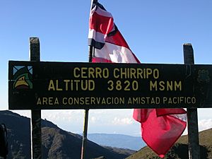
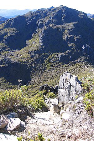
The main reason people visit Pérez Zeledón is its amazing variety of nature. Tourist spots include the Chirripó National Park. This park has one of the highest peaks in Central America and the Caribbean, reaching 3,820 meters (about 12,533 feet) above sea level.
Another popular activity is going on journeys along the fast-moving rivers, known as rapids.
The Parque Internacional La Amistad, which means 'The Friendship International Park', is another important park in the area.
Education
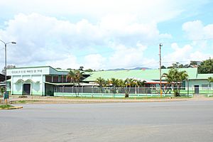
The first elementary school in Pérez Zeledón opened between 1902 and 1906. It was called Escuela Mixta de Ureña. It was located in the Ureña district, south of San Isidro de El General's central park.
After the Costa Rican Civil War, the school moved to a new building. It is now called "Escuela 12 de Marzo". This name honors the start date of the Costa Rican Civil War, which had just ended when the school moved to its current location.
Transportation
Road Transportation
These are the main road routes that go through Pérez Zeledón:
 National Route 2
 National Route 242
 National Route 243
 National Route 244
 National Route 321
 National Route 322
 National Route 323
 National Route 325
 National Route 326
 National Route 327
 National Route 328
 National Route 329
 National Route 330
 National Route 331
 National Route 332
 National Route 333
 National Route 334
 National Route 335
Notable People
- Keylor Navas, a famous football goalkeeper.
See also
 In Spanish: Cantón de Pérez Zeledón para niños
 | John T. Biggers |
 | Thomas Blackshear |
 | Mark Bradford |
 | Beverly Buchanan |


