Pacheco State Park facts for kids
Quick facts for kids Pacheco State Park |
|
|---|---|

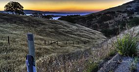
Dinosaur Point in Pacheco State Park
|
|
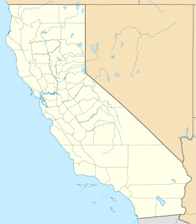
| Location | San Benito County / Merced County / Santa Clara County, California |
| Nearest city | Hollister |
| Area | 6,890 acres (2,790 ha) |
| Established | 1997 |
| Governing body | California Department of Parks & Recreation |
Pacheco State Park is a California State Park. It's found in the Diablo Range, mostly in Merced County, California. Parts of it also reach into Santa Clara County and San Benito County, near Hollister.
The park is about 24 miles (39 km) west of Los Banos, California and 20 miles (32 km) east of Gilroy. You can find the entrance on Dinosaur Point Road, close to California State Route 152. Pacheco State Park covers a huge area of 6,890 acres (2,788 hectares). But only the western 2,600 acres (1,052 hectares) are open for visitors. The rest of the park is closed. This is because the trails aren't fully built yet. Also, there are many large wind turbines in that area, which can be a safety concern. In 2018, plans were made to replace the old wind turbines from the 1980s. New, more efficient ones will produce much more electricity.
Contents
Park History: How it Began
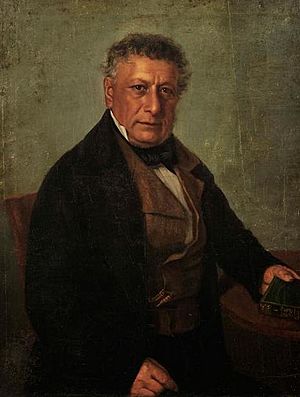
Pacheco State Park is named after Don Francisco Pérez Pacheco. He was a "Californio" rancher, meaning a person of Spanish descent born in California before it became part of the United States. The park was created in 1997. It was the last part of a large ranch called Rancho San Luis Gonzaga.
The land was given to the state by Paula M. Fatjó. She was a great-great-granddaughter of Don Francisco Pérez Pacheco. Both the park and the nearby Pacheco Pass are named after him. The Pacheco family owned this ranch since 1843. They used it to raise horses and cattle.
Fun Things to Do at the Park
The park has about 28 miles (45 km) of trails. You can enjoy hiking, horseback riding, and mountain biking here. Please remember that dogs are not allowed on the trails. There are no places to camp inside the park. Also, there is no drinking water available, so bring your own!
The park offers amazing views. You can see the Central Valley to the east and the Santa Clara Valley to the west. In spring, the park is filled with beautiful, colorful wildflowers.
You can also find some historic spots in the park. There's an old "line shack" that a cattle company used in the 1800s. Part of the old Butterfield Stage route also runs through the park. You can even see the ruins of the original Pacheco adobe, an old mud-brick house.
Wildlife You Might See
Pacheco State Park is home to many animals. You might spot tule elk, deer, bobcats, coyotes, and foxes. Several types of hawks and golden eagles also live here. Many smaller animals make their homes in the park too. Even today, the park land is still used for cattle grazing during the winter and spring months.
How the Park Makes Power
A big part of the park is closed to visitors. This area is used for wind turbines. These turbines were put in during the 1980s. They were designed to make 16.5 megawatts (MW) of electricity.
A company called Quinbrook Infrastructure Partners won a long-term agreement to improve the Gonzaga Wind Farm in Pacheco State Park. Another company, Scout Clean Energy, will replace the old turbines. They will put in newer, more modern designs. These new turbines are expected to produce much more power, up to 80 MW!
 | Shirley Ann Jackson |
 | Garett Morgan |
 | J. Ernest Wilkins Jr. |
 | Elijah McCoy |


