Padrón Real facts for kids

The Padrón Real (which means Royal Register) was Spain's official and secret master map during the 1500s. After August 2, 1527, it was called the Padrón General (General Register). This map was used as a guide for all maps on Spanish ships. It was kept safe in Seville, Spain, by an organization called the Casa de Contratación.
Ship pilots had to use a copy of this official map. If they didn't, they could be fined 50 doblas, which was a lot of money! Famous mapmakers and pilots who worked on this map included Amerigo Vespucci, Diogo Ribeiro, Sebastian Cabot, and Alonzo de Santa Cruz.
How the Map Started


The Padrón Real was always being updated. Its first version was made around 1507 or 1508. It was created by the Casa de Contratación, a Spanish group set up in Seville in 1503.
Every time a ship returned from a voyage, its crew had to report any new lands or discoveries to the Casa de Contratación. They also had to share details like latitude and longitude. The ship's officers even had to promise under oath that their information was true.
The mapmakers at the Casa de Contratación would then add this new information to the master map. When a new ship was getting ready to sail, its crew would receive maps that were copied from the Padrón Real.
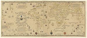
Diego Ribeiro started working for Spain in 1518. He made several versions of the map between 1525 and 1532. This was after Juan Sebastian Elcano sailed around the world and after Spanish explorers discovered new places in North America. Other mapmakers like Alonso de Chaves (in 1536) and Alonzo de Santa Cruz (in 1542) also updated the map.
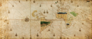
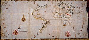
Most of these original maps no longer exist. However, some copies were made for foreign leaders and important people. A few of these copies can still be seen today. For example, a map called the "Salviati Planisphere" in Florence, Italy, is believed to be a copy of the Padrón Real. It was probably given by Emperor Charles V to Cardinal Giovanni Salviati in 1526. Another similar world map was given to Count Baldassare Castiglione.
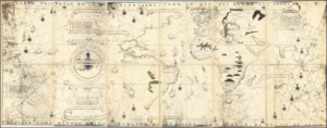
One of the most impressive copies of the Padrón Real is in the Vatican Library. Emperor Charles V gave it to the Pope in 1529. This large map is on vellum (a type of treated animal skin). It shows many rhumb lines and compass roses, which were common on old navigation charts. The coastlines have many place names, showing where Spain claimed land. Ribeiro's map also included early latitude lines, the equator, and the Tropic of Cancer and Capricorn. It only showed known information, not imagined places.
The Padrón Real was similar to Portugal's secret master map, called the Padrão Real. That map was made by the Portuguese organization Casa da Índia, which started in Lisbon around 1500.
Important Mapmakers
Making and updating the Padrón Real was a huge and very serious project. Without good maps, Spain would have struggled to explore and benefit from its new discoveries. The Casa de Contratación had many skilled people working on the map. These included cartographers (mapmakers), navigators (pilots), archivists, and administrators.
The famous explorer Amerigo Vespucci, who traveled to the New World at least twice, worked at the Casa de Contratación. He was the "pilot major" (chief of navigation) starting in 1508. His job was to train new pilots for long ocean voyages. When Amerigo Vespucci died in 1512, his nephew Juan Vespucci took over his role.
In the 1530s and 1540s, the main mapmakers (called "cosmographers") working on the Padrón General included Alonso de Santa Cruz, Sebastian Cabot, and Pedro de Medina.
Diego Gutiérrez became a cosmographer in 1554. In 1562, Diego Gutiérrez published an amazing map called "Americae ... Descriptio" in Antwerp. It was printed there because Spanish engravers at the time didn't have the skills to print such a detailed map. Other cosmographers included Alonso de Chaves and Sancho Gutiérrez (Diego's brother).
In the late 1500s, Juan Lopez de Velasco was the chief cosmographer in Seville. He created a master map and twelve smaller maps that showed the entire Spanish Empire around the world. This was a huge achievement for its time. However, after Velasco's work, other countries like England, the Netherlands, and France became better at organizing and presenting geographic information. This marked the end of Spain's lead in mapmaking.
See also
 In Spanish: Padrón Real para niños
- Cartography
- Cartography of Latin America
 | Ernest Everett Just |
 | Mary Jackson |
 | Emmett Chappelle |
 | Marie Maynard Daly |

