Padre Bay facts for kids
Quick facts for kids Padre Bay |
|
|---|---|

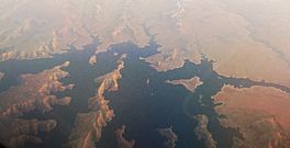
Aerial view of Padre Bay of Lake Powell, January 2012
|
|
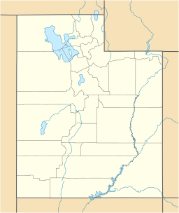
| Location | Lake Powell, Kane County and San Juan County, Utah |
| Coordinates | 37°05′48″N 111°18′13″W / 37.09667°N 111.30361°W |
| Type | bay |
Padre Bay is a large bay located within Lake Powell. Lake Powell is a huge man-made lake on the Colorado River. You can find Padre Bay in Kane County and San Juan County, Utah. Its waters are about 3,704 feet (1,129 meters) above sea level.
This bay is about 13.5 miles northeast of the Glen Canyon Dam. It is the biggest open water area on Lake Powell. Padre Bay is surrounded by interesting landforms. To the west, you'll find Alstrom Point and the island of Gunsight Butte. On the east side is Gooseneck Point.
Cookie Jar Butte sits on the north shore of the bay. At the southern entrance, near Dominguez Butte, is Padres Butte. This used to be an island, but now with lower water levels, it's the tip of Padre Point. Padres Butte marks the spot of the historic Crossing of the Fathers. This important crossing is now nearly 400 feet underwater.
History of Padre Bay
Padre Bay got its name from a group of priests, also known as "padres." These priests were the first to record and use a special river crossing in 1776. This crossing was called the Crossing of the Fathers.
The priests were part of the Domínguez–Escalante expedition. This group of ten men was led by two priests: Silvestre Vélez de Escalante and his leader, Francisco Atanasio Domínguez. They were trying to find a land route to Monterey, California, but their attempt was not successful. On their way home, they needed to cross the Colorado River. They first tried to cross at Lees Ferry in Arizona.
Things to See
Near Padre Bay, you can find some cool hiking spots. One interesting feature is the "weathering pits." These are perfectly round holes in the ground. They can be anywhere from 10 to 50 feet (3 to 15 meters) wide. They are also quite deep, ranging from 20 to 70 feet (6 to 21 meters).
 | Calvin Brent |
 | Walter T. Bailey |
 | Martha Cassell Thompson |
 | Alberta Jeannette Cassell |


