Lees Ferry facts for kids
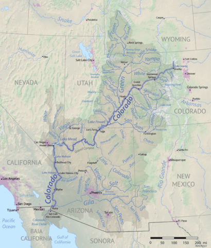
Lees Ferry is a special place on the Colorado River in Coconino County, Arizona, in the United States. It's about 7.5 miles (12 km) southwest of Page. This spot is unique because it's the only place for hundreds of miles where you can easily reach the Colorado River from both sides.
Because of its easy access, Lees Ferry became an important river crossing. In the mid-1800s, a man named John Doyle Lee started a ferry service here, and that's how the place got its name. The ferry ran for over 55 years. Later, bridges were built, making it easier for cars to cross the river.
Lees Ferry was also a military outpost in the 1800s. People even searched for gold here. Since the 1920s, it has been the main place where river flow is measured. This measurement helps decide how much water each state in the Colorado River basin can use. Lees Ferry marks the boundary between the Upper and Lower parts of the Colorado River. Today, Lees Ferry is a popular spot for fishing and launching whitewater rafting trips through the Grand Canyon.
Quick facts for kids Lees Ferry |
|
|---|---|
|
IUCN Category III (Natural Monument)
|
|
| Location | Coconino County, Arizona, United States |
| Nearest city | Page |
| Area | 25 acres (10 ha) |
| Designation | National Register of Historic Places |
| Established | 1870 |
| Governing body | National Park Service |
Contents
River and Rocks: The Geography of Lees Ferry
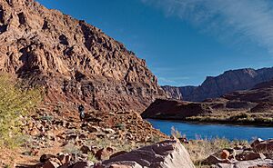
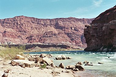
Lees Ferry is in northern Arizona. It's where the Paria River joins the Colorado River. This area is special because it's an open valley. Upstream is Glen Canyon, and downstream is Marble Canyon, which is the start of the Grand Canyon. For over 260 miles (420 km), this is the only place where the Colorado River isn't surrounded by steep canyon walls.
This open area made Lees Ferry a key crossing point before bridges were built. The river here is also much calmer than other parts. Upstream, the former Glen Canyon area is now covered by Lake Powell, which was formed by Glen Canyon Dam about 16 miles (26 km) away. Lees Ferry is part of the Glen Canyon National Recreation Area and is considered the northern end of Grand Canyon National Park.
The valley formed because of how the rocks underneath the Colorado Plateau are shaped. Softer rock layers, like those from the Triassic period (about 208–245 million years ago), are found here. These rocks, including sandstone and limestone, erode more easily. This creates a gentle slope down to the river, unlike the steep canyons nearby.
A Look Back: History of Lees Ferry
First People and Explorers
Long ago, about 11,500 years ago, early people called Paleo-Indians lived in the Lees Ferry area. Later, the Archaic culture arrived about 8,000 years ago. More recently, groups like the Anasazi, Paiute, and Navajo peoples lived here. Evidence shows the Anasazi used the area around the 12th century.
Native peoples didn't live in the canyon parts of the Colorado River much. They preferred the open plains for hunting. However, Lees Ferry became a disputed area between the Navajos and Paiutes. They both saw it as a good place for their animals to drink water.
The first Europeans to see Lees Ferry were part of the Domínguez–Escalante expedition in the 1700s. They were trying to find a land route between Spanish settlements. In 1776, they needed to cross the Colorado River. Their guides told them about two places, one at Lees Ferry. But when they got to Lees Ferry, the river was too wide and deep. They had to go 40 miles (64 km) upstream to another crossing. This spot is now under Lake Powell and is called Crossing of the Fathers.
In the 1800s, Lees Ferry was a gateway for settlers moving from Utah into Arizona. Many of these settlers were Mormons. They found that while the river at Lees Ferry was often too deep to walk across, its calm current made it a good place to cross by boat. Jacob Hamblin crossed here in 1864. Later, a small fort was built to protect against raids.
John D. Lee and the Ferry (1870–1876)
John D. Lee came to Lees Ferry in 1870 to start a permanent ferry service. He wanted to help Mormon settlers travel south to Arizona. Lee had been involved in a difficult event in 1857. Years later, he moved to this remote river crossing.
Lee arrived in September with some of his family and started a small settlement called Lonely Dell. The ferry officially began in January 1873. The first boat was named the Colorado. Travelers had to climb a steep path called "Lee's Backbone" to get up the valley wall. Four years later, Lee was arrested and faced legal action for his past involvement. He was executed on March 28, 1877.
The Ferry Continues (1877–1929)
After John D. Lee's death, his wife Emma continued to run the ferry for two years. In 1878, she found a new route that avoided the difficult Lee's Backbone. However, this route couldn't be used in summer due to high water from melting snow. In 1879, the LDS Church took over the ferry. Later, Jim Emett added a cable across the river to make crossings safer.
During this time, people came to Lees Ferry because of gold discoveries in southern Utah. Prospectors, like Cass Hite in 1883, found gold in Glen Canyon. In 1910, Charles H. Spencer started a large mining operation at Lees Ferry. He brought in a huge steamboat, the Charles H. Spencer, to extract gold. But the operation failed, and Spencer left in 1912. The steamboat sank in 1921, and its pieces are still along the Colorado River.
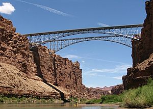
The ferry ran until 1928. In 1929, the first Navajo Bridge was finished about 4 miles (6.4 km) downstream. This bridge made road travel between Utah and Arizona much easier. The ferry even helped transport materials for the bridge. But in June 1928, the ferryboat capsized, and three men drowned. The ferry was never replaced. The bridge was completed seven months later, turning Lees Ferry from a busy crossing into a quiet spot.
Water Rights: Sharing the Colorado River
Since 1921, Lees Ferry has had a special device called a stream gage. This device measures the river's flow. It has one of the longest records of river flow in the United States. The flow measured here is very important for deciding how much water each state in the Colorado River basin can use.
The Colorado River Compact of 1922 divided the river's water equally between the Upper Basin states (Colorado, New Mexico, Utah, Wyoming, and northern Arizona) and the Lower Basin states (Arizona, California, and Nevada). Lees Ferry is the imaginary line that separates these two basins.
People believed the river's natural flow was about 16.5 million acre-feet (20.3 cubic kilometers) per year. To use all this water, the U.S. government built large dams. Hoover Dam was completed in 1936. Later, Glen Canyon Dam was built in 1966. This dam created Lake Powell, which covered many historic places, including the Crossing of the Fathers. The dam also made the river's flow much smoother, which helped with the old ferry operations.
Lees Ferry has been central to water discussions in the American Southwest. It's called "both the physical and spiritual heart of water history in the arid West." Over time, it was found that the Colorado River's actual flow was less than what was allocated. This has created challenges for water supply in the river basin.
Lees Ferry Today: Adventure and History
Lees Ferry is known as the official start of Grand Canyon National Park on the Colorado River. It's a popular place for fishing and launching river rafting trips. You can get there by Lees Ferry Road, which connects to U.S. Route 89A.
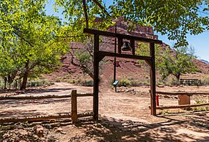
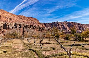
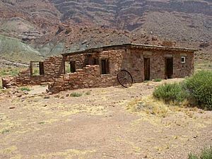
The Lonely Dell Ranch Historic District is here, listed on the National Register of Historic Places. It has several old buildings from John D. Lee's time and parts of the Charles H. Spencer steamboat. There's also a small historic cemetery. The National Park Service manages the area as a historical site within the Glen Canyon National Recreation Area.
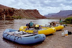
Lees Ferry is the main starting point for whitewater rafting trips through the Grand Canyon. These trips are like "a trip backwards through time" as the river cuts through older rock layers. Most trips are run by companies using large rafts, carrying many tourists. Trips can last from one week to several weeks, some going all the way to Lake Mead. Permits for private trips are now given out through a lottery system. These trips are for experienced adventurers because they can be dangerous.
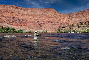
You can also take trips upstream from Lees Ferry without a special permit. You can travel 16 miles (26 km) on calm waters to the base of Glen Canyon Dam. This part of the Colorado River is famous for its excellent fishing. Cold, clear water from the dam creates perfect conditions for rainbow trout. The river has been stocked with rainbow trout since 1964.
Lees Ferry is also the end point for backpacking and canyoneering trips down the Paria River. This area has ancient petroglyphs, narrow slot canyons, waterfalls, and natural bridges like Wrather Arch. Fishing is a very popular activity at Lees Ferry, attracting many anglers each year hoping to catch large trout.
Lees Ferry in Movies
Lees Ferry has been featured in films. In 1924, Irvin Willat filmed The Heritage of the Desert here. Lees Ferry is also mentioned in the classic movie Stagecoach (1939).
Scenes from the movie Into the Wild were filmed at the Lees Ferry National Park Service Station in 2006. Actors Emile Hirsch and Steven Wiig were in these scenes. The TV show "Here's Lucy" also filmed an episode called 'Lucy runs the rapids' at Lees Ferry.
More to Explore
- Lee's Ferry and Lonely Dell Ranch
- The Church of Jesus Christ of Latter-day Saints in Arizona
- Vermilion Cliffs
 | Lonnie Johnson |
 | Granville Woods |
 | Lewis Howard Latimer |
 | James West |


