Padre Canyon facts for kids
Quick facts for kids Padre Canyon |
|
|---|---|
| Geography | |
| Country | United States |
| State | Utah |
| County | Washington |
| Population center | Ivins |
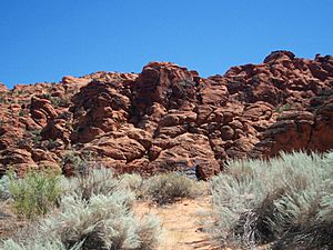
Padre Canyon is a cool natural area in Ivins, Utah. It sits right next to Snow Canyon State Park and Red Mountain. This canyon is special because it has three sides and amazing rock formations. These formations, like tall towers, are made from red Navajo Sandstone.
Padre Canyon is part of the Red Cliffs Desert Reserve. This huge protected area covers 62,000 acres. It's home to three different natural environments: the Mojave Desert, the Colorado Plateau, and the Great Basin. You can find cool rock features here, like Padre Rock, the Padre Arch, and even sand dunes.
Contents
Exploring Padre Canyon
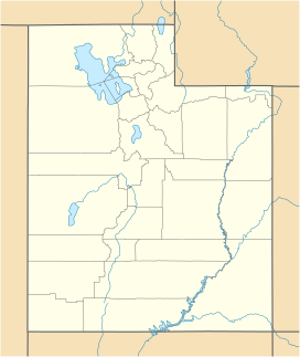
Padre Canyon is located in southwest Utah. It's about 50 miles west of Zion National Park. The lowest part of the canyon is about 3,100 feet above sea level. This canyon has a unique three-sided shape, running from north to south.
To the east, there's a steep hillside. It slowly rises into tall cliffs of Kayenta and Navajo Sandstone, reaching 4,000 feet high. The east side then drops to 3,500 feet and ends at the North Black Rocks lava field. The northern end of the canyon has a saddle, which is like a low pass, with a trail peak of 3,740 feet.
On the west side of the canyon is Red Mountain, which stands at 4,500 feet tall. Looking south from the canyon, you'll see the flat basin of the Mojave Desert. You can also spot the Utah Range, which is the first of many mountain ranges in this area.
Padre Canyon is protected by several important areas. These include Snow Canyon State Park, the Red Cliffs National Conservation Area, and the Red Cliffs Desert Reserve. The canyon is also next to the Red Mountain Wilderness. The Tuacahn Center for the Arts, a famous outdoor theater, is located right at the entrance of the canyon.
Visiting Padre Canyon
You can reach Padre Canyon by car on Tuacahn Drive. If you prefer hiking, there's a trailhead called Padre Canyon Trailhead. You can park your car at the end of Tuacahn Drive, at the Padre Canyon Trailhead, or at the start of the Toe Trail.
Keep in mind that there are no restrooms, picnic areas, or campgrounds available here. Also, there's almost no parking for trailers. So, plan your visit accordingly!
Weather in Padre Canyon
Padre Canyon has a desert climate. This means summers can be very hot during the day, often over 105°F (41°C). Nights are warm, usually in the low 70s°F (21-23°C). Fall and winter days are milder, while nights can get cool or cold. Winter lows can be in the mid-20s°F (-6 to -3°C), with highs in the 60s°F (15-18°C).
The area usually gets a small amount of rain each month, about half an inch to an inch. However, in May and June, the rainfall drops to about a quarter-inch on average.
A Look Back: History of Padre Canyon
The area next to Padre Canyon became Snow Canyon State Park in 1958. Long ago, from about 200 AD to 1250 AD, the Ancestral Puebloans lived here. They used the canyon for hunting and gathering food. Later, from 1200 AD to the mid-1800s, the Paiute Indians were present in this region.
Mormon pioneers discovered the area in the 1850s. They were actually looking for lost cattle when they stumbled upon this beautiful canyon. In nearby areas, you can still see amazing evidence of the past. There are fossilized dinosaur tracks and ancient human art like rock etchings and petroglyphs.
Plants and Animals of Padre Canyon
The plants in Padre Canyon are mostly desert types. You'll see many different desert shrubs growing among the rock formations.
During springtime, the desert wildflowers bloom, making the area colorful. You might spot desert baileya, banana and soap tree yucca, brittle brush, creosote bush, indigo bush, purple sage, range ratany, Palmers penstemon, and different types of cactus like hedgehog and prickly pear. Areas where water flows, called washes, often have tamarisk plants.
The wildlife here is fascinating! You might see a Gila monster, a peregrine falcon, or a desert tortoise. In 1990, the Mojave Desert tortoise was listed as a "threatened" species, meaning it needs protection. You'll notice small fences along the roads leading into the canyon. These fences help keep ground-dwelling creatures from wandering onto the roads by accident.
Other cool animals in the area include the giant desert hairy scorpion, coyote, Mojave sidewinder snake, red-spotted toad, Utah banded gecko, and the side-blotched lizard. There are many more creatures that call this desert home!
How Padre Canyon Was Formed: Geology
Padre Canyon is in Washington County, Utah. This area sits on a major crack in the Earth's crust called the Hurricane Fault. You can see this fault clearly at the Hurricane Cliffs, which stretch south all the way to the Grand Canyon. This fault has pushed up and exposed colorful layers of rock. These rocks date back millions of years, even to the time of dinosaurs!
Most of the beautiful red rock you see is called Navajo Sandstone. This sandstone formed from layers of sand that blew into Utah almost 200 million years ago and then hardened over time. In the last million years, volcanoes erupted here. These eruptions left black basaltic rocks scattered across the ground.
Trails to Explore in Padre Canyon
There are several trails for you to explore in and around Padre Canyon:
Padre Canyon Trail
- Length: 4.7 miles (7.6 km)
- Difficulty: Medium to hard. This trail can be challenging! You might need to squeeze through narrow slots, climb off ledges, and even crawl through holes. Sometimes, especially in winter and spring, you might have to wade through water.
- Highlights: You'll get to hike on slickrock, see cool arched alcoves, and discover a unique area called the Doll House. This trail also offers a chance to see an untouched natural environment.
- Note: This trail is not recommended if you don't have some experience hiking in the backcountry.
Red Mountain Route
- Length: 10.8 miles (17.4 km)
- Difficulty: Strenuous. This is a very tough trail. It's a primitive route, meaning it's remote and hard to follow in some places.
- Highlights: You'll get amazing panoramic views from the top.
- Caution: Extreme caution is recommended if you try this route.
Toe Trail
- Length: 2.8 miles (4.5 km)
- Difficulty: Easy. This is a much simpler trail.
- Path: It follows the Ivins flood control dike.


