
Para Hills, South Australia facts for kids
Quick facts for kids Para HillsAdelaide, South Australia |
|||||||||||||||
|---|---|---|---|---|---|---|---|---|---|---|---|---|---|---|---|

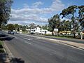
A gully next to Para Hills primary school
|
|||||||||||||||
| Established | 1959 | ||||||||||||||
| Postcode(s) | 5096 | ||||||||||||||
| Area | 3.21 km2 (1.2 sq mi) | ||||||||||||||
| Location | 16 km (10 mi) from Adelaide | ||||||||||||||
| LGA(s) |
|
||||||||||||||
| State electorate(s) | Playford | ||||||||||||||
| Federal Division(s) | Makin | ||||||||||||||
|
|||||||||||||||
Para Hills is a lively suburb located in Adelaide, South Australia. It's a great place with lots of green parks, schools, and sports facilities. You'll also find two shopping centres nearby. A small airport for light aircraft is close to its edge. Most of Para Hills is part of the City of Salisbury, but a small part belongs to the City of Tea Tree Gully.
Contents
Discovering Para Hills: A Look at Its Past
Para Hills has an interesting history, starting with early settlers.
Early Settlers and Farms
One of the first families to settle here was the Goodalls. They started a farm at the bottom of the hills in 1850. In 1853, Andrew Melville Goodall made the farm bigger and called it Para Hills Farm. He built his farmhouse near where St Clair Avenue and Goodall Road are today.
The Para Hills Post Office opened its doors on June 28, 1961. This was an important step for the growing community.
Indigenous History and Land Use
Long before European settlers arrived, the Kaurna tribe of Indigenous Australians lived in this area. Sadly, diseases brought by Europeans, like smallpox, greatly reduced their population by the 1840s.
European land grants in Para Hills began in 1847. Important farming families like the Goodalls (1850), Kesters (1893), and MacIntyres (1865) were among the first to own land here. Over time, the land became much more valuable.
Building a New Community: The R.M.D. Project
For many years, farming and quarrying were the main activities. Then, in 1959, a company called Reid Murray Developments (R.M.D.) started buying land. They planned to build a huge new housing area. This was the biggest private housing project in Australia at the time!
R.M.D. wanted to create a complete neighbourhood from the start. They set aside 15% of the land for parks. They also arranged for a supermarket and worked with the government to quickly get a post office and a school.
New residents were even given six plants to help them start their gardens! R.M.D. only sold complete house-and-land packages, not just empty land. The houses usually had three or more bedrooms and were built with bricks or concrete blocks.
Attracting New Residents
R.M.D. even opened offices in London to attract new British migrants to Australia. Salespeople would meet new immigrants when they arrived. Some temporary apartments were built to house people who were planning to buy homes.
The suburb grew very quickly. In the first six months, 55 homes were finished, and 70 more were being built. Roads, water, and electricity services were also set up. Today, many main roads in Para Hills are named after the original farming families: Goodall, Kesters, and McIntyre.
Para Hills Timeline: Key Moments
- 1847: First land grants were given out.
- 1850: The Goodall family started their farm.
- 1893: The Kesters family bought land and started farming.
- 1934: Allen Kester's farmhouse was built. You can still see it today!
- 1959: R.M.D. bought all the Kesters family land to start building homes.
- 1960: Construction of the very first house began.
- 1960: South Australian Premier Sir Thomas Playford officially opened the new housing estate.
- 1961: The first school lessons started at Para Hills Primary School.
- 1961: The 100th family moved into the Para Hills estate.
- 1962: A community hall and a swimming pool opened.
- 1963: The shopping centre on Wilkinson Road opened.
- 1964: The original Para Hills Farmhouse was taken down to make way for more houses.
- 1968: The first Para Hills library opened.
- 1972: The Para Hills police station opened.
- 1976: The population of Para Hills reached over 11,000 people.
Para Hills Primary School, located on Frances Ave, was built in 1961. It has been serving the community for many years.
People of Para Hills: Demographics
According to the 2021 census, Para Hills has a population of 6,793 people. Slightly more than half (51.7%) are male, and 48.3% are female. The average age of people living here is 36, which is a bit younger than the national average.
The most common backgrounds for people in Para Hills are English (36.1%), Australian (29.1%), German (6.4%), Scottish (6.1%), and Irish (5.9%). Most people (64.7%) were born in Australia. Other countries of birth include England (6.7%), India (4.8%), Afghanistan (2.8%), the Philippines (1.6%), and Vietnam (0.9%).
Most people (69.4%) speak only English at home. Other languages spoken include Arabic (3.0%), Hazaraghi and Punjabi (both 2.4%), and Vietnamese and Hindi (both 1.1%).
Exploring the Landscape of Para Hills
Para Hills has unique natural features that make it special.
Geology: Hills and Gullies
Para Hills is built on a raised area called an escarpment. This escarpment is part of the Para Fault Block and rises about 61 metres (200 feet) above the flat plains. Because of this, Para Hills has short, steep-sided gullies.
These gullies are usually dry, filling with water only after it rains. Many of them have been kept as public parks, which is great for nature. You can also find exposed pre-Cambrian rocks here. These rocks have been used for building roads and other structures since the late 1800s.
Flora: Plants and Trees

Before houses were built, there isn't much information about the plants here. However, records show that the plains were mostly covered in kangaroo grass. The hills had a light covering of Eucalyptus Porosa (Mallee box), Acacia paradoxa (Kangaroo thorn wattle), and Acacia pyncantha (Golden Wattle).
Today, the public parks in Para Hills are filled with Australian native plants. Many streets also have beautiful rows of Eucalypts, Acacias, and other native Australian trees, thanks to the Salisbury council.
Geography: Where is Para Hills?
The borders of Para Hills are clearly defined. To the north, you'll find McIntyre Road and the Para Hills reserve. Kelly Road is to the east, Bridge Road to the west, and Maxwell Road and Milne Road to the south. The northern boundary changed in 2002 when Gulfview Heights became its own suburb.
Getting Around: Transport in Para Hills
Para Hills is easy to reach from Adelaide by bus. Some bus routes even use Adelaide's special O-Bahn Busway, which is a fast bus track. There's also a train station about 2 kilometres (1.2 miles) to the west.
Public transport started in Para Hills in 1961 with a single daily bus service to Adelaide. Over time, it grew a lot. By 1974, when the Municipal Tramways Trust took over, there were 44 buses and many different routes!
Today, bus routes in Para Hills connect you to many important places. These include Elizabeth Shopping Centre, Lyell McEwin Hospital, Royal Adelaide Hospital, Women's and Children's Hospital, and Westfield Tea Tree Plaza.
Fun Facts About Para Hills
Para Hills was once used to show off an "expandable house." This special house was designed so that new rooms could be added in four different stages as a family grew. It was part of a demonstration village opened in 1982 by the Housing Trust of South Australia.
Images for kids
-
Kester's Farmhouse in 2006

