Patagonia Mountains facts for kids
Quick facts for kids Patagonia Mountains |
|
|---|---|

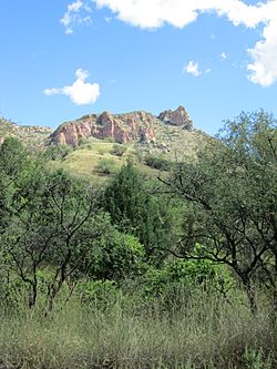
The Patagonia Mountains, north of Harshaw
|
|
| Highest point | |
| Peak | Mount Washington |
| Elevation | 7,221 ft (2,201 m) |
| Geography | |
| Country | United States |
| State | Arizona |
| Range coordinates | 31°25′50″N 110°45′32″W / 31.43056°N 110.75889°W |
The Patagonia Mountains are a mountain range about 15 miles (24 km) long. They are located in Santa Cruz County, Arizona, United States. These mountains are part of the Coronado National Forest.
Contents
Where are the Patagonia Mountains?
The Patagonia Mountains start close to the Mexico border, east of Nogales, Arizona. They stretch north and are connected to the Santa Rita Mountains. The Santa Rita Mountains continue further north past Sonoita Creek.
Both the Patagonia Mountains and the Santa Rita Mountains are east of the Santa Cruz River Valley. Arizona State Route 82 travels through the Sonoita Valley. This valley follows Sonoita Creek, which flows between the Santa Rita and Patagonia ranges. Patagonia Lake and the town of Patagonia are found in this valley.
Important Peaks and Features
Some of the tallest peaks in the Patagonia Mountains include:
- Mount Washington, which is the highest at 7,221 feet (2,201 meters).
- Veteran's Peak, standing at 7,211 feet (2,198 meters).
- Guajalote Peak, which is 6,490 feet (1,978 meters) tall.
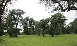
North of Guajalote Peak is an area called Soldier Basin. Above and to the east of this basin, you can find the largest natural forest of ponderosa and Chihuahua pine trees in the range.
Neighboring Areas
The Sierra San Antonio mountains are a continuation of the Patagonia Mountains. They extend south into Mexico for about 10 miles (16 km). These mountains become lower in elevation where the Santa Cruz River bends near the town of San Lázaro in Sonora, Mexico.
Several old mining towns and ghost towns are located in the Patagonia Mountains. These include Mowry, Washington Camp, Harshaw, and Duquesne.
The cities of Nogales, Arizona, and Nogales, Sonora, are in the valley southwest of the mountain range. To the east of the Patagonia Mountains, you will find the San Rafael Valley and the Canelo Hills.
What is a Sky Island?
The Santa Rita, Patagonia, and Sierra San Antonio mountain ranges are part of a special area called the Madrean Sky Islands. A "sky island" is a mountain range that is isolated by surrounding lowlands of a very different environment. Imagine an island in the ocean, but instead of water, it's surrounded by desert or grassland.
These mountain ranges are like islands of cooler, wetter habitats. They are home to plants and animals that usually live at higher elevations. This region is located north of the Sierra Madre Occidental, which is a major mountain range in central-western and northwestern Mexico.
See also
 In Spanish: Sierra de la Patagonia para niños
 | Janet Taylor Pickett |
 | Synthia Saint James |
 | Howardena Pindell |
 | Faith Ringgold |


