Pedley, California facts for kids
Quick facts for kids
Pedley
|
|
|---|---|
|
Former census-designated place
|
|

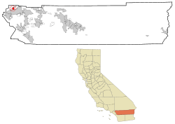
Location in Riverside County and the state of California
|
|
| Country | |
| State | |
| County | Riverside |
| Inc. into Jurupa Valley | July 1, 2011 |
| Area | |
| • Total | 5.116 sq mi (13.250 km2) |
| • Land | 5.079 sq mi (13.155 km2) |
| • Water | 0.037 sq mi (0.096 km2) 0.72% |
| Elevation | 722 ft (220 m) |
| Population
(2010)
|
|
| • Total | 12,672 |
| • Density | 2,476.9/sq mi (956.38/km2) |
| Time zone | UTC-8 (PST) |
| • Summer (DST) | UTC-7 (PDT) |
| ZIP code |
92509
|
| Area code(s) | 951 |
| FIPS code | 06-56350 |
| GNIS feature ID | 1661208 |
Pedley was a community in Riverside County, California. It was known as a census-designated place (CDP). This means it was an area identified by the government for gathering population data.
In 2010, about 12,672 people lived there. This was more than the 11,207 people counted in 2000. On July 1, 2011, Pedley became part of a new city called Jurupa Valley.
Contents
History of Pedley
Pedley got its name from a man named William Pedley. He was an English cricket player. Later, he became the manager of the San Jacinto Land Company in Riverside, California.
William Pedley designed and built the irrigation system for the area. This system helped bring water to the land. The community was named Pedley around 1903 or 1904. This happened when a railroad company, the San Pedro, Los Angeles and Salt Lake Railroad (now Union Pacific Railroad Company), put in a switch and a train station there.
A large concrete train bridge crosses the Santa Ana River nearby. It was once the longest concrete railroad bridge in the United States. On the northern side of Pedley, there is a special railroad track setup called the Bly Wye. This wye connected to a cement mill and a rock quarry. The rock from the quarry was used for things like building the San Pedro Harbor.
Becoming Part of Jurupa Valley
On March 8, 2011, people in the area voted on a plan. They voted to create a new city called Jurupa Valley. The vote was successful, with 54.03% of people voting yes.
This new city included Pedley and other nearby communities. These were Mira Loma, Rubidoux, Glen Avon, and Sunnyslope. Pedley officially became part of Jurupa Valley on July 1, 2011.
People of Pedley
In 2010, the community of Pedley had 12,672 residents. Most of these people, about 98.7%, lived in homes.
There were 3,451 households in Pedley. Many of these households, about 46.8%, had children under 18 living in them. Most households were married couples living together. The average household had about 3.62 people.
The population included people of all ages. About 27.7% of residents were under 18 years old. About 10% of residents were 65 years or older. The average age in Pedley was 33.4 years.
Most homes in Pedley were owned by the people living in them. About 75.6% of homes were owner-occupied. The rest were rented.
Emergency Services
The Riverside County Fire Department helps Pedley. They work with CAL FIRE to provide fire and paramedic services. This means they respond to fires and medical emergencies.
For law enforcement, the Riverside County Sheriff's Department serves Pedley. Their office is located in Rubidoux. They help keep the entire Jurupa Valley area safe.
See also
 In Spanish: Pedley (California) para niños


