Petit Bois Island (Mississippi) facts for kids
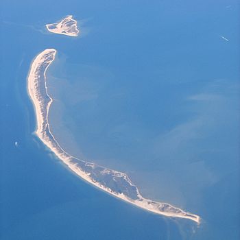
Aerial view of Petit Bois Island (viewed towards the west; north is to the right)
|
|
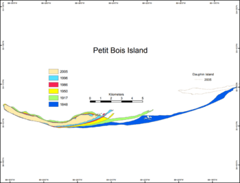
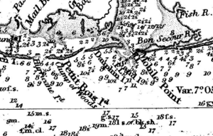
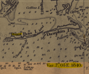
Historical map of the changing geomorphology of Petit Bois Island
|
|
| Geography | |
|---|---|
| Location | Gulf of Mexico |
| Coordinates | 30°12′N 88°27′W / 30.200°N 88.450°W |
| Archipelago | Mississippi–Alabama barrier islands |
| Administration | |
| State | Mississippi |
| County | Jackson County |
Petit Bois Island is a barrier island located off the Mississippi Gulf Coast. It sits south of Pascagoula. This island is one of several Mississippi–Alabama barrier islands. It is part of Jackson County, Mississippi. Since 1971, it has been managed by the U.S. National Park Service. It is part of the Gulf Islands National Seashore.
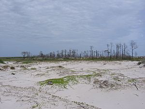
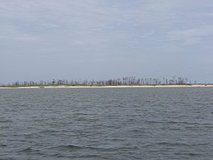
The name Petit Bois comes from French. It means "little woods." Early French explorers gave the island this name. They saw a small wooded area on its eastern side. Most of the island is covered in sand and scrub plants. After Hurricane Katrina hit, many of the trees in this "little woods" section died.
Contents
How Petit Bois Island Changes Shape
Islands like Petit Bois are always changing. They are shaped by ocean currents, winds, and storms. A French map from 1732 showed a long sandbar connecting Petit Bois Island to Dauphin Island.
This connection broke apart sometime between 1740 and 1766. A big hurricane in 1740 might have caused this change. Over time, the island's shape and size have continued to shift.
Island Size and Location Changes
Petit Bois Island used to be longer. It stretched about 7 miles (11 km) east of the Alabama-Mississippi state line. This meant it was partly in both states. But from 1933 to 1968, the eastern end of the island wore away.
This erosion happened because of hurricanes and natural shoreline movements. Now, the island's eastern end is about 0.5 miles (0.8 km) west of the Mississippi state line. The island is currently about 6 miles (9.7 km) long.
Wildlife on the Island
Petit Bois Island is an important home for many animals. You can find gulls, terns, and plovers here. These birds often nest on the sandy shores. Alligators also live on the island. Many other types of wildlife make their homes in this unique environment.
The Name Massacre Island
Some old maps suggest that Petit Bois Island might have once been called Massacre Island. This name came from a discovery made on the island in 1699. It is thought that this discovery led to the island being given such a memorable name.
See also
 In Spanish: Isla Petit Bois para niños
 | James Van Der Zee |
 | Alma Thomas |
 | Ellis Wilson |
 | Margaret Taylor-Burroughs |


