Mississippi Sound facts for kids
Quick facts for kids Mississippi Sound |
|
|---|---|

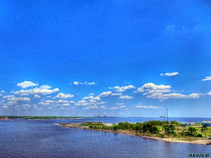
The Mississippi Sound between the Gulf coast and the Mississippi–Alabama barrier islands
|
|
| Location | Gulf Coast of the United States |
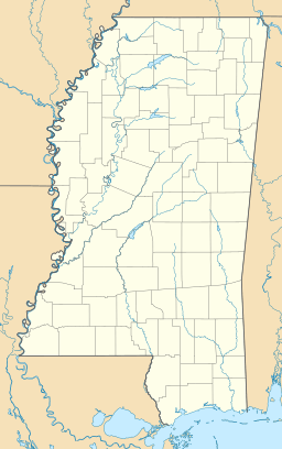
| Coordinates | 30°16′N 88°31′W / 30.267°N 88.517°W |
| Part of | Gulf of Mexico |
| River sources | Pearl River, Pascagoula River, Mobile River |
| Max. length | 90 miles (145 km) |
| Max. depth | 20 feet (6 m) |
| Islands | Mississippi–Alabama barrier islands |
The Mississippi Sound is a special body of water along the Gulf Coast of the United States. It's like a big, calm bay that stretches from Waveland, Mississippi, to the Dauphin Island Bridge in Alabama. This sound is about 90 miles (145 km) long.
The sound is separated from the big Gulf of Mexico by a chain of sandy islands. These are called the Mississippi–Alabama barrier islands. They include Cat, Ship, Horn, West Petit Bois, Petit Bois, and Dauphin Island. These islands act like a natural wall, protecting the sound from the strong waves of the open ocean. Some of these islands, like Ship and Horn, are part of the Gulf Islands National Seashore, which is a national park.
A Special Waterway
The islands that protect the Mississippi Sound were formed a very long time ago. Over two thousand years ago, the ancient Mississippi River helped create the sand and dirt for these islands. As the river's delta grew, it slowly separated the Mississippi Sound from the open Gulf of Mexico. This made the sound a calmer, more protected area.
Life in the Sound
The Mississippi Sound is home to many kinds of seafood, especially shellfish like oysters and crabs. However, in recent years, the amount and quality of seafood have gone down. This is due to things like pollution and big weather events, such as hurricanes, floods, or droughts.
Government groups are working to help bring back the shellfish and keep the water clean for people who visit the beaches. Sometimes, large amounts of freshwater are released into the sound from places like the Bonnet Carré Spillway. This can harm the oyster and crab populations. After some of these events, efforts are made to help the fisheries recover. People also enjoy sport fishing in the sound all year round.

Traveling the Waters
Much of the Mississippi Sound is about 20 feet (6 meters) deep. A part of the Gulf Intracoastal Waterway goes through the sound. This waterway is like a highway for boats, especially towboats and barges. It's kept at a depth of about 12 feet (3.7 meters) by the United States Army Corps of Engineers.
For most of its path, the waterway simply follows a natural deep area. But in some places, like west of Cat Island or north of Dauphin Island, channels need to be dug deeper. These channels are marked with special signs to help boats navigate safely. The United States Coast Guard helps maintain these navigation aids.
Rivers and Bays
Several important rivers flow into the Mississippi Sound. These include the Pascagoula River and the Pearl River. On the northern side of the sound, there are also bays that reach into the mainland of Mississippi. These include the Bay of St. Louis and Biloxi Bay. These bays also have smaller rivers and bayous, like the Wolf and Jourdan Rivers, that drain into them.
 | Emma Amos |
 | Edward Mitchell Bannister |
 | Larry D. Alexander |
 | Ernie Barnes |


