Pigeon Run (Sullivan Branch) facts for kids
Quick facts for kids Pigeon Run |
|
|---|---|
| Physical characteristics | |
| Main source | eastern Davidson Township, Sullivan County, Pennsylvania 2,300 to 2,320 feet (700 to 710 m) |
| River mouth | Sullivan Branch in Davidson Township, Sullivan County, Pennsylvania 1,489 ft (454 m) |
| Length | 1.3 mi (2.1 km) |
| Basin features | |
| Progression | Sullivan Branch → East Branch Fishing Creek → Fishing Creek → Susquehanna River → Chesapeake Bay |
| Basin size | 0.78 sq mi (2.0 km2) |
Pigeon Run is a small stream in Sullivan County, Pennsylvania. It flows into Sullivan Branch. The stream is about 1.3 miles (2.1 km) long. It runs through Davidson Township.
Pigeon Run has a low pH, which means its water is often acidic. This can make the water quality poor. However, there are plans to help improve the stream's health. The area around the stream has different types of rocks and soils.
Contents
Where Pigeon Run Flows
Pigeon Run starts in the eastern part of Davidson Township. This is close to the border of Luzerne County. The stream first flows south. Then it enters a very steep valley. About halfway down the valley, it changes direction. It starts flowing southwest. Pigeon Run then meets Sullivan Branch at the end of this valley.
Water Quality of Pigeon Run
When Pigeon Run has an average amount of water flowing, about 636 gallons per minute move through it. The water's pH can be very low, sometimes less than 4. A pH of 7 is neutral, so lower numbers mean more acidic water. On average, its pH is 5.11. The water also has a small amount of aluminum in it.
Pigeon Run often has acidic water. This is called chronic acidification. The stream's water quality is considered "fair" when water levels are normal. But when there's a lot of water, like after heavy rain, the quality becomes "very poor."
To make the water healthier, Pigeon Run needs more alkalinity. Alkalinity helps to balance out the acid. About 7 pounds (3.2 kg) of alkalinity are needed each day. Scientists are looking at ways to add this. They might use special wetlands or add lime to nearby roads. The Pennsylvania Department of Environmental Protection says Pigeon Run is harmed by air pollution. This pollution affects the water's pH and adds metals.
Land and Rocks Around the Stream
The land around where Pigeon Run meets Sullivan Branch is about 1,489 feet (454 m) above sea level. Where Pigeon Run starts, the land is much higher. It's between 2,300 feet (700 m) and 2,320 feet (710 m) above sea level.
The rocks near the mouth of Pigeon Run are from the Catskill Formation. As you go upstream, the stream flows over rocks from the Huntley Mountain Formation. The highest parts of the stream are on Burgoon Sandstone. These are all different types of rock layers.
The soils near Pigeon Run are mostly acidic. There are also some rock outcroppings, which are places where rock sticks out of the ground. There is even a bed of iron ore along Pigeon Run.
Pigeon Run's Area
The entire area that drains water into Pigeon Run is called its watershed. This watershed covers about 0.78 square miles (2.0 km2). There are 1.3 miles (2.1 km) of streams within this watershed.
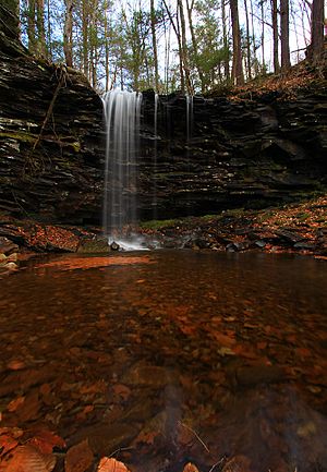
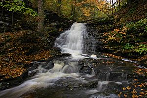
You can only reach Pigeon Run by hiking. There is a trail that crosses the stream. The Pennsylvania Department of Environmental Protection wants Pigeon Run to be a good home for aquatic life. This means they want fish and other water creatures to thrive there. Pigeon Run also has a beautiful waterfall called Pigeon Run Falls.
History of Restoration Efforts
Efforts to restore Pigeon Run are part of a bigger plan. This plan is called the East Branch Fishing Creek Restoration Plan. Fixing Pigeon Run is the fourth step in this plan. This phase also includes helping other parts of Sullivan Branch. It is expected to cost about $400,000. This makes it the most expensive part of the restoration plan.
The Pennsylvania Department of Environmental Protection first noted that Pigeon Run was unhealthy in 2002. By December 2011, a plan was set to fully address its issues by 2015.
 | Laphonza Butler |
 | Daisy Bates |
 | Elizabeth Piper Ensley |


