
Pigniu facts for kids
Quick facts for kids
Pigniu
|
||
|---|---|---|
 |
||
|
||

Pigniu
Location in Switzerland

Pigniu
Location in Canton of Graubünden
|
||
| Country | Switzerland | |
| Canton | Graubünden | |
| District | Surselva | |
| Area | ||
| • Total | 17.98 km2 (6.94 sq mi) | |
| Elevation | 1,301 m (4,268 ft) | |
| Population
(Dec 2011)
|
||
| • Total | 33 | |
| • Density | 1.835/km2 (4.75/sq mi) | |
| Postal code |
7156
|
|
| Surrounded by | Andiast, Glarus Süd (GL), Rueun, Siat | |

Pigniu (also known as Panix in German) used to be a small town, called a municipality, in Switzerland. It was located in the Surselva district, in the Graubünden area. The main language spoken there was Romansh.
On January 1, 2014, Pigniu joined with several other nearby towns. These included Castrisch, Ilanz, Ladir, Luven, Pitasch, Riein, Ruschein, Schnaus, Sevgein, Duvin, Rueun, and Siat. Together, they formed a new, larger municipality called Ilanz/Glion.
Contents
A Look at Pigniu's History

Pigniu was likely first settled by people from a place called Andiast. The name Pingyow was first written down in 1403. Later, in 1522, the German name Panix appeared. Until 1984, the town was known as Pigniu/Panix.
The Church of St. Valentin was officially opened in 1465. It was a very popular place for people to visit on religious journeys. Pigniu had its own church community until 1667.
An important event happened in 1799. On October 7, the Russian Army, led by Field Marshal Suvorov, traveled through the Pigniu pass.
Understanding Pigniu's Coat of Arms
A coat of arms is like a special symbol for a town or family. Pigniu's coat of arms shows St. Valentin. He is dressed in gold and silver. He holds one hand up in a blessing. In his other hand, he holds a special staff called a crosier. He stands over a sick boy dressed in black. This symbol comes from the church's patron saint.
Exploring Pigniu's Geography
Before it merged, Pigniu covered an area of about 18 square kilometers (7 square miles). A good portion of this land, about 36%, was used for farming. Forests covered about 14.8% of the area.
Only a small part, 0.4%, had buildings or roads. The rest of the land, nearly half (48.8%), was made up of natural features. These included rivers, glaciers, or mountains.
The former town is located in the Surselva district. It is near the border with the canton of Glarus. It sits at the entrance to the Panix Pass. Pigniu is also on an old Alpine road that leads into Italy. This road goes over the Lukmanier Pass.
Above the village, there is a reservoir called Lag da Pigniu. A reservoir is a large lake used to store water.
Pigniu's Population and People
In 2011, Pigniu had a population of 33 people. In 2008, about 5.7% of the people living there were from other countries. Over the ten years before 2008, the population got smaller by almost 30%.
Most people in Pigniu (91.1%) spoke Romansh in the year 2000. The rest (8.9%) spoke German.
In 2000, the population was split evenly between males and females. Each made up 50% of the total.
Here's how the ages were spread out in 2000:
- 7 children (15.6%) were between 0 and 9 years old.
- 9 teenagers (20.0%) were between 10 and 19 years old.
- 4 adults (8.9%) were between 20 and 29 years old.
- 6 adults (13.3%) were between 30 and 39 years old.
- 9 adults (20.0%) were between 40 and 49 years old.
- 2 adults (4.4%) were between 50 and 59 years old.
- 1 person was between 60 and 69 years old.
- 5 people (11.1%) were between 70 and 79 years old.
- 1 person was between 80 and 89 years old.
- 1 person was between 90 and 99 years old.
In the 2007 national election, the SVP was the most popular. It received 72.3% of the votes. Other parties also received some votes.
Many adults in Pigniu have a good education. About 68.4% of people aged 25-64 have finished high school or gone on to higher education. This could be a university or a specialized college.
Historical Population Changes
The table below shows how Pigniu's population has changed over many years.
| year | population |
|---|---|
| 1850 | 70 |
| 1900 | 61 |
| 1920 | 87 |
| 1950 | 78 |
| 2000 | 45 |
| 2010 | 28 |
Pigniu's Economy and Work
Pigniu was mainly a farming community. It did not have large factories or many businesses. The local school in Pigniu closed in 1974. Since 1972, the town has received support from the nearby town of Schlieren.
Pigniu had a very low unemployment rate of 0.93%. In 2005, five people worked in farming. There were three businesses related to farming. There were no jobs or businesses in manufacturing. Only one person worked in the service industry, which had one business.
Pigniu's Weather Patterns
Pigniu experiences about 166.3 days of rain or snow each year. On average, it receives about 1347 millimeters (53 inches) of rain or snow annually.
The wettest month is August. During this month, Pigniu gets about 141 millimeters (5.6 inches) of rain or snow. It rains or snows for about 16 days in August.
May has the most days with rain or snow, averaging 16.6 days. However, it gets less total precipitation, about 124 millimeters (4.9 inches). The driest month is October. It receives about 90 millimeters (3.5 inches) of precipitation over 16 days.
Images for kids
-
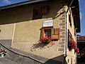
A house in Pigniu.

See also
 In Spanish: Pigniu para niños
