Siat facts for kids
Quick facts for kids
Siat
|
||
|---|---|---|
 |
||
|
||
| Country | Switzerland | |
| Canton | Graubünden | |
| District | Surselva | |
| Area | ||
| • Total | 13.48 km2 (5.20 sq mi) | |
| Elevation | 1,296 m (4,252 ft) | |
| Population
(Dec 2011)
|
||
| • Total | 171 | |
| • Density | 12.69/km2 (32.86/sq mi) | |
| Postal code |
7157
|
|
| Surrounded by | Glarus Süd (GL), Pigniu, Rueun, Ruschein, Schnaus | |
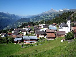
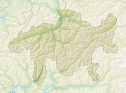
Siat was once a small town, or municipality, in Switzerland. It was located in the Graubünden area, which is a canton (like a state). Siat was part of the Surselva district.
On January 1, 2014, Siat joined with 12 other towns. These towns were Castrisch, Ilanz, Ladir, Luven, Pitasch, Riein, Ruschein, Schnaus, Sevgein, Duvin, Pigniu, and Rueun. They all became part of a new, larger town called Ilanz/Glion.
Contents
History of Siat
Siat is a very old place. It was first written about around the year 840. Back then, its name was Septe.
The town's name changed over time. Until 1943, Siat was known as Seth.
Geography of Siat
Before it merged with other towns, Siat covered about 13.5 square kilometers (about 5.2 square miles). A large part of this land, 51.1%, was used for farming. Forests covered 33.6% of the area.
About 1.9% of the land had buildings or roads. The rest, 13.4%, was made up of things like rivers, glaciers, or mountains.
Location and Landscape
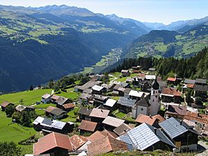
Siat was located in the Surselva district. It sat high up on the north side of the Vorderrhein valley. The town itself did not reach the flat land in the valley or the river.
Siat was a haufendorf village. This means it was an unplanned village with buildings packed closely around a central area. It also included a mountain farming area called Alp da Siat. This area was used for herding animals in the mountains.
Hiking Trails
A long hiking path called the Senda Sursilvana goes through Siat. This trail follows the northern side of the Vorderrhein valley. Hikers can walk through towns like Falera, Ladir, and Siat, and then continue towards Panix.
Siat's Coat of Arms
A coat of arms is like a special symbol for a town. Siat's coat of arms has a blue background. On it, there is a golden cup and a golden seven-pointed star at the top.
The golden cup on the coat of arms stands for Saint Florinus. He is the special patron saint of the village church in Siat. The seven-pointed star is also important. It represents the Romansh name of the village, which means "seven".
People of Siat
In 2011, Siat had 171 people living there. In 2008, a small part of the population, 2.8%, were people from other countries. Over the 10 years before 2011, the number of people living in Siat went down by 12.3%.
Languages Spoken
Most people in Siat speak Romansh. In 2000, about 82.5% of the people spoke Romansh. The second most common language was German, spoken by 16.4% of the people. A small number, 0.5%, spoke French.
Education and Jobs
Many adults in Siat have a good education. In 2000, about 65.9% of people aged 25-64 had finished upper secondary education (like high school). Some also had higher education from a university or a special college called a Fachhochschule.
Siat had a very low unemployment rate, meaning almost everyone who wanted a job had one. In 2005, 20 people worked in farming, which is the primary economic sector. There were 9 businesses in this area. Only 1 person worked in the secondary sector (like manufacturing), with 1 business. In the tertiary sector (like services), 8 people worked, and there were 4 businesses.
Population Changes Over Time
The table below shows how the number of people living in Siat changed over many years:
| year | population |
|---|---|
| 1803 | 203 |
| 1850 | 239 |
| 1900 | 185 |
| 1950 | 219 |
| 1960 | 241 |
| 1990 | 187 |
| 2000 | 189 |
See also
 In Spanish: Siat para niños
 | Dorothy Vaughan |
 | Charles Henry Turner |
 | Hildrus Poindexter |
 | Henry Cecil McBay |


