Pilot Knob, Missouri facts for kids
Quick facts for kids
Pilot Knob, Missouri
|
|
|---|---|

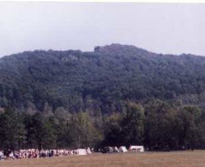
Pilot Knob Mountain, near the city of Pilot Knob
|
|

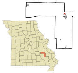
Location of Pilot Knob, Missouri
|
|
| Country | United States |
| State | Missouri |
| County | Iron |
| Area | |
| • Total | 0.90 sq mi (2.32 km2) |
| • Land | 0.89 sq mi (2.32 km2) |
| • Water | 0.00 sq mi (0.01 km2) |
| Elevation | 965 ft (294 m) |
| Population
(2020)
|
|
| • Total | 671 |
| • Density | 750.56/sq mi (289.84/km2) |
| Time zone | UTC-6 (Central (CST)) |
| • Summer (DST) | UTC-5 (CDT) |
| ZIP code |
63663
|
| Area code(s) | 573 |
| FIPS code | 29-57656 |
| GNIS feature ID | 2396205 |
Pilot Knob is a small city located in the northeastern part of Iron County, Missouri, in the United States. In 2020, about 671 people lived there. It is about 18 miles (29 km) southeast of Belgrade and 27 miles (43 km) northeast of Centerville.
Contents
History of Pilot Knob
Pilot Knob was officially planned and settled in 1858. The city got its name from the nearby Pilot Knob mountain. This mountain was a very important landmark. It helped hunters and travelers find their way, acting like a "pilot" for them. A post office has been open in Pilot Knob since 1858.
The Battle of Pilot Knob
A very important event in the area was the Battle of Pilot Knob. This battle happened in the fall of 1864 during the Civil War. It was a major fight in this region. Today, there is a museum close to the battle site. It helps people learn all about this historical event.
Geography of Pilot Knob
Pilot Knob is located along Missouri Route 21. It is about 1.5 miles (2.4 km) north-northeast of Ironton. The city is also about 3 miles (4.8 km) southeast of Elephant Rocks State Park, a popular place to visit.
The United States Census Bureau says that Pilot Knob covers a total area of about 0.90 square miles (2.32 square kilometers). Most of this area, about 0.89 square miles (2.30 square kilometers), is land. A very small part, about 0.01 square miles (0.026 square kilometers), is water.
Population and People
The word "demographics" means studying the population of a place. This includes how many people live there and what groups they belong to.
| Historical population | |||
|---|---|---|---|
| Census | Pop. | %± | |
| 1860 | 302 | — | |
| 1870 | 581 | 92.4% | |
| 1880 | 1,359 | 133.9% | |
| 1890 | 757 | −44.3% | |
| 1950 | 582 | — | |
| 1960 | 524 | −10.0% | |
| 1970 | 582 | 11.1% | |
| 1980 | 722 | 24.1% | |
| 1990 | 783 | 8.4% | |
| 2000 | 697 | −11.0% | |
| 2010 | 746 | 7.0% | |
| 2020 | 671 | −10.1% | |
| U.S. Decennial Census 2020 | |||
Pilot Knob in 2010
According to the census from 2010, 746 people lived in Pilot Knob. There were 335 households, which are groups of people living together in one home. Out of these, 195 were families.
The city had about 838 people per square mile (323 people per square kilometer). There were also 392 housing units, like houses or apartments.
- About 29.3% of households had children under 18 living with them.
- About 38.8% of households were married couples living together.
- The average household had 2.23 people.
- The average family had 2.83 people.
The average age of people in the city was 39.9 years old.
- About 24.1% of residents were under 18 years old.
- About 20.6% of residents were 65 years or older.
- The population was made up of 46.4% males and 53.6% females.
See also
 In Spanish: Pilot Knob (Misuri) para niños
 | Janet Taylor Pickett |
 | Synthia Saint James |
 | Howardena Pindell |
 | Faith Ringgold |

