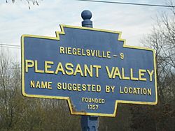
Pleasant Valley, Bucks County, Pennsylvania facts for kids
Quick facts for kids
Pleasant Valley
Schuckenhausen
|
||
|---|---|---|
|
Unincorporated community
|
||
|
||
| Country | United States | |
| State | Pennsylvania | |
| County | Bucks | |
| Township | Springfield | |
| Elevation | 472 ft (144 m) | |
| Time zone | UTC-5 (Eastern (EST)) | |
| • Summer (DST) | UTC-4 (EDT) | |
| Area code(s) | 215, 267, 445 | |
Pleasant Valley is a small community in Springfield Township, Bucks County, Pennsylvania, in the United States. It's called an "unincorporated community" because it doesn't have its own local government like a city or town. Instead, it's part of the larger township.
Contents
History of Pleasant Valley
Early Days and Name Changes
Long ago, before European settlers arrived, the Lenape people lived in the area where Pleasant Valley is now.
The first name for this place was Schuckenhausen. This name came from the very first church built here, which was a simple log building. Later, in 1872, a new stone church called the Union Church was built in its place. This stone church later became a house.
The oldest building still standing is the Pleasant Valley Inn. This inn is no longer open for business. A famous person, General Lafayette, once stopped at the inn. He was on his way to a hospital in Bethlehem after being hurt in the Battle of Brandywine.
The village of Pleasant Valley grew on land that used to be two farms. One farm belonged to Jacob Smith, and the other to John J. Ott. The name of the community changed to Pleasant Valley when a post office was opened there on September 15, 1828. Lewis Ott was the first postmaster.
Pleasant Valley is officially recognized by the United States Geological Survey. It was added to their Geographic Names Information System on August 2, 1979.
Geography of Pleasant Valley
Location and Nearby Areas
Pleasant Valley is located on Quakertown Road, which is also known as Pennsylvania Route 212. You can find it at these coordinates: 40°31′16″N 75°17′34″W / 40.52111°N 75.29278°W.
The community is about 4 miles (6.4 km) northeast of Richlandtown. Coopersburg is located about 5 miles (8.0 km) to the west. Pleasant Valley sits at an elevation of about 472 feet (144 m) above sea level.
Hills and Waterways
Pleasant Valley is surrounded by three nearby hills. Cressman Hill is about 1.5 miles (2.4 km) to the southeast, with an elevation of 673 feet (205 m). Molasses Hill is about 1.25 miles (2.0 km) to the east, at 495 feet (151 m) high. The Lookout is about 3 miles (4.8 km) to the west, reaching 906 feet (276 m).
Cooks Creek flows just south of the community. This creek is part of the Delaware River watershed. A watershed is an area of land where all the water drains into a common river, lake, or ocean.
Geology of Pleasant Valley
Understanding the Rocks Below
Pleasant Valley is located in an area with a type of rock formation called the Brunswick Formation. These rocks were formed during the Triassic period, which was a very long time ago.
The Brunswick Formation is made up of different kinds of sedimentary rocks. These include mudstone, siltstone, and shale. Mudstone is a type of rock made from hardened mud. Siltstone is similar but made from silt, which is finer than sand. Shale is a soft, layered rock that can be brown, green, or reddish-brown.
 | William Lucy |
 | Charles Hayes |
 | Cleveland Robinson |


