Poestenkill, New York facts for kids
Quick facts for kids
Poestenkill, New York
|
|
|---|---|

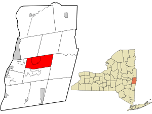
Location in Rensselaer County and the state of New York.
|
|
| Country | United States |
| State | New York |
| County | Rensselaer |
| Settled | 1770 |
| Incorporated | March 2, 1848 |
| Area | |
| • Total | 32.57 sq mi (84.37 km2) |
| • Land | 32.35 sq mi (83.80 km2) |
| • Water | 0.22 sq mi (0.57 km2) |
| Elevation | 928 ft (283 m) |
| Population
(2020)
|
|
| • Total | 4,322 |
| Time zone | UTC-5 (Eastern (EST)) |
| • Summer (DST) | UTC-4 (EDT) |
| ZIP code |
12140
|
| Area code(s) | 518 |
| FIPS code | 36-58805 |
| GNIS feature ID | 0979380 |
| Website | poestenkillny.com |
Poestenkill is a small town located in Rensselaer County, New York, United States. In 2020, about 4,322 people lived there. The town is found southeast of Troy and sits in the middle of Rensselaer County.
The town gets its name from the Poesten Kill, which is an important stream in the area. The word Poesten Kill comes from Dutch. Kil means "water" or "creek." It's believed the stream was named after Jan Barentsen Wemp, a farmer and miller from the 1600s. He had a nickname, Poest, and owned a farm and mill on the creek.
Some of the first people to settle in the town included Archelaus Lynd. He rented land and started clearing it near what is now Hillside Cemetery. The Whyland and Ives families also settled there early on.
Contents
History of Poestenkill
When Poestenkill Was Settled
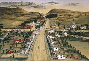
People first started settling in the Poestenkill area around 1770. The town of Poestenkill was officially created on March 2, 1848. It was formed from a part of the nearby Town of Sand Lake.
Poestenkill During Wars
During the American Revolutionary War, several men from the Poestenkill area joined the fight for independence. One person, Benjamin Cotterel, is said to have helped carry earth at the Battle of Bunker Hill.
Later, in the War of 1812, five men from Poestenkill served. They all joined a group known as the Eddy expedition. Many men from Poestenkill also served in the American Civil War to support the Union.
Early Community Life
The very first school in the area was started in or soon after 1788. The land for this school was given by Stephen Van Rensselaer III. The first regular church in Poestenkill was the First Baptist Church, which was formed in 1814 in East Poestenkill.
Famous Visitors and Anniversaries
In 1856, future president James A. Garfield thought about becoming a high school principal in Poestenkill. However, someone else got the job.
In 1998, Poestenkill celebrated its 150th anniversary. Many events were held, including a reenactment of a Revolutionary War battle, an antique car show, and a parade. A special postcard was also made for the town.
Geography and Location
What is Poestenkill Like?
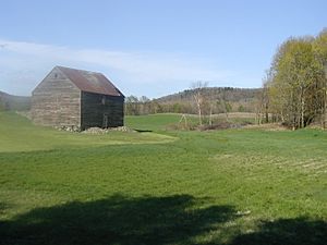
The town of Poestenkill covers about 32.6 square miles (84.37 square kilometers). Most of this area is land, with only a small part being water. The eastern and central parts of the town are located on the Rensselaer Plateau, which is a raised, flat area.
Schools and Services
Students in Poestenkill attend schools in either the Brunswick (Brittonkill) Central School District or the Averill Park Central School District.
Where is Poestenkill?
Poestenkill is surrounded by other towns:
 |
Town of Brunswick, Town of Grafton |  |
||
| Town of North Greenbush | Town of Berlin | |||
| Town of Sand Lake |
People of Poestenkill
Population Changes Over Time
The number of people living in Poestenkill has changed over the years. Here's how the population has grown:
| Historical population | |||
|---|---|---|---|
| Census | Pop. | %± | |
| 1850 | 2,092 | — | |
| 1860 | 1,833 | −12.4% | |
| 1870 | 1,769 | −3.5% | |
| 1880 | 1,672 | −5.5% | |
| 1890 | 1,602 | −4.2% | |
| 1900 | 1,362 | −15.0% | |
| 1910 | 1,078 | −20.9% | |
| 1920 | 1,002 | −7.1% | |
| 1930 | 1,164 | 16.2% | |
| 1940 | 1,438 | 23.5% | |
| 1950 | 1,799 | 25.1% | |
| 1960 | 2,493 | 38.6% | |
| 1970 | 3,426 | 37.4% | |
| 1980 | 3,664 | 6.9% | |
| 1990 | 3,809 | 4.0% | |
| 2000 | 4,054 | 6.4% | |
| 2010 | 4,530 | 11.7% | |
| 2020 | 4,322 | −4.6% | |
| U.S. Decennial Census | |||
Who Lives in Poestenkill?
According to the 2000 census, there were 4,054 people living in Poestenkill. Most residents were White (98.35%). There were also small percentages of African American, Native American, and Asian residents. About 0.67% of the population identified as Latinx.
There were 1,527 households in the town. About 36.4% of these households had children under 18 living with them. The average household had 2.64 people. The median age in the town was 38 years old. This means half the people were younger than 38, and half were older.
The median income for a household in Poestenkill was $58,945. This is the middle income for all households. For families, the median income was $63,819.
Communities and Places in Poestenkill
Poestenkill has several smaller communities and interesting places:
- Barberville – This is a small hamlet located southeast of Poestenkill village. It's named after a local family.
- East Poestenkill (formerly "Columbia") – Another hamlet in the southeastern part of the town.
- Ives Corner – A hamlet found east of Poestenkill village, named after the Ives family.
- Poestenkill – This is the main hamlet of Poestenkill, where Routes 68 and 351 meet.
- Rensselaer County Airport (5B7) – An airport in the northwestern part of the town. It's mainly for small, privately owned planes, not large commercial ones.
- Poestenkill Library – This local library is part of the Upper Hudson Library System. It's a community hub where many town events take place, like book sales, children's reading hours, and holiday parties.
- Barberville Falls – A beautiful waterfall that flows into the Poestenkill creek. There's a small trail to view the waterfall, but swimming is not allowed.
See also
 In Spanish: Poestenkill para niños


