
Brunswick, New York facts for kids
Quick facts for kids
Brunswick
|
|||
|---|---|---|---|

Skyline of Brunswick from Pinewoods Avenue
|
|||
|
|||

Map of Brunswick and its major thoroughfares
|
|||

Location in Rensselaer County and the state of New York.
|
|||

Brunswick, New York
Location in New York
|
|||
| Country | |||
| State | |||
| County | Rensselaer | ||
| Settled | 1715 | ||
| Incorporated | 1807 | ||
| Area | |||
| • Total | 44.63 sq mi (115.58 km2) | ||
| • Land | 44.35 sq mi (114.86 km2) | ||
| • Water | 0.28 sq mi (0.73 km2) | ||
| Elevation | 509 ft (155 m) | ||
| Population
(2020)
|
|||
| • Total | 12,581 | ||
| • Density | 281.90/sq mi (108.851/km2) | ||
| Time zone | UTC-5 (Eastern (EST)) | ||
| • Summer (DST) | UTC-4 (EDT) | ||
| ZIP code |
12180
|
||
| Area code(s) | 518 | ||
| FIPS code | 36-10275 | ||
| GNIS feature ID | 0978762 | ||
| Website | townofbrunswick.org | ||


Brunswick is a town in Rensselaer County, New York, United States. It's a place where history meets modern life. The area was first settled in the early 1700s. It became an official town in 1807.
Brunswick is next to the city of Troy on its west side. It also shares borders with Schaghticoke, Pittstown, Grafton, Poestenkill, and North Greenbush. In 2020, about 12,581 people lived here. No one is completely sure where the town's name came from. Some people think it's named after a region in Germany called Brunswick-Lüneburg, where some of the first settlers came from.
For a long time, Brunswick was mostly farmland. But in recent decades, it has grown into a suburban area. This growth happened a lot around the town's main roads: New York Route 7 (Hoosick Road) and New York Route 2 (Brunswick Road). When Route 7 became a four-lane highway in the 1980s, more people decided to move to Brunswick.
Contents
History of Brunswick
Early Settlements and Colonial Life
The first people settled in Brunswick around 1711 to 1715. This happened in an area called Haynersville. It's hard to know exact dates because Haynersville is right on the border with Pittstown.
Haynersville was first known as "Hosek Road." This was a main road that went north from the manor along the Hudson River. It then turned east towards Hoosick, near the Vermont border. This road is mostly what we know today as Route 7. It was very important for connecting to places like Hoosick, Bennington, Vermont, and Williamstown.
Many of the early settlers were German Palatines. They were people from Germany who had first settled in another area. Some of them had been soldiers and liked the land north of them. So, they decided to move to Brunswick. More settlers came after wars in 1724.
The first church in Brunswick was the Gilead Lutheran Church. Its earliest records are from 1746. The first minister started working there in 1743. The first church building was probably a simple log structure built between 1743 and 1749.
Life was not always easy. During wars between the English and French in the 1740s and 1750s, many settlers had to leave their homes. They would go to safer places down the river. Things got better after 1760 when the French lost a big battle. After the wars, more people moved to Brunswick. These new settlers came from many different places, including Dutch, English, Scotch, Irish, and French backgrounds.
The first tavern, a place to eat and drink, opened in the area. Later, another tavern opened in 1772, run by Johannes Hayner Jr. This is how Haynersville got its name. The first store opened at Tamarack. The first mill, which ground grain, was built in 1772 on the Quackenkill. By the 1770s, the log church was too small for the growing community.
Brunswick During the Revolutionary War
Brunswick was in a tough spot during the American Revolutionary War. It was close to important travel routes between New York City and Canada. This meant people in Brunswick faced many problems from both sides. Many people had to leave their homes.
Some people in Brunswick supported the British, called Loyalists or Tories. But most, especially the German settlers, wanted freedom. This caused problems between families and neighbors. When the British army came close, many people fled to Lansingburgh.
Bald Mountain was a place where Tory groups would gather. From there, they could see the whole area. This helped them plan their attacks.
Becoming an Official Town
Brunswick was first part of the town of Troy. But Troy was growing fast and needed to be separate from its rural areas. So, in 1807, Brunswick became its own town. Grafton also became a separate town at this time.
The first town meeting was held at Nathan Betts' inn. The first town supervisor was Flores Bancker. He served from 1807 to 1809. The town didn't grow very fast at first. This was because people didn't own the land they farmed. They rented it from a manor system. But after the manor system ended in the 1840s, things changed.
Famous writer Herman Melville lived in Lansingburgh in 1840. He taught for half a year at a one-room schoolhouse in Brunswick. During the American Civil War, Brunswick sent more than 125 men to fight.
Today, Vanderhyden Lake is a popular place for fun. It used to be a water supply for Troy. Now, people use it for swimming.
Brunswick's Industrial Growth
_Restored_(Downsampled).png)
The area known as Eagle Mills became an important industrial center in the mid-to-late 1800s. Many factories were built along the Poesten Kill creek. This was because the creek had rapids and a waterfall, which provided power.
One famous business was the Eagle flour mills, which gave the area its name. Later, the building became a factory that made tools like augers and hoes. These companies were run by Joseph H. Allen. He was also the supervisor of Brunswick from 1856 to 1857. Allen even served in the American Civil War and was honored by President Lincoln. His house on Brunswick Road is still there today.
Modern Brunswick: Growth and Change
The Brunswick Historical Society started in 1974. It helps preserve the town's history. It has been located in the Garfield School since 1988.
Brunswick stayed mostly rural until the mid-to-late 1900s. In the 1990s, the town saw a lot of new development along Hoosick Road. Big stores like Walmart and Price Chopper opened in 1996. This made developers want to build more homes in Brunswick. It was a good place to live because it was easy to get to Troy and other parts of the Capital District. With new stores, people didn't have to travel far to shop.
Balancing Growth with "Smart Growth"


Around 2005, Walmart wanted to build a much larger store. This made many people in town upset. Also, in 2006, there were plans for five big housing developments. These would have added 1387 new homes. The town usually only added about 43 new homes each year.
These plans led to a group called Brunswick Smart Growth, Inc. They started a campaign against too much fast development. They wanted "sustainable and positive growth." Many people worried Brunswick would grow too fast, like Clifton Park. Brunswick Smart Growth became well-known because many residents put signs in their yards.
Some of these new developments wanted to change zoning rules. This would allow houses to be built on smaller plots of land. Also, some residents were upset that the land for one development, Highland Creek, was sold by the town supervisor and his brother. This land used to be farmland.
The issue even led to lawsuits against the town. The first lawsuit claimed the town didn't hold enough public meetings. It also said the land for Highland Creek wasn't properly zoned for homes. This lawsuit was dismissed. A second lawsuit was filed in 2007. It focused on the town's overall development plan. This lawsuit was also dismissed in 2009.
In 2007, the plan for the large Walmart store was canceled. Instead, the current Walmart was updated. None of the big housing developments have been built yet. This might be partly because of the economic downturn around that time.
Geography and Communities
Brunswick has gently rolling hills that rise to the east. You can see some ridges of the Petersburg mountain range. The highest point in Brunswick is Bald Mountain, also called Mount Rafinesque. From here, you can see a wide view of the Hudson Valley. Bald Mountain also has television and radio towers.
The Poesten Kill creek flows through Brunswick. It eventually empties into the Hudson River in Troy. This creek was important for powering mills in the past.
Brunswick covers about 44.6 square miles (115.58 square kilometers). Most of this is land, with a small amount of water.
Local Communities and Hamlets
Brunswick has several smaller communities or hamlets:
- Center Brunswick is near the middle of town. It was an early settlement point on the Hoosick Road (Route 7).
- Haynersville is in the northern part of town. It's named after the Hayner families who ran a tavern there. It was a stop for stagecoaches traveling between Troy and Bennington.
- Tamarac (also called Tamarack or Platestown) was once a busy business area. It's on a route that used to be popular for travel.
- Eagle Mills was the biggest business center in Brunswick in the late 1800s. It was also known as Millville because of its mills along the Poestenkill Creek. The creek's water power helped many businesses, like flour mills and tool factories. Today, Eagle Mills is mostly a residential area.
- Cropseyville is on Route 2. It was known for businesses that worked with wagons. It has its own post office.
- East Brunswick (also known as Rock Hollow) is above Cropseyville. It also used the Quackenkill for water power.
- Clum's Corners was an important spot in early times. It was known for good farmland. Today, it's where the regional high school is located. It's also becoming a retail center with new developments.
Important Landmarks
Brunswick has three places listed on the National Register of Historic Places. These are the Garfield School, the Little Red Schoolhouse, and the Marsh–Link–Pollock Farm.
The town is also home to Forest Park Cemetery. Some urban legends say it's one of the most haunted cemeteries in the United States. A small part of the historic Oakwood Cemetery is also in Brunswick. This cemetery is where Samuel Wilson is buried. He might be the person who inspired the character of Uncle Sam.
Community Services
Brunswick has five volunteer fire departments that help keep the town safe. These are located in Eagle Mills, Center Brunswick, Sycaway, Wynantskill, and Speigletown. The New York State Police also has a station in Brunswick.
Some homes in Brunswick get their water from Troy. But many people get their water from wells on their own property. Most homes also have their own septic systems for waste.
Fun and Recreation

Brunswick has several places for fun and recreation. The Brunswick Town Beach and Park is on North Lake Avenue. It used to be a reservoir. The town bought it in 1967, and it opened in 1968. Town residents can use it for free.
During the summer, the town hosts free concerts on Tuesday nights. These happen on the lawn of the Brunswick Community Center. The Community Center also has tennis courts, a basketball court, and a playground. You can also rent space there for special events.
The town has three golf courses. One is private, and two are open to the public. The Country Club of Troy is actually in Brunswick, even though its name says Troy. It has an 18-hole golf course. Brunswick Greens has a nine-hole course. Parts of the Frear Park Municipal Golf Course are also in Brunswick. It's an 18-hole course that opened in 1931.
Getting Around Brunswick
The two main roads in Brunswick are New York Route 2 (Brunswick Road) and New York Route 7 (Hoosick Road). Both roads start in Troy and go through Brunswick. Route 7 continues into Pittstown and then into Vermont. Route 2 continues into Grafton and then into Massachusetts.
Other important roads include New York Route 278 (Brick Church Road), which connects Routes 2 and 7. New York Route 142 (Grange Road) connects Brunswick to Lansingburgh. New York Route 351 (Farm to Market Road) connects Brunswick to Poestenkill. Route 7 in Troy becomes a four-lane highway and connects to major highways like Interstate 787 and Interstate 87. This makes it easy to get to other parts of the Capital District.
The closest airport for small, private planes is in Poestenkill. For bigger commercial flights, the Albany International Airport in Colonie is the closest. Bus service is mostly available only in the western part of town, which is close to Troy.
Education in Brunswick

Most of Brunswick is part of the Brunswick (Brittonkill) Central School District. Its main campus is at Clums Corners. Other parts of the town are in the Averill Park Central School District, the Enlarged City School District of Troy, Lansingburgh Central School District, and a small part of Wynantskill Union Free School District.
Schools located within Brunswick include Tamarac Secondary School and Tamarac Elementary School. George Washington Elementary School was scheduled to close in 2010.
High school students can also attend vo-tech (vocational-technical) programs. These programs help students learn job skills. They can also attend higher-level learning programs and Tech Valley High School.
The Capital District area has many colleges and universities. This gives students in Brunswick many choices for higher education after high school. Some popular local colleges include Hudson Valley Community College and the University at Albany. Other options are The College of Saint Rose, Rensselaer Polytechnic Institute, Russell Sage College, and Union College.
Images for kids
-
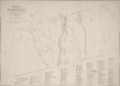
Map of the Manor of Rensselaerswyck from 1767
-
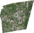
Satellite photo of Brunswick


See also
 In Spanish: Brunswick (Nueva York) para niños
