
National Register of Historic Places listings in Rensselaer County, New York facts for kids

This page is a list of special places and buildings in Rensselaer County, New York, New York, United States. These places are listed on the National Register of Historic Places. This means they are important to history and are protected. Seven of these places are even more special and are called National Historic Landmarks.
Rensselaer County is located east of the Hudson River in New York. It's part of an area called the Capital District. It also shares borders with Massachusetts and Vermont.
A Look Back: Rensselaer County's History
Long ago, the Mohican Native American tribe lived here. In 1630, a Dutch merchant named Kiliaen van Rensselaer bought the land. It became part of his large estate called Rensselaerswyck. This estate was part of the Dutch colony of New Netherland.
Later, in 1664, the land became part of English territory. The Dutch took it back for a year in 1673, but the English got control again in 1674. It stayed under British rule until 1776, when America became independent during the American Revolution.
Rensselaer County officially became its own government area in 1791. Before that, it was part of Albany County. Today, Rensselaer County has two cities: Rensselaer and Troy. It also has fourteen towns and six villages.
Historic Places in Rensselaer County
Many buildings and areas in Rensselaer County are on the National Register of Historic Places. These places help us learn about the past. They show us how people lived, worked, and built things long ago.
Here are some examples of these interesting places:
Historic Homes and Farms
Many old homes and farms in Rensselaer County are protected. They show us what life was like in earlier times.
- Adams–Myers–Bryan Farmstead in Valley Falls: This is an old farm that tells the story of farming in the area.
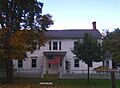
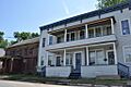
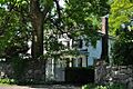
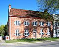
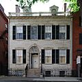
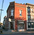
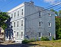
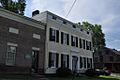
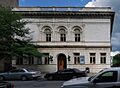
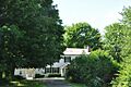
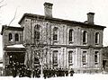
- Aiken House in Rensselaer: A historic house that has been around since 1974.
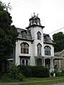
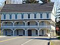
- Blink Bonnie in Schodack: This house was added to the list in 2000.
- Breese-Reynolds House in Hoosick: Built in 1880, this house has a lot of history.
- Defreest Homestead in North Greenbush: An early Dutch house from around 1750, with an old Dutch barn.
- Estabrook Octagon House in Hoosick Falls: This unique eight-sided house was built in 1854. It followed ideas from a famous book about house design.
- Fort Crailo in Rensselaer: This is a very important National Historic Landmark. It's one of the best-preserved Dutch patroon houses in the Hudson Valley.
- Hart-Cluett Mansion in Troy: A beautiful 1827 mansion built in the Federal style. It's now home to the Rensselaer County Historical Society.
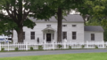
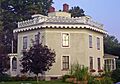
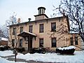
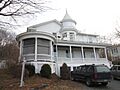
- Knickerbocker Mansion in Schaghticoke: Another historic mansion that dates back to 1972.
- Patroon Agent's House and Office in Rensselaer: This building was where the agent for the patroon (landowner) worked and lived.
- Sharpe Homestead and Cemetery in Defreestville: This property includes an old family home and cemetery.
- Henry Tunis Smith Farm in Nassau: An important farm that has been on the list since 1975.
Important Buildings and Districts
Many buildings in the cities and villages are also historic. They show how communities grew and changed.
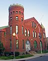
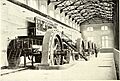
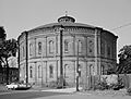
- Burden Iron Works Site and Burden Ironworks Office Building in Troy: These sites are remnants of a very important iron-making company. They show Troy's industrial past.
- Buskirk Covered Bridge in Buskirk: A historic covered bridge that spans the Hoosic River.
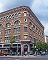
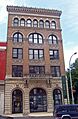
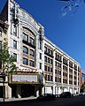
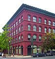
- Cannon Building in Troy: An old commercial building from 1835, which was later updated.
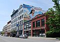
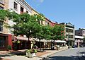
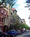
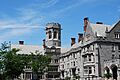
- Central Troy Historic District in Troy: This is a large area in downtown Troy with many historic commercial buildings. It includes two National Historic Landmarks.
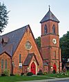
- Church of the Holy Cross in Troy: A beautiful Gothic Revival church built in 1844.
- Clark-Dearstyne-Miller Inn in Rensselaer: An old inn that has been recognized for its history.
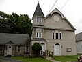
- Delaney Hotel in North Hoosick: An old hotel from around 1850 that shows Greek Revival style.
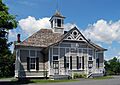
- District #6 Schoolhouse in Brunswick: Also known as the "Little Red Schoolhouse," this one-room school was built around 1830. It's one of the oldest schoolhouses left in the county.
- East Nassau Central School in East Nassau: A school building that became historic in 1997.
- Fire Alarm, Telegraph and Police Signaling Building in Troy: Built in 1922, this building helped organize the city's emergency services after many big fires.
- Gardner Earl Memorial Chapel and Crematorium in Troy: Located in Oakwood Cemetery, this chapel is a National Historic Landmark. It was built by a local businessman for his son and influenced other similar buildings.
- Garfield School in Brunswick: The first building in Brunswick to be added to the National Register.
- Hoosick Falls Armory in Hoosick Falls: An intact armory building from 1889. It was home to military units that fought in important battles.
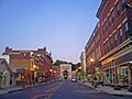
- Hoosick Falls Historic District in Hoosick Falls: The main commercial area of the village, with many buildings from its industrial peak.
- Ilium Building in Troy: A commercial building from 1904 that is still mostly as it was built.
- International Shirt and Collar Company in Troy: A building that was part of Troy's famous shirt and collar industry.
- W. P. Irwin Bank Building in Rensselaer: An old bank building that is now a historic site.
- Lansingburgh Academy in Troy: An academy building that has been recognized since 1976.
- McCarthy Building in Troy: A landmark building in downtown Troy from 1904.
- Mechanicville Hydroelectric Plant in Mechanicville: This power plant on the Hudson River is a historic district.
- Methodist Episcopal Church of Lansingburgh in Troy: A church built in 1849, expanded, and rebuilt over the years.
- Kate Mullany House in Troy: This apartment building is a National Historic Landmark. It was home to Kate Mullany, an Irish immigrant who became the first major female labor leader in the U.S.
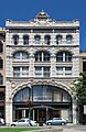
- National State Bank Building in Troy: A 1904 bank building that shows the influence of early skyscrapers.
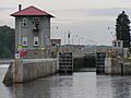
- New York State Barge Canal in Troy and Schaghticoke: This canal system, a successor to the Erie Canal, is a National Historic Landmark.
- Oakwood Cemetery in Troy: This cemetery is the burial site of famous people like "Uncle Sam" Wilson and Civil War General George H. Thomas.
- Old Troy Hospital (also known as West Hall) in Troy: This building is now part of RPI and is known for its French Second Empire style.
- Petersburgh United Methodist Church in Petersburgh: A church that became a historic site in 2004.
- Proctor's Theater in Troy: A theater from 1914 that shows how entertainment changed from live shows to movies.
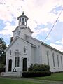
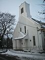
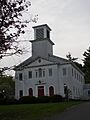
- Sand Lake Baptist Church in Averill Park: This church was added to the list in 2004.
- Searle, Gardner and Company Cuff and Collar Factory in Troy: Another example of Troy's textile industry history.
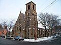
- St. Mark's Episcopal Church in Hoosick Falls: An 1858 church known for its brick Gothic style.
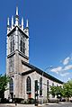
- St. Paul's Episcopal Church Complex in Troy: An early Gothic Revival church from 1828.
- Theta Xi Fraternity Chapter House in Troy: A well-preserved fraternity house built in 1931 in the Tudor Revival style.
- Tomhannock Methodist Episcopal Church in Pittstown: A historic church building.
- Trinity Church Lansingburgh in Troy: A church that became a historic district in 1995.
- Troy Gas Light Company in Troy: An unusual building from the 1800s that held coal gas.
- Troy Public Library in Troy: The city's public library, recognized for its architecture.
- Troy Savings Bank and Music Hall in Troy: This building is a National Historic Landmark. It's a late 19th-century bank with a full theater and a pipe organ upstairs.
- Troy Waste Manufacturing Company Building in Troy: Another textile factory building from Troy's industrial past.
- U.S. Post Office-Hoosick Falls in Hoosick Falls: A 1925 post office building in the Colonial Revival style.
- U.S. Post Office-Troy in Troy: A large post office from 1936 with a unique interior mural.
- United Waste Manufacturing Company Building in Troy: A factory building from 1902 on the Hudson River.
- Van Rensselaer High School in Rensselaer: A former high school building that is now historic.
- Van Zandt, Jacobs and Company Collar and Cuff Factory in Troy: Another factory building from Troy's textile history.
- W. & L. E. Gurley Building in Troy: This is a National Historic Landmark. It's a great example of a Neoclassical commercial building, built in just eight months after a fire in 1862. It was home to a precision instrument company for over 150 years.
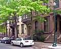
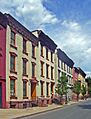
- Washington Park Historic District in Troy: This area has rows of townhouses built in 1839, designed like British residential squares.
- Wilbur–Campbell–Stephens Company Cuff and Collar Factory in Troy: An 1899 factory building, one of many on River Street.
- William Connors Paint Manufacturing Company Building in Troy: An 1880s building that housed one of the first companies to sell ready-mixed paint in cans.
- Winslow Chemical Laboratory in Troy: An 1866 building on the RPI campus.
Images for kids
-
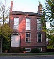
Aiken House in Rensselaer
-
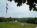
Bennington Battlefield
-
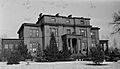
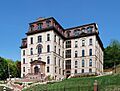
Beverwyck Manor
-
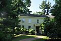
Blink Bonnie in Schodack
-
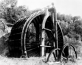
Burden Wheel
-
Burden Ironworks Office Building
-
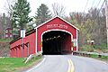
Buskirk Covered Bridge
-
Cannon Building
-
John Carner Jr. House
-
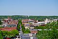
Central Troy Historic District
-
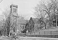
Church of the Holy Cross
-
Church Street Historic District
-
Clark-Dearstyne-Miller Inn
-
Craver Farmstead
-
Delaney Hotel
-
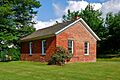
District #6 Schoolhouse
-
Elmbrook Farm
-
Estabrook Octagon House
-
Fifth Avenue-Fulton Street Historic District
-
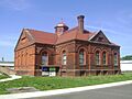
Fire Alarm, Telegraph and Police Signaling Building
-
Fort Crailo
-
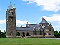
Gardner Earl Memorial Chapel and Crematorium
-
Garfield School
-
Grand Street Historic District
-
Hart-Cluett Mansion
-
Hoosick Falls Armory
-
Hoosick Falls Historic District
-
Ilium Building
-
W. P. Irwin Bank Building
-

Knickerbocker Mansion
-
Lansingburgh Academy
-
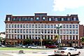
McCarthy Building
-
Mechanicville Hydroelectric Plant
-
Muitzes Kill Historic District
-
Kate Mullany House
-
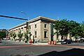
National State Bank Building
-
New York State Barge Canal
-
Northern River Street Historic District
-
Oakwood Avenue Presbyterian Church
-
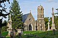
Oakwood Cemetery
-
Old Troy Hospital (West Hall)
-
Patroon Agent's House and Office
-
Petersburgh United Methodist Church
-
Proctor's Theater
-
River Street Historic District
-
Sand Lake Baptist Church
-
Schodack Landing Historic District
-
Second Street Historic District
-
Sharpe Homestead and Cemetery
-
St. Mark's Episcopal Church
-
St. Paul's Episcopal Church Complex
-
Trinity Church Lansingburgh
-
Troy Gas Light Company
-
Troy Public Library
-
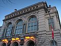
Troy Savings Bank and Music Hall
-
U.S. Post Office-Hoosick Falls
-
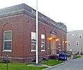
U.S. Post Office-Troy
-
John Evert Van Alen House
-
W. & L. E. Gurley Building
-
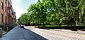
Washington Park Historic District
-
Emma Willard School
-
Winslow Chemical Laboratory


.jpg)


.jpg)


.jpg)


