Schaghticoke, New York facts for kids
Quick facts for kids
Schaghticoke
|
|
|---|---|

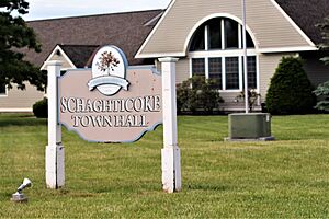
Town hall
|
|

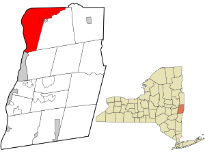
Location in Rensselaer County and the state of New York.
|
|
| Country | United States |
| State | New York |
| County | Rensselaer |
| Settled | 1668 |
| Incorporated | 1788 |
| Area | |
| • Total | 51.86 sq mi (134.32 km2) |
| • Land | 49.75 sq mi (128.85 km2) |
| • Water | 2.11 sq mi (5.48 km2) |
| Elevation | 377 ft (115 m) |
| Population
(2020)
|
|
| • Total | 7,445 |
| • Density | 143.560/sq mi (55.427/km2) |
| Time zone | UTC-5 (Eastern (EST)) |
| • Summer (DST) | UTC-4 (EDT) |
| ZIP code |
12154
|
| Area code(s) | 518 |
| FIPS code | 36-65486 |
| GNIS feature ID | 0979467 |
| Website | Town of Schaghticoke, NY |
Schaghticoke (say it like SKAT-ih-kohk) is a town in Rensselaer County, New York. In 2020, about 7,445 people lived here. The town got its name from the Schaghticoke, a Native American tribe. This tribe formed in the 1600s from different groups of Native Americans in New York and New England.
The Schaghticoke tribe has one of the oldest reservations in the United States. It is located in Litchfield County, Connecticut. The state of Connecticut recognizes the tribe, but the U.S. government does not yet.
Schaghticoke is on the northern edge of Rensselaer County, just north of Troy. The town includes a village also called Schaghticoke. Part of the village of Valley Falls is also in the town.
Contents
History
Early Native American Life
Long ago, the Mohican tribe lived in this area. Later, other Native American groups joined them. These groups were from New England and moved west to escape European settlers.
The Tree of Welfare
In 1675, Governor Andros of the New York colony did something special. He planted a "Tree of Welfare" near where the Hoosic River and Tomhannock Creek meet. This spot was already known as Schaghticoke, which means "the place where the waters mingle."
The tree was a symbol of friendship. It showed the good relationship between the English, the Dutch, and the Schaghticoke Indians. The Native Americans who lived there were Mohican refugees. They were welcomed to Schaghticoke because they agreed to help protect the English from the French and the Iroquois. They stayed in the area until 1754.
Settling the Land
Before the United States became independent, Schaghticoke was part of the New York colony. Most people living there rented land from the city of Albany.
Life in early Schaghticoke was sometimes dangerous. Native American groups and Tories (people loyal to the British during the American Revolution) often raided the area. This made it slow for people to settle the land.
After the American Revolution, many people from England and Ireland came to live in Schaghticoke. The town grew because of the water-powered mills built on the Hoosic River. Schaghticoke was mostly a farming town, with many farmers growing crops for local businesses.
Important Buildings
The Knickerbocker Mansion is a historic building in Schaghticoke. It was added to the National Register of Historic Places in 1972.
Schaghticoke Today
Today, Schaghticoke still has a lot of farms. But more and more homes are being built there too. The town is growing and changing.
Geography
Schaghticoke covers about 51.9 square miles (134.3 square kilometers). Most of this area is land, about 49.9 square miles (129.3 square kilometers). The rest, about 2.0 square miles (5.1 square kilometers), is water.
The northern edge of the town is the border with Washington County. The western edge of the town is the Hudson River, which is also the border with Saratoga County.
The Hoosic River flows through the town. It eventually joins the Hudson River at the western border of Schaghticoke.
Population
| Historical population | |||
|---|---|---|---|
| Census | Pop. | %± | |
| 1790 | 1,833 | — | |
| 1800 | 2,355 | 28.5% | |
| 1810 | 2,492 | 5.8% | |
| 1820 | 2,522 | 1.2% | |
| 1830 | 3,002 | 19.0% | |
| 1840 | 3,389 | 12.9% | |
| 1850 | 3,290 | −2.9% | |
| 1860 | 2,929 | −11.0% | |
| 1870 | 3,125 | 6.7% | |
| 1880 | 3,591 | 14.9% | |
| 1890 | 3,059 | −14.8% | |
| 1900 | 2,631 | −14.0% | |
| 1910 | 2,780 | 5.7% | |
| 1920 | 2,177 | −21.7% | |
| 1930 | 3,006 | 38.1% | |
| 1940 | 3,246 | 8.0% | |
| 1950 | 4,019 | 23.8% | |
| 1960 | 5,269 | 31.1% | |
| 1970 | 6,220 | 18.0% | |
| 1980 | 7,094 | 14.1% | |
| 1990 | 7,574 | 6.8% | |
| 2000 | 7,456 | −1.6% | |
| 2010 | 7,679 | 3.0% | |
| 2020 | 7,445 | −3.0% | |
| U.S. Decennial Census | |||
In 2000, there were 7,456 people living in Schaghticoke. The population density was about 149 people per square mile. Most of the people were White (97.57%). There were also smaller groups of African American, Native American, and Asian people. About 0.66% of the population was Hispanic or Latino.
The average household had about 2.75 people. The average family had about 3.12 people. About 26.3% of the people in town were under 18 years old. The average age of people living in Schaghticoke was 38 years old.
Places in Schaghticoke
- East Schaghticoke – A place south of Schaghticoke village.
- Grant Hollow – A small community northeast of Troy and Spiegletown, located on Route 40.
- Hemstreet Park – A community near the Hudson River, close to Mechanicville.
- Melrose – A community northeast of Grant Hollow, also on Route 40.
- Pleasantdale – A community north of Troy.
- Reynolds – A community in the western part of the town.
- Schaghticoke – The main village in the town.
- Schaghticoke Hill – A community south of Schaghticoke village on Route 40.
- Speigletown – A community northeast of Troy on Route 40.
- Valley Falls – A village, with a small part of it located in Schaghticoke town, near Schaghticoke village.
Famous People From Schaghticoke
- Albert Francis Mando – A musician.
- Jack Barsky – An author and IT specialist who was a former secret agent.
Images for kids
See also
 In Spanish: Schaghticoke (Nueva York) para niños
 | Stephanie Wilson |
 | Charles Bolden |
 | Ronald McNair |
 | Frederick D. Gregory |

