Port of Stockton facts for kids
Quick facts for kids Port of Stockton |
|
|---|---|
 |
|
| Location | |
| Country | United States |
| Location | Stockton, California |
| Coordinates | 37°57′06″N 121°19′04″W / 37.95164°N 121.31764°W |
| Details | |
| Opened | 1932 |
| Land area | 4,200 acres (17 km2) |
| Available berths | 14 |
| Statistics | |
| Vessel arrivals | 278 (CY 2022) |
| Annual cargo tonnage | 4.4 million metric revenue tons (CY 2022) |
| Value of cargo | US$1.6 billion (CY 2022) |
| Website www.portofstockton.com |
|
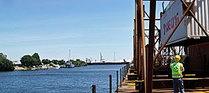
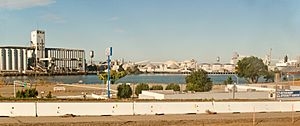
The Port of Stockton is a big port in Stockton, California. It's special because it's an "inland port." This means it's far from the ocean, about 70 miles (113 km) inland. Ships reach it by traveling up the San Joaquin River and the Stockton Deepwater Shipping Channel.
It's the second largest port in California by land size. It covers about 4,200 acres (17 square kilometers). The port is located on an island in the Sacramento–San Joaquin River Delta. A special group from Stockton City and San Joaquin County manages the port. It helps the local economy a lot.
Contents
Where is the Port of Stockton?
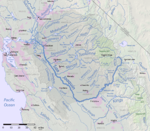
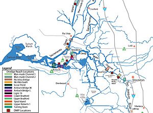
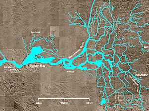
The water from California's Central Valley flows to the ocean through a narrow passage. This passage is called the Carquinez Strait. Further inland are Suisun Bay and Grizzly Bay. These are parts of the Pacific Ocean that reach deep into California.
Even further inland is the large Sacramento–San Joaquin River Delta. This is where the San Joaquin River and Sacramento River meet. This green area of land has rich, dark soil. It is in the middle of the Central Valley. The delta stretches about 50 miles (80 km) from Suisun Bay to Stockton and Sacramento. The Port of Stockton is the second largest port in California. It covers 4,200 acres (17 square kilometers).
How the Port Helps the Environment
The Port of Stockton is a busy place. It is in a city with many people. The port cares about the air quality and climate change. In 2022, the port worked hard to lower its emissions. Emissions are gases released into the air. They also made plans for a cleaner future. This helps cargo move smoothly.
The Port of Stockton wants to stop all port-related emissions one day. For now, they are working to greatly reduce their impact on nearby communities. They have a Clean Air Plan. They also have a plan to use electric vehicles for trucks. This shows their commitment to a greener future.
History of the Port
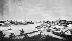
In 1846, the first cargo boat traveled up the San Joaquin River. In 1848, John Doak started the first ferry service on the river. The first freight ship, the Maria, also visited Stockton that year. In 1849, Doak brought wood from San Francisco to Stockton. He then started a lumber business.
By the 1850s, the port became a key place for shipping goods. It was also a supply center for the California goldfields. In the 1860s, gold mining slowed down. But farming, known as agriculture, grew a lot.
Work to dig the Stockton Deepwater Channel began in 1930. This channel made the river deeper for bigger ships. The Port District officially opened on February 2, 1933. The first ship to arrive was the Daisy Grey. It brought lumber from Oregon.
During World War II, there was a fear of attacks on California's coast. The U.S. War Department asked for ships to be built at an inland port. So, many new ships were built near the Port of Stockton.
Later, port managers saw that containerized cargo was becoming very important. This is cargo packed in large metal boxes. They improved the docks to handle these containers. The ship channel was also made better for large Panamax ships. These are very big ships.
The Navy's Rough and Ready Island Naval Supply Depot was built during World War II. It was later closed down. This area was given to the port between 2000 and 2003. Now, this part of the port is called the "West Complex."
What Services Does the Port Offer?
The deepwater channel is about 35 feet (11 m) deep. It can handle ships up to 900 feet (274 m) long. These ships can carry up to 60,000 tons of cargo. The port has large storage buildings near the docks. These are called transit sheds. They cover about 1.1 million square feet (102,000 square meters). There is also warehouse storage of about 7.7 million square feet (715,000 square meters).
- The port is a Foreign Trade Zone. This means certain goods can be stored or processed without customs duties.
- The port has two large mobile cranes. Each crane can lift 140 tons.
- The port handles large amounts of bulk cargo. This is cargo like grain or coal. It also handles breakbulk cargo. This is cargo that is not in containers.
- It is the fourth busiest port in California for ship visits.
- Three railroads serve the port. The Central California Traction Company handles local rail shipments. Union Pacific (UP) and Burlington Northern Santa Fe (BNSF) connect the port to the rest of North America. The Port of Stockton has 75 miles (121 km) of rail lines. They ship over 2.79 million short tons (2.53 million metric tons) each year.
- Major highways serve the port. These include Interstate 5, California State Route 4, and California State Route 99. More than 200 truck companies work with the port. Interstate 80 is about 50 miles (80 km) north of the port.
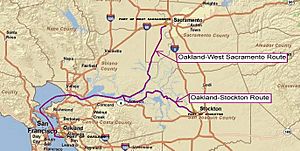
- The port is part of the California’s Green Trade Corridor Marine Highway project. Ships are often greener than trucks and trains for moving cargo. This project helps move goods through Northern California. It connects the ports of Oakland, Stockton, and West Sacramento.


