Portage Des Sioux, Missouri facts for kids
Quick facts for kids
Portage Des Sioux, Missouri
|
|
|---|---|

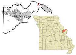
Location of Portage Des Sioux, Missouri
|
|

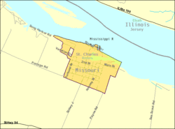
U.S. Census map
|
|
| Country | United States |
| State | Missouri |
| County | St. Charles |
| Area | |
| • Total | 0.67 sq mi (1.75 km2) |
| • Land | 0.57 sq mi (1.49 km2) |
| • Water | 0.10 sq mi (0.26 km2) |
| Elevation | 433 ft (132 m) |
| Population
(2020)
|
|
| • Total | 335 |
| • Density | 582.61/sq mi (224.85/km2) |
| Time zone | UTC-6 (Central (CST)) |
| • Summer (DST) | UTC-5 (CDT) |
| ZIP code |
63373
|
| Area code(s) | 636 |
| FIPS code | 29-59150 |
| GNIS feature ID | 0756547 |
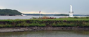
Portage Des Sioux is a small city in St. Charles County, Missouri, United States. It is located right by the Mississippi River, across from Elsah, Illinois. The city is known for a special riverside shrine called Our Lady of the Rivers. In 2020, about 335 people lived there.
The city was started in 1799 by Spanish Lieutenant Governor Zenon Trudeau and François Saucier. They founded it because Americans were planning to build a military post nearby. The name "Portage Des Sioux" comes from a French phrase meaning "portage of the Sioux." A group of Sioux people used this area as a shortcut. They carried their canoes overland between the Missouri River and the Mississippi River to escape their enemies. This helped them get away faster than paddling all the way around.
Important agreements called the Treaties of Portage des Sioux were signed here in 1815. These treaties aimed to end conflicts between Native American tribes and the United States after the War of 1812. The treaties confirmed earlier agreements where tribes like the Sac, Fox, and Osage Nation gave up large areas of land in Missouri, Illinois, and Arkansas. Sadly, these treaties eventually led to the Black Hawk War and forced many tribes to move west of Missouri.
Contents
Exploring the Geography of Portage Des Sioux
Portage Des Sioux is located in a unique spot. According to the United States Census Bureau, the city covers a total area of about 0.53 square miles (1.37 square kilometers). Most of this area, about 0.45 square miles (1.17 square kilometers), is land. The rest, about 0.08 square miles (0.21 square kilometers), is water, mainly from the nearby rivers.
Population Changes Over Time
| Historical population | |||
|---|---|---|---|
| Census | Pop. | %± | |
| 1860 | 98 | — | |
| 1870 | 160 | 63.3% | |
| 1880 | 225 | 40.6% | |
| 1900 | 242 | — | |
| 1910 | 218 | −9.9% | |
| 1920 | 283 | 29.8% | |
| 1930 | 248 | −12.4% | |
| 1940 | 254 | 2.4% | |
| 1950 | 264 | 3.9% | |
| 1960 | 371 | 40.5% | |
| 1970 | 509 | 37.2% | |
| 1980 | 488 | −4.1% | |
| 1990 | 503 | 3.1% | |
| 2000 | 351 | −30.2% | |
| 2010 | 328 | −6.6% | |
| 2020 | 335 | 2.1% | |
| U.S. Decennial Census | |||
The number of people living in Portage Des Sioux has changed over many years. For example, in 1860, there were only 98 residents. The population grew to over 500 people by 1970 and 1990. By 2020, the city had 335 residents.
Understanding the 2010 Census Data
In 2010, the census counted 328 people living in Portage Des Sioux. These people lived in 136 households, and 90 of these were families. The city had about 729 people per square mile. There were 166 housing units in total.
Most of the people living in the city were White (98.5%). A small number were from other racial backgrounds (0.6%) or from two or more races (0.9%). About 1.8% of the population identified as Hispanic or Latino.
Out of the 136 households, about 28.7% had children under 18 living with them. More than half (52.2%) were married couples. About 7.4% of households had a female head without a husband, and 6.6% had a male head without a wife. About 31.6% of all households were made up of single individuals. Around 9.5% of households had someone living alone who was 65 years old or older.
The average age of people in the city was 44.3 years. About 22% of residents were under 18 years old. Around 7.6% were between 18 and 24, and 21.3% were between 25 and 44. A larger group, 38.8%, were between 45 and 64. About 10.4% of the residents were 65 years old or older. The city had slightly more males (51.2%) than females (48.8%).
Learning and Education in the City
Public schools in Portage Des Sioux are part of the Orchard Farm School District. This district helps provide education for the children in the area.
Portage Des Sioux also used to have a public library. It was a branch of the St. Charles City-County District Library. However, the library had to close in 2019 because of flooding.
See also
 In Spanish: Portage Des Sioux (Misuri) para niños
 | William M. Jackson |
 | Juan E. Gilbert |
 | Neil deGrasse Tyson |


