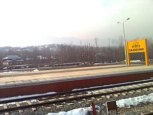
Qazigund facts for kids
Quick facts for kids
Qazigund
|
|
|---|---|
|
Town
|
|
| Country | |
| Union Territory | Jammu and Kashmir |
| District | Anantnag |
| Government | |
| • Body | Municipal Committee |
| Elevation | 1,670 m (5,480 ft) |
| Population
(2011)
|
|
| • Total | 9,871 |
| Languages | |
| • Official | Kashmiri, Urdu, Hindi, Dogri, English |
| Time zone | UTC+5:30 (IST) |
| Vehicle registration | JK03 |
Qazigund is a town in the union territory of Jammu and Kashmir, India. It is often called the Gateway Of Kashmir because of its important location. Qazigund is about 1670 meters (5478 feet) above sea level.
Sometimes, people think Qazigund is part of the Kulgam district because they are so close. A special road called the Qazigund Bypass goes through nearby villages like Dalwatch, Chimulla, and Shampora.
Contents
Discover Qazigund: Gateway to Kashmir
Qazigund is surrounded by many natural springs, which are called nags in the local language. One very famous spring, Verinag, is only 10 kilometers away. This spring is where the Jhelum River begins!
The area around Qazigund is also home to several important spiritual places. These include shrines dedicated to Sufi saints, which are special places for prayer and reflection. Some of these shrines are for Syed Shamas din Simnani, Baba Sa'd Shah sahab, and Baba Habib Shah Sahab.
Who Lives in Qazigund?
In 2011, about 9,871 people lived in Qazigund. More than half of the people living there were male (55%), and 45% were female.
Most people in Qazigund can read and write. The literacy rate (the number of people who can read and write) was about 70.21%. This is higher than the average for India, which was 67.16% at that time. For males, the literacy rate was even higher, at 79.82%, while for females, it was 58.27%. About 20.67% of the town's population was under 6 years old.
Weather in Qazigund
| Climate data for Qazigund (1981–2010, extremes 1962–2012) | |||||||||||||
|---|---|---|---|---|---|---|---|---|---|---|---|---|---|
| Month | Jan | Feb | Mar | Apr | May | Jun | Jul | Aug | Sep | Oct | Nov | Dec | Year |
| Record high °C (°F) | 16.2 (61.2) |
19.2 (66.6) |
26.5 (79.7) |
31.4 (88.5) |
33.6 (92.5) |
35.7 (96.3) |
34.5 (94.1) |
35.0 (95.0) |
32.8 (91.0) |
32.2 (90.0) |
24.3 (75.7) |
18.9 (66.0) |
35.7 (96.3) |
| Mean daily maximum °C (°F) | 6.6 (43.9) |
9.4 (48.9) |
14.4 (57.9) |
20.0 (68.0) |
23.6 (74.5) |
27.1 (80.8) |
27.9 (82.2) |
27.9 (82.2) |
26.3 (79.3) |
21.9 (71.4) |
16.2 (61.2) |
9.8 (49.6) |
19.3 (66.7) |
| Mean daily minimum °C (°F) | −3.1 (26.4) |
−0.7 (30.7) |
2.8 (37.0) |
6.5 (43.7) |
9.7 (49.5) |
13.4 (56.1) |
16.6 (61.9) |
15.8 (60.4) |
11.0 (51.8) |
5.2 (41.4) |
1.0 (33.8) |
−1.5 (29.3) |
6.4 (43.5) |
| Record low °C (°F) | −15.7 (3.7) |
−16.7 (1.9) |
−7.5 (18.5) |
−1.5 (29.3) |
−0.2 (31.6) |
7.0 (44.6) |
9.4 (48.9) |
8.4 (47.1) |
4.0 (39.2) |
−1.2 (29.8) |
−8.2 (17.2) |
−14.4 (6.1) |
−16.7 (1.9) |
| Average rainfall mm (inches) | 143.2 (5.64) |
172.7 (6.80) |
192.4 (7.57) |
115.8 (4.56) |
106.4 (4.19) |
69.7 (2.74) |
145.1 (5.71) |
141.1 (5.56) |
62.5 (2.46) |
42.2 (1.66) |
44.9 (1.77) |
79.1 (3.11) |
1,235.1 (48.63) |
| Average rainy days | 7.3 | 8.4 | 9.3 | 7.9 | 7.9 | 5.4 | 7.1 | 5.7 | 3.6 | 2.7 | 2.5 | 4.6 | 72.5 |
| Average relative humidity (%) (at 17:30 IST) | 69 | 64 | 56 | 52 | 55 | 54 | 62 | 65 | 56 | 51 | 56 | 65 | 59 |
| Source: India Meteorological Department | |||||||||||||
Getting Around Qazigund
Qazigund is well-connected to other towns and cities. You can travel to Anantnag and Srinagar by both road and train. There's a train service from Qazigund to Srinagar that runs ten times a day, making it easy to travel. The town is also connected to Kulgam by road.
Qazigund is linked to Jammu and the rest of India by a major road called NH 44. This highway goes through the Qazigund Tunnel in the Pir Panjal mountains. There's also a newer road, NH444, which connects Qazigund to Srinagar through Shupiyan.
The Amazing Qazigund Railway Tunnel
The Pir Panjal Railway Tunnel, also known as the Qazigund railway tunnel, is a very important part of the transport system. This tunnel is 11 kilometers long and goes right under the Pir Panjal mountains! It connects Qazigund railway station to Banihal railway station.
The tunnel was finished in late 2011 and started working on December 26, 2012. It officially opened in June 2013. This tunnel is India's longest railway tunnel and the third longest in all of Asia! It made the journey between Qazigund and Banihal much shorter, cutting the distance down to just 11 kilometers.
See also
 In Spanish: Qazigund para niños
- Qazigund, Kakapora (a village in Pulwama district)
 | Valerie Thomas |
 | Frederick McKinley Jones |
 | George Edward Alcorn Jr. |
 | Thomas Mensah |


