
States and union territories of India facts for kids
Quick facts for kids States and union territories of India |
|
|---|---|
|
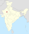
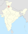
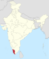
Puducherry
|
|
| Category | Federated states |
| Location | Republic of India |
| Created by | Constitution of India |
| Created | 26 January 1950 |
| Number | 28 States 8 Union territories (as of 2024) |
| Populations | States: Sikkim – 610,577 (lowest) Uttar Pradesh – 199,812,341 (highest) Union Territories: Lakshadweep – 64,473 (lowest) Delhi – 16,787,941 (highest) |
| Areas | States: Goa – 3,702 km2 (1,429 sq mi) (smallest) Rajasthan – 342,269 km2 (132,151 sq mi) (largest) Union territories: Lakshadweep – 32 km2 (12 sq mi) (smallest) Ladakh – 59,146 km2 (22,836 sq mi) (largest) |
| Government | Government of India State governments |
| Subdivisions | Divisions Districts Tehsils |
India is a large country made up of 28 states and 8 union territories. Think of them like different regions or areas within the country. Each state has its own government, which works with the main government of India.
Union territories are a bit different. They are mostly controlled directly by the main government of India. However, some of them have their own local governments too.
The way these states and union territories are set up comes from the Constitution of India. This important document was put into effect on January 26, 1950. Only the Parliament of India can create new states or union territories, or change their borders.
Contents
How India's States and Territories Changed Over Time
India Before 1947: British Rule
Before India became independent in 1947, it was ruled by the British. This period was called the British Raj. During this time, India was divided into many different parts. Some parts were directly ruled by the British. These were called provinces.
Other parts were called Princely States. These were ruled by Indian kings or princes. But even these rulers had to follow the British Crown. It was a very complex system!

In 1911, the capital of India moved from Calcutta to Delhi. This led to Delhi becoming a special province. Over the years, the British made some changes to how these areas were governed. They even allowed more Indian people to be elected to local governments.
India After Independence: 1947–1950
When India became independent in 1947, the old British system ended. The new Union of India was formed. The old provinces mostly stayed the same. The princely states joined India, and some became part of existing provinces. Others formed new provinces.

In 1950, when India adopted its Constitution, the country's areas were grouped into four types:
- Part A States: These were like the old provinces, ruled by a governor and an elected government.
- Part B States: These were former princely states. They had a special ruler called a rajpramukh and an elected government.
- Part C States: These were smaller areas, often former chief commissioner's provinces or small princely states. They were ruled by a chief commissioner.
- Part D Territory: This was just one area, the Andaman and Nicobar Islands, ruled by a lieutenant governor.
Reorganizing States: 1950s
After 1950, India continued to change its map. In 1953, Andhra state was created for people who spoke the Telugu language. This was a big step!
In 1956, a major change happened with the States Reorganisation Act, 1956. This law reorganized the country into 14 states and 6 union territories. Many states were created or changed based on the languages people spoke. For example:
- Andhra Pradesh was formed by joining Andhra state with Telugu-speaking parts of Hyderabad.
- Kerala was created by combining different Malayalam-speaking areas.
- Mysore State (now Karnataka) was reorganized to include more Kannada-speaking areas.
- Bombay State grew bigger, adding Marathi and Gujarati-speaking regions.

Later Changes: 1960 to Today
India's map kept changing as the country grew.
- In 1960, Bombay State was split into two new states: Gujarat (for Gujarati speakers) and Maharashtra (for Marathi speakers).
- In 1961, Goa, Daman and Diu became a union territory after being freed from Portuguese rule.
- Nagaland became a new state in 1963, separating from Assam.
- In 1966, Punjab was reorganized. This created the state of Haryana and the union territory of Chandigarh.
- Many states were renamed, like Madras becoming Tamil Nadu in 1969 and Mysore becoming Karnataka in 1973.
- New states like Himachal Pradesh, Manipur, Meghalaya, Tripura, Sikkim, Arunachal Pradesh, and Mizoram were also formed.
In 2000, three more new states were created: Chhattisgarh, Uttarakhand (originally Uttaranchal), and Jharkhand.
- In 2014, Telangana was separated from Andhra Pradesh to become India's 29th state.
- In 2019, the state of Jammu and Kashmir was divided into two new union territories: Jammu and Kashmir and Ladakh.
- In 2020, two union territories, Daman and Diu and Dadra and Nagar Haveli, were merged into one.

How States and Union Territories Work
The Constitution of India explains how power is shared in India. It gives certain powers to the main government (called the union government) and other powers to the state governments.
For example, the union government makes laws for the whole country on big topics like defense and foreign affairs. State governments make laws on things like education and health within their state. Union territories are mostly managed directly by the union government.
India's States and Union Territories Today
India has 28 states and 8 union territories. Each has its own capital city and official languages.
States
| State | ISO | Vehicle code |
Zone | Capital | Largest city | Established | Population (2011) |
Area (km2) |
Official languages |
Additional official languages |
|---|---|---|---|---|---|---|---|---|---|---|
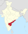
| Andhra Pradesh | IN-AP | AP | Southern | Amaravati | Visakhapatnam | 1 November 1956 | 49,506,799 | 162,975 | Telugu | Urdu |
| Arunachal Pradesh | IN-AR | AR | North-Eastern | Itanagar | 20 February 1987 | 1,383,727 | 83,743 | English | — | |
| Assam | IN-AS | AS | North-Eastern | Dispur | Guwahati | 26 January 1950 | 31,205,576 | 78,438 | Assamese, Boro | Bengali |
| Bihar | IN-BR | BR | Eastern | Patna | 26 January 1950 | 104,099,452 | 94,163 | Hindi | Urdu | |
| Chhattisgarh | IN-CG | CG | Central | Raipur | 1 November 2000 | 25,545,198 | 135,194 | Hindi | Chhattisgarhi | |
| Goa | IN-GA | GA | Western | Panaji | Vasco da Gama | 30 May 1987 | 1,458,545 | 3,702 | Konkani | Marathi |
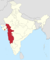
| Gujarat | IN-GJ | GJ | Western | Gandhinagar | Ahmedabad | 1 May 1960 | 60,439,692 | 196,024 | Gujarati, Hindi | — |
| Haryana | IN-HR | HR | Northern | Chandigarh | Faridabad | 1 November 1966 | 25,351,462 | 44,212 | Hindi | English, Punjabi |
| Himachal Pradesh | IN-HP | HP | Northern | Shimla (Summer) Dharamshala (Winter) |
Shimla | 25 January 1971 | 6,864,602 | 55,673 | Hindi | Sanskrit |
| Jharkhand | IN-JH | JH | Eastern | Ranchi | Jamshedpur | 15 November 2000 | 32,988,134 | 79,714 | Hindi | 16 languages |
| Karnataka | IN-KA | KA | Southern | Bangalore | 1 November 1956 | 61,095,297 | 191,791 | Kannada | — | |
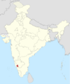
| Kerala | IN-KL | KL | Southern | Thiruvananthapuram | 1 November 1956 | 33,406,061 | 38,863 | Malayalam | English | |
| Madhya Pradesh | IN-MP | MP | Central | Bhopal | Indore | 1 November 1956 | 72,626,809 | 308,252 | Hindi | — |
| Maharashtra | IN-MH | MH | Western | Mumbai (Summer) Nagpur (Winter) |
Mumbai | 1 May 1960 | 112,374,333 | 307,713 | Marathi | — |
| Manipur | IN-MN | MN | North-Eastern | Imphal | 21 January 1972 | 2,855,794 | 22,327 | Manipuri | English | |
| Meghalaya | IN-ML | ML | North-Eastern | Shillong | 21 January 1972 | 2,966,889 | 22,429 | English | — | |
| Mizoram | IN-MZ | MZ | North-Eastern | Aizawl | 20 February 1987 | 1,097,206 | 21,081 | Mizo, English, Hindi | — | |
| Nagaland | IN-NL | NL | North-Eastern | Kohima | Dimapur | 1 December 1963 | 1,978,502 | 16,579 | English | — |
| Odisha | IN-OD | OD | Eastern | Bhubaneswar | 26 January 1950 | 41,974,218 | 155,707 | Odia | — | |
| Punjab | IN-PB | PB | Northern | Chandigarh | Ludhiana | 1 November 1966 | 27,743,338 | 50,362 | Punjabi | — |
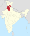
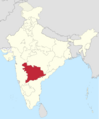
| Rajasthan | IN-RJ | RJ | Northern | Jaipur | 26 January 1950 | 68,548,437 | 342,239 | Hindi | English | |
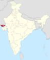
| Sikkim | IN-SK | SK | North-Eastern | Gangtok | 16 May 1975 | 610,577 | 7,096 | Nepali, Sikkimese, Lepcha, English | 8 languages | |
| Tamil Nadu | IN-TN | TN | Southern | Chennai | 1 November 1956 | 72,147,030 | 130,058 | Tamil | English | |
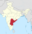
| Telangana | IN-TS | TG | Southern | Hyderabad | 2 June 2014 | 35,193,978 | 112,077 | Telugu | Urdu | |
| Tripura | IN-TR | TR | North-Eastern | Agartala | 21 January 1972 | 3,673,917 | 10,491 | Bengali, English, Kokborok | — | |
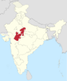
| Uttar Pradesh | IN-UP | UP | Central | Lucknow | 26 January 1950 | 199,812,341 | 240,928 | Hindi | Urdu | |
| Uttarakhand | IN-UK | UK | Central | Dehradun (Winter) Bhararisain (Summer) |
Dehradun | 9 November 2000 | 10,086,292 | 53,483 | Hindi | Sanskrit |
| West Bengal | IN-WB | WB | Eastern | Kolkata | 26 January 1950 | 91,276,115 | 88,752 | Bengali, English | Nepali and 10 other languages | |
Union territories
Images for kids
-
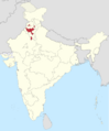
Ajmer State (1950–56)
-
Andhra State (1953–56)
-
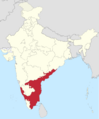
Andhra Pradesh (1956-2014)
-
Bhopal State (1949–56)
-
Bilaspur State (1950–54)
-
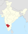
Bombay State (1950–60)
-
Coorg State (1950–56)
-
East Punjab (1947–66)
-
Hyderabad State (1948–56)
-
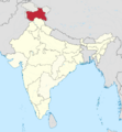
Jammu and Kashmir (1952–2019)
-
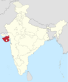
Kutch State (1947–56)
-
Madhya Bharat (1948–56)
-
Madras State (1947–53)
-
Mysore State (1947–73)
-
Patiala and East Punjab States Union (1948–56)
-
Saurashtra (1948–56)
-
Travancore–Cochin (1949–56)
-
Vindhya Pradesh (1948–56)
.svg)

.svg)
.svg)
.svg)
.svg)
.svg)
.png)
.svg)
_(claims_hatched).svg)
.svg)
.svg)
.svg)
.svg)
.svg)
.svg)
.svg)
.svg)
See also
 In Spanish: Estados y territorios de la India para niños
- Administrative divisions of India
- Autonomous administrative divisions of India
- List of adjectives and demonyms for states and territories of India
- List of Indian state and union territory name etymologies
- List of states in India by past population
