Itanagar facts for kids
Quick facts for kids
Itanagar
|
|
|---|---|
|
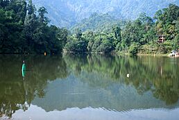
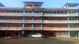
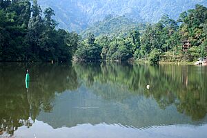
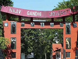
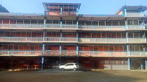
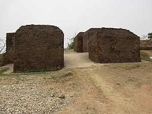
From top, left to right: Donyi Polo Airport, Ganga/Gyakar Sinyi lake, Lake at Itanagar, Ita Fort southern gate, Shatabdi Express from Itanagar to Guwahati, Arunachal A/C Superfast, Jawaharlal Nehru Museum, Itanagar, Rajiv Gandhi University, Rajiv Gandhi Government Polytechnic, Bunny's fantasy world
|
|
| Nickname(s):
Capital of Arunachal
|
|
| Country | |
| State | Arunachal Pradesh |
| District | Itanagar |
| Government | |
| • Type | Municipal Corporation |
| • Body | Itanagar Municipal Corporation |
| Area | |
| • Total | 51.69 km2 (19.96 sq mi) |
| Elevation | 320 m (1,050 ft) |
| Population
(2011)
|
|
| • Total | 59,490 |
| • Density | 1,150.90/km2 (2,980.8/sq mi) |
| Time zone | UTC+5:30 (IST) |
| Vehicle registration | AR-01, AR-02, ARX |
| Climate | Humid subtropical climate |
Itanagar is the capital city and largest town in the Indian state of Arunachal Pradesh. It's where the state government works, including the Arunachal Pradesh Legislative Assembly (like a state parliament) and a part of the Gauhati High Court (a big court) in Naharlagun. Itanagar and the nearby town of Naharlagun form the Itanagar Capital Complex. This important area stretches from Chandranagar Town to Nirjuli Town. It's a busy center for culture, business, fashion, education, and fun activities.
Contents
Geography and Climate
Itanagar is located at about 27.1 degrees North and 93.62 degrees East. It sits at an average height of 320 meters (about 1,050 feet) above sea level.
Itanagar's Climate
Itanagar has a humid subtropical climate. This means it has dry, warm winters. Summers are hot, very humid, and wet.
| Climate data for Itanagar | |||||||||||||
|---|---|---|---|---|---|---|---|---|---|---|---|---|---|
| Month | Jan | Feb | Mar | Apr | May | Jun | Jul | Aug | Sep | Oct | Nov | Dec | Year |
| Record high °C (°F) | 27.2 (81.0) |
30.0 (86.0) |
33.9 (93.0) |
33.7 (92.7) |
40.5 (104.9) |
35.8 (96.4) |
38.0 (100.4) |
36.6 (97.9) |
35.2 (95.4) |
35.6 (96.1) |
31.3 (88.3) |
28.9 (84.0) |
40.5 (104.9) |
| Mean daily maximum °C (°F) | 23.4 (74.1) |
25.0 (77.0) |
27.8 (82.0) |
29.0 (84.2) |
31.0 (87.8) |
31.4 (88.5) |
31.9 (89.4) |
31.6 (88.9) |
31.5 (88.7) |
30.3 (86.5) |
28.1 (82.6) |
25.2 (77.4) |
28.8 (83.8) |
| Daily mean °C (°F) | 17.1 (62.8) |
18.1 (64.6) |
21.0 (69.8) |
23.4 (74.1) |
25.9 (78.6) |
27.1 (80.8) |
27.6 (81.7) |
27.6 (81.7) |
27.2 (81.0) |
25.3 (77.5) |
21.0 (69.8) |
18.0 (64.4) |
23.3 (73.9) |
| Mean daily minimum °C (°F) | 10.8 (51.4) |
11.2 (52.2) |
14.2 (57.6) |
17.8 (64.0) |
20.8 (69.4) |
22.8 (73.0) |
23.3 (73.9) |
23.6 (74.5) |
22.9 (73.2) |
20.2 (68.4) |
13.8 (56.8) |
10.7 (51.3) |
17.7 (63.9) |
| Record low °C (°F) | 6.6 (43.9) |
5.2 (41.4) |
8.8 (47.8) |
13.6 (56.5) |
18.7 (65.7) |
20.0 (68.0) |
20.5 (68.9) |
21.3 (70.3) |
17.4 (63.3) |
15.6 (60.1) |
9.8 (49.6) |
7.4 (45.3) |
5.2 (41.4) |
| Average rainfall mm (inches) | 33.7 (1.33) |
67.6 (2.66) |
106.1 (4.18) |
226.8 (8.93) |
468.7 (18.45) |
633.2 (24.93) |
577.7 (22.74) |
503.0 (19.80) |
492.3 (19.38) |
241.6 (9.51) |
19.2 (0.76) |
11.3 (0.44) |
3,381.2 (133.12) |
| Average rainy days (≥ 2.5 mm) | 2.5 | 5.3 | 6.9 | 12.2 | 14.4 | 19.7 | 20.5 | 16.4 | 16.2 | 8.5 | 1.8 | 1.0 | 125.4 |
| Average relative humidity (%) (at 17:30 IST) | 85 | 77 | 71 | 75 | 78 | 84 | 83 | 86 | 89 | 87 | 85 | 86 | 82 |
| Source: India Meteorological Department | |||||||||||||
Culture and People
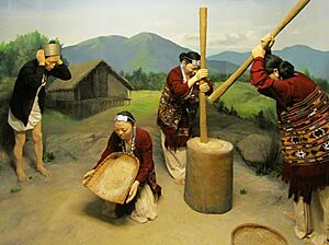
Itanagar is home to many different tribes. These include the Nyishi, Adi, Apatani, Tagin, and Galo tribes, among others.
Population and Languages
According to the 2011 India census, Itanagar had a population of 59,490 people. About 53% of the population were males and 47% were females. The average literacy rate (people who can read and write) was 66.95%. This was a bit lower than India's national average of 74.4%. For males, literacy was 73.69%, and for females, it was 59.57%. About 15% of the population in Itanagar was under 6 years old.
Others include Sikhism, Jainism & Other religions
| Religion in Itanagar City (2011) | ||||
|---|---|---|---|---|
| Religion | Percent | |||
| Hinduism | 40.94% | |||
| Christianity | 29.51% | |||
| Donyi Polo | 21.17% | |||
| Islam | 4.52% | |||
| Buddhism | 2.88% | |||
| Others | 0.98% | |||
Many tribes in Itanagar worship nature. For example, the Tani Tribes, who believe they are descendants of a forefather named Abotani, follow the Donyi-Polo faith. In 2011, the census showed that 40.94% of people were Hindu, 29.51% were Christian, 21.17% followed Donyi Polo, 4.52% were Muslim, and 2.88% were Buddhist.
In 2011, the most spoken language in Itanagar was Nishi, with 17,896 speakers. Other common languages included Bengali (8,125 speakers), Adi (8,102 speakers), and Apatani (4,256 speakers).
Education in Itanagar
Itanagar has several important universities and colleges:
- Dera Natung Government College
- Don Bosco College
- Himalayan University
- NERIST
- National Institute of Technology, Arunachal Pradesh
- Rajiv Gandhi Government Polytechnic
- Rajiv Gandhi University
- Tomo Riba Institute of Health and Medical Sciences
- Indira Gandhi National Open University
Media and Communication
Television and Radio
DD Arunprabha is the official state television channel for Arunachal Pradesh. For radio, Itanagar has All India Radio, RadioCity Itanagar (the first community radio in Arunachal Pradesh), and Big FM 92.7.
Newspapers
Some of the local newspapers in Itanagar are:
- The Arunachal Times
- Echo of Arunachal
- Dawnlit Post
Places to Visit
- Ita Fort is a very important historical site in Arunachal Pradesh. Its name means "Fort of bricks" in the Assamese language. The fort was built a long time ago, around the 14th or 15th century. It has an unusual shape and was made using 16,200 cubic meters of bricks. Some experts think it might be linked to the Chutiya kingdom. The fort has three entrances on its western, eastern, and southern sides.
- Jawaharlal Nehru Museum, Itanagar is a great place to learn about the rich tribal culture of the state. It shows off many interesting artifacts.
- Gekar Sinyi (Ganga Lake) is a beautiful natural lake. In the Nyishi language, its name means "confined lake." It is surrounded by strong rock formations. Old plants, orchids on tall trees, and tree ferns make it a popular spot for picnics and fun. You can also enjoy boating and a swimming pool there.
- Buddhist Monastery (Gompa Mandir) is a peaceful place for worship and reflection.
Transportation Hub
Roads
National Highway 415 connects Itanagar to other parts of Arunachal Pradesh and the rest of India. You can easily find buses and taxis from Guwahati and its airport to Itanagar.
Railways
The closest train station is Naharlagun railway station, which is about 15 km from Itanagar. Taxis and buses are available from the station. The Donyi Polo Express runs daily from Guwahati. The Shatabdi Express runs three times a week from Guwahati. The Arunachal AC Superfast Express connects Naharlagun to Anand Vihar Terminal in the national capital twice a week.
Air Travel
Regular helicopter services are available from Guwahati to Naharlagun. On February 9, 2019, Prime Minister Narendra Modi started the construction of Itanagar Airport at Hollongi. It was named Donyi Polo Airport and opened on November 19, 2022. Airlines like Alliance Air, IndiGo, and FlyBig now operate flights from there.
See also
 In Spanish: Itanagar para niños
 | William Lucy |
 | Charles Hayes |
 | Cleveland Robinson |


