Ahmedabad facts for kids
Quick facts for kids
Ahmedabad
Amdavad (Gujarati)
Ashaval, Karnavati
|
|||||||||||||||
|---|---|---|---|---|---|---|---|---|---|---|---|---|---|---|---|
|
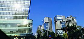
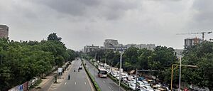
Skyline across SG Highway
Sabarmati Riverfront
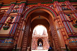
Hutheesing Temple
Atal Pedestrian Bridge
Ahmedabad Aerial View
Heritage Pol in Ahmedabad
Jama Mosque
IIM-Ahmedabad
Narendra Modi Stadium
|
|||||||||||||||
| Nickname(s):
Manchester of the East, Heritage City of India
|
|||||||||||||||
| Country | |||||||||||||||
| State | |||||||||||||||
| District | Ahmedabad | ||||||||||||||
| Region | Central Gujarat | ||||||||||||||
| Establishment | 11th Century as Ashaval | ||||||||||||||
| Founded by | King Asha Bhil | ||||||||||||||
| Named for | Ahmad Shah I | ||||||||||||||
| Government | |||||||||||||||
| • Type | Mayor–Council | ||||||||||||||
| • Body | Amdavad Municipal Corporation | ||||||||||||||
| Area | |||||||||||||||
| • Metropolis | 505 km2 (195 sq mi) | ||||||||||||||
| • Urban | 1,060.95 km2 (409.64 sq mi) | ||||||||||||||
| • Metro | 1,866 km2 (720 sq mi) | ||||||||||||||
| Area rank | 8th in India (1st in Gujarat) | ||||||||||||||
| Elevation | 69.65 m (228.51 ft) | ||||||||||||||
| Population
(2011)
|
|||||||||||||||
| • Metropolis | 5,577,940 | ||||||||||||||
| • Density | 11,045/km2 (28,608/sq mi) | ||||||||||||||
| • Urban | 9,062,000 | ||||||||||||||
| • Urban density | 8,541.4/km2 (22,122.1/sq mi) | ||||||||||||||
| Demonym(s) | Amdavadi, Ahmedabadi | ||||||||||||||
| Language | |||||||||||||||
| • Official | Gujarati | ||||||||||||||
| • Additional official | English | ||||||||||||||
| Time zone | UTC+5:30 (IST) | ||||||||||||||
| PIN |
3800xx
|
||||||||||||||
| Area code(s) | +9179xxxxxxxx | ||||||||||||||
| Vehicle registration | GJ-01 (West) GJ-27 (East) GJ-38 (Rural) |
||||||||||||||
| HDI (2016) | |||||||||||||||
| Sex ratio | 1.11 ♂/♀ | ||||||||||||||
| Literacy rate | 85.3% | ||||||||||||||
| Gross Domestic Product (PPP) (2022-23) | $136.1 Billion | ||||||||||||||
|
|||||||||||||||
Ahmedabad (also called Amdavad) is a very important city in the Indian state of Gujarat. It is the largest city in Gujarat. Ahmedabad is also the main city for the Ahmedabad district. The Gujarat High Court is located here.
In 2011, Ahmedabad had over 5.5 million people. This made it the fifth most populated city in India. The larger city area, including its suburbs, had about 8.8 million people in 2024. This makes it the seventh most populated urban area in India. Ahmedabad sits by the Sabarmati River. It is about 25 kilometers (15 miles) from Gandhinagar, the capital of Gujarat. These two cities are often called twin cities.
Ahmedabad is a major center for business and industry in India. It is famous for producing a lot of cotton. Because of this, it was once known as the 'Manchester of India'. Cricket is very popular here. The Narendra Modi Stadium in Motera is the largest stadium in the world. It can hold 132,000 people! The Sardar Vallabhbhai Patel Sports Enclave is also being built. It will be one of India's biggest sports centers.
The city's economy has grown a lot. It now focuses on services like trade, communication, and construction. More people moving to Ahmedabad has led to many new buildings, including skyscrapers. In 2010, Forbes magazine said Ahmedabad was the third fastest-growing city of the decade. In 2012, The Times of India called it India's best city to live in. In 2022, Time magazine listed Ahmedabad as one of the world's 50 greatest places.
Ahmedabad is also part of India's Smart Cities Mission. This project aims to make cities more modern and efficient. In 2017, the historic part of Ahmedabad was named a UNESCO World Heritage City.
Contents
History of Ahmedabad
How Ahmedabad Got Its Name
Long ago, there was a settlement here called Ashaval. This was a tribal village. Later, a ruler named Karna from Anhilvada (now Patan) took over Ashaval. He started a new city nearby called Karnavati.
In 1411 CE, Ahmad Shah I of the Gujarat Sultanate moved his capital to Ashaval. It was common to rename cities after the ruler. So, the city became Ahmedabad, named after Sultan Ahmad Shah I. Some stories say he named it after four Muslim saints who were all named Ahmed.
Early Beginnings
People have lived in the Ahmedabad area since the 11th century. It was first known as Ashaval. King Karna built Karnavati on the banks of the Sabarmati River. This was after he won a war against the Bhil king of Ashaval.
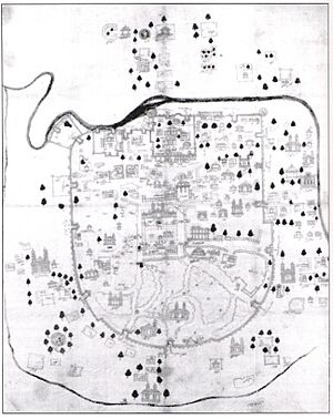
The Solanki rulers governed until the 13th century. Then, the Delhi Sultanate took control in the 14th century. In 1411, Sultan Ahmed Shah chose this area for his new capital. He started building a walled city near Karnavati. He named it Ahmedabad after himself. The city's foundation was laid on February 26, 1411. This happened at Manek Burj, named after the saint Maneknath.
In 1487, Mahmud Begada, Ahmed Shah's grandson, built strong outer walls around the city. These walls were 10 kilometers (6 miles) long. They had twelve gates and many towers. In 1573, the Mughals took over Gujarat. Ahmedabad became a busy trading center, especially for textiles. These textiles were even sent to Europe. The Mughal ruler Shah Jahan lived in the city for a long time. He helped build the Moti Shahi Mahal. Ahmedabad stayed a Mughal center until 1758. Then, the Marathas took control.
Modern Times
During Maratha rule, Ahmedabad was a place of conflict. The British East India Company took over the city in 1818. A military camp was set up in 1824. A city government started in 1858. Ahmedabad became a very important city in Gujarat under British rule. In 1864, a railway line connected Ahmedabad to Mumbai. This helped trade between northern and southern India. The city became famous for its growing textile industry. This is why it was called the "Manchester of the East."
Mahatma Gandhi played a big role in Ahmedabad. He started two ashrams here. These were the Kochrab Ashram (1915) and the Sabarmati Ashram (1917). These ashrams became centers for India's fight for freedom. In 1930, Gandhi began the famous Salt Satyagraha from his ashram. Many people joined peaceful protests in the city. This made it hard for the British to run the city. This also happened during the Quit India Movement in 1942.
After Independence
After India became independent in 1947, Ahmedabad saw some unrest. Many Hindu people from Pakistan moved to the city. This changed the city's population and economy. By 1960, Ahmedabad was a large city with almost half a million people. It became the capital of Gujarat on May 1, 1960. Many new schools and research centers were built. This made Ahmedabad a hub for higher education and technology. The city's economy also grew with new industries like chemicals and heavy manufacturing.
In the late 1970s, the capital moved to Gandhinagar. Ahmedabad then faced a period of slower growth. In the 1970s and 1980s, there were student protests and social protests in the city. In 2001, a big earthquake hit Gujarat. Many buildings in Ahmedabad collapsed, and some people lost their lives. In 2002, there was a period of unrest between different communities.
In 2008, Ahmedabad experienced a series of bomb blasts. These attacks caused injuries and deaths. In recent years, Ahmedabad has hosted leaders from other countries. For example, US President Donald Trump visited in 2020. Chinese President Xi Jinping and Canadian Prime Minister Justin Trudeau also visited the city.
People of Ahmedabad
Population Growth
| Population census | ||||||||||||||||||||||||||||||||||||||||||||||||||||
|---|---|---|---|---|---|---|---|---|---|---|---|---|---|---|---|---|---|---|---|---|---|---|---|---|---|---|---|---|---|---|---|---|---|---|---|---|---|---|---|---|---|---|---|---|---|---|---|---|---|---|---|---|
|
|
|||||||||||||||||||||||||||||||||||||||||||||||||||
| Source: Census of India | ||||||||||||||||||||||||||||||||||||||||||||||||||||
The city's population grew by over 23% from 2001 to 2011. In 2011, Ahmedabad had 5,577,940 people. This included 2,938,985 males and 2,638,955 females. For every 1,000 males, there were 898 females. The city's literacy rate was high, at 88.29%. This means most people could read and write.
As of 2023, the estimated population of Ahmedabad city is 7,692,000. The larger urban area has about 8,772,000 people. The official census for 2021 was delayed.
Helping People in Need
Ahmedabad has worked hard to reduce poverty. It also tries to improve living conditions for its poorer residents. The number of people living in poverty has gone down a lot. This is partly because the city government (AMC) works with groups that help poor residents.
Through different projects, the AMC has provided basic services to informal settlements. These services include water, electricity, and sanitation. While challenges remain, there has been a general improvement in living conditions.
Slum Networking Project
In the 1990s, the city faced a growing number of informal settlements. Residents often paid high prices for poor quality services. To fix this, the AMC started the Slum Networking Project (SNP) in 1995. This project aimed to improve basic services in 60 settlements. It helped about 13,000 families.
The project involved residents, the AMC, private groups, and local NGOs. It provided water, sewers, toilets, paved roads, and storm drains. It also helped with community development and health. Families living in these areas were given a guarantee to stay for at least ten years. This project has been very successful. It helped residents work more hours and reduced illnesses. Children's school attendance also went up. The SNP won an award in 2006 for improving living environments.
Different Cultures and Languages
| Religions in Ahmedabad City (2011) | ||||
|---|---|---|---|---|
| Religion | Percent | |||
| Hinduism | 81.56% | |||
| Islam | 13.51% | |||
| Jainism | 3.62% | |||
| Christianity | 0.85% | |||
| Other or not stated | 0.48% | |||
Most people in Ahmedabad are Gujaratis. But many people from other states also live here. They speak different languages like Hindi and Urdu. There are also smaller communities like Sindhi and Marathi people. The city is home to about 2,000 Parsis (Zoroastrians). There are also about 125 members of the Bene Israel Jewish community. The city has one synagogue.
In 2011, most people (68.44%) spoke Gujarati. Other common languages were Hindi (19.49%), Urdu (3.47%), and Sindhi (2.24%).
Geography and Climate
City Layout
Ahmedabad is in western India. It is about 53 meters (174 feet) above sea level. The city is on the banks of the Sabarmati river. It covers an area of 505 square kilometers (195 sq mi). The Sabarmati river used to dry up in summer. But now, water from the Narmada river is sent to the Sabarmati. This keeps the river flowing all year.
The city is mostly flat, except for some small hills. There are three lakes within the city: Kankaria, Vastrapur, and Chandola. Kankaria is an artificial lake built in 1451.
Ahmedabad is divided by the Sabarmati River into two parts. The eastern side has the old city. This area has busy markets and a unique housing system called pols. A pol is a group of houses where many families from the same group live close together. The old city also has the main railway station and historic buildings.
The western side of the city is more modern. It has schools, new buildings, shopping malls, and business areas. The Ellis Bridge (built in 1875) and the Nehru Bridge connect the two parts of the city.
The Sabarmati Riverfront is a beautiful area along the river. It was planned in the 1960s and opened in 2012. It offers a nice place for people to relax.
Weather in Ahmedabad
Ahmedabad has a hot, semi-dry climate. It has three main seasons: summer, monsoon, and winter. Most of the year is very dry. Summers are hot, from March to June. The average high temperature is 43°C (109°F). Winters are mild, from November to February. The average high is 30°C (86°F).
The monsoon season brings humid weather from mid-June to mid-September. The city gets about 800 mm (31 inches) of rain each year. Sometimes, heavy rains cause floods. But droughts can also happen if the monsoon is weak. The highest temperature ever recorded was 48°C (118°F) on May 20, 2016.
| Climate data for Ahmedabad (1991–2020) | |||||||||||||
|---|---|---|---|---|---|---|---|---|---|---|---|---|---|
| Month | Jan | Feb | Mar | Apr | May | Jun | Jul | Aug | Sep | Oct | Nov | Dec | Year |
| Record high °C (°F) | 36.1 (97.0) |
40.6 (105.1) |
43.9 (111.0) |
46.2 (115.2) |
48.0 (118.4) |
47.2 (117.0) |
42.2 (108.0) |
40.4 (104.7) |
41.7 (107.1) |
42.8 (109.0) |
38.9 (102.0) |
35.6 (96.1) |
48.0 (118.4) |
| Mean daily maximum °C (°F) | 27.9 (82.2) |
31.0 (87.8) |
35.8 (96.4) |
39.7 (103.5) |
41.8 (107.2) |
39.0 (102.2) |
33.7 (92.7) |
32.3 (90.1) |
33.6 (92.5) |
35.6 (96.1) |
33.1 (91.6) |
29.5 (85.1) |
34.4 (93.9) |
| Daily mean °C (°F) | 20.1 (68.2) |
22.8 (73.0) |
27.7 (81.9) |
31.9 (89.4) |
34.5 (94.1) |
33.3 (91.9) |
29.8 (85.6) |
28.8 (83.8) |
29.3 (84.7) |
28.8 (83.8) |
25.1 (77.2) |
21.6 (70.9) |
27.8 (82.0) |
| Mean daily minimum °C (°F) | 12.4 (54.3) |
14.6 (58.3) |
19.6 (67.3) |
24.2 (75.6) |
27.3 (81.1) |
27.7 (81.9) |
26.1 (79.0) |
25.3 (77.5) |
24.9 (76.8) |
21.8 (71.2) |
17.2 (63.0) |
13.6 (56.5) |
21.2 (70.2) |
| Record low °C (°F) | 3.3 (37.9) |
2.2 (36.0) |
9.4 (48.9) |
12.8 (55.0) |
19.1 (66.4) |
19.4 (66.9) |
20.4 (68.7) |
21.2 (70.2) |
17.2 (63.0) |
12.6 (54.7) |
8.3 (46.9) |
3.6 (38.5) |
2.2 (36.0) |
| Average rainfall mm (inches) | 1.2 (0.05) |
0.6 (0.02) |
1.1 (0.04) |
2.5 (0.10) |
5.5 (0.22) |
84.3 (3.32) |
310.1 (12.21) |
242.2 (9.54) |
120.2 (4.73) |
13.1 (0.52) |
1.9 (0.07) |
0.9 (0.04) |
783.6 (30.85) |
| Average rainy days | 0.2 | 0.1 | 0.2 | 0.3 | 0.3 | 3.9 | 11.3 | 10.3 | 6.1 | 0.9 | 0.3 | 0.1 | 33.9 |
| Average relative humidity (%) (at 17:30 IST) | 35 | 26 | 21 | 20 | 25 | 44 | 69 | 72 | 63 | 43 | 39 | 38 | 41.25 |
| Average dew point °C (°F) | 9 (48) |
10 (50) |
10 (50) |
14 (57) |
19 (66) |
23 (73) |
25 (77) |
25 (77) |
24 (75) |
19 (66) |
14 (57) |
11 (52) |
17 (62) |
| Mean monthly sunshine hours | 287.3 | 274.3 | 277.5 | 297.2 | 329.6 | 238.3 | 130.1 | 111.4 | 220.6 | 290.7 | 274.1 | 288.6 | 3,019.7 |
| Average ultraviolet index | 6 | 8 | 11 | 12 | 12 | 12 | 12 | 12 | 11 | 9 | 7 | 6 | 10 |
| Source 1: India Meteorological Department Time and Date (dewpoints, 2005-2015) | |||||||||||||
| Source 2: NOAA (sun 1971–1990), IEM ASOS (May record high) Tokyo Climate Center (mean temperatures 1991–2020); Weather Atlas | |||||||||||||
After a very hot period in May 2010, the city created a Heat Action Plan. This plan helps people stay safe during extreme heat. It raises awareness and trains workers to help prevent heat-related illnesses. Ahmedabad was ranked the 7th best "National Clean Air City" in India in 2024.
City Views and Architecture
Ahmedabad is known for its beautiful buildings. It blends Hindu art with Persian architecture. This style is called Indo-Saracenic. Many mosques in the city show this style. The Sidi Saiyyed Mosque is famous for its stone latticework windows. Old private homes called havelis also have detailed carvings.
After India became independent, modern buildings appeared. Famous architects like Louis Kahn and Le Corbusier designed buildings here. B. V. Doshi also designed many important buildings.
The city has many lovely gardens. These include Law Garden, Victoria Garden, and Bal Vatika. Bal Vatika is a children's park at Kankaria Lake. It has an amusement park. The Kamla Nehru Zoological Park has many rare animals.
City Government
Ahmedabad is managed by the Ahmedabad Municipal Corporation (AMC). The AMC was started in 1950. An officer appointed by the state government leads the AMC. The city's mayor is chosen by elected councillors. The AMC is in charge of water, sewerage, education, health, fire services, and public transport. In 2014, the AMC was ranked 9th among 21 cities for good governance in India.
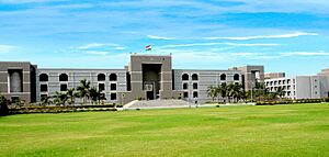
The city is divided into seven zones with 48 wards. The larger urban areas are managed by the Ahmedabad Urban Development Authority (AUDA). Ahmedabad has two members of parliament in the Lok Sabha. It also has 21 members in the state legislative assembly. The Gujarat High Court is in Ahmedabad. The Ahmedabad City Police keeps law and order.
Public Services
- Electricity is provided by Torrent Power Limited. Ahmedabad is one of the few Indian cities where electricity is privately managed.
Hospitals
Ahmedabad has many hospitals, including:
- Ahmedabad Civil Hospital
- Care Institute of Medical Sciences
- GCS Medical College, Hospital and Research Centre
- Krishna Heart Institute
- Sola Civil Hospital
- SVP Hospital
- Victoria Jubilee Hospital for Women
Culture and Fun
Ahmedabad is known for its unique architecture and traditional homes. People here celebrate many festivals.
- Uttarayana is a harvest festival in January. People fly kites during this time.
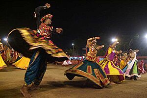
- The nine nights of Navratri are celebrated with Garba dancing. This is a popular folk dance of Gujarat.
- The annual Rath Yatra procession takes place at the Jagannath Temple.
- Other festivals like Diwali, Holi, and Christmas are also celebrated.
Food in Ahmedabad
A very popular dish in Ahmedabad is the Gujarati thali. It includes roti (bread), dal (lentils), rice, and cooked vegetables. It also comes with pickles and roasted papads. Sweet dishes like laddoo are also enjoyed. Dhoklas and theplas are other popular snacks.
Most restaurants in Ahmedabad serve only vegetarian food. This is because of the strong tradition of vegetarianism among the Jain and Hindu communities. The world's first all-vegetarian Pizza Hut opened in Ahmedabad. Many fast-food chains also have separate kitchens for vegetarian food.
Manek Chowk is a famous open square. It is a vegetable market in the morning and a jewelry market in the afternoon. In the evening, it turns into a huge collection of food stalls. They sell delicious local street food. Ahmedabad was named India's most vegan-friendly city in 2024 by Peta India.
Art and Crafts
Some parts of Ahmedabad are famous for their folk art.
- Artisans in Rangeela pol make tie-dyed bandhinis.
- Cobbler shops in Madhupura sell traditional mojdi footwear.
- The Gulbai Tekra area is known for making idols of Hindu gods.
- Shops at the Law Garden sell beautiful mirrorwork handicrafts.
Ahmedabad has important places for Gujarati literature. These include Gujarat Vidhya Sabha and Gujarati Sahitya Parishad. The Saptak School of Music festival is held every year.
The Sanskar Kendra is a museum designed by Le Corbusier. It shows the city's history, art, and culture. The Gandhi Smarak Sangrahalaya has items related to Mahatma Gandhi. The Calico Museum of Textiles has a large collection of fabrics. The Hazrat Pir Mohammad Shah Library has rare old manuscripts. The Vechaar Utensils Museum displays many types of tools. The Conflictorium is a unique space that explores conflict through art.
The Shreyas Foundation has four museums. The Shreyas Folk Museum shows art from Gujarati communities. The Kalpana Mangaldas Children's Museum has toys and puppets. The L. D. Institute of Indology has a huge collection of Jain manuscripts.
The Darpana Academy of Performing Arts was started in 1949. It has made Ahmedabad a center for Indian classical dance.
Education and Learning
Schools and Colleges
Schools in Ahmedabad are run by the city government or by private groups. Most schools follow the Gujarat Secondary and Higher Secondary Education Board. Some are linked to national or international boards.
Higher Education and Research
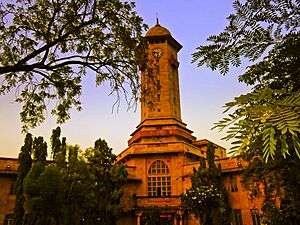
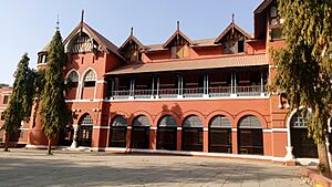
Ahmedabad has many colleges for engineering, management, and design. The oldest college is Gujarat College. Gujarat University is a large university with many colleges. Indira Gandhi National Open University also has a center here. Other state universities include Dr. Babasaheb Ambedkar Open University and Gujarat Technological University. Gujarat Vidyapith was founded by Mahatma Gandhi in 1920.
Private universities include Ahmedabad University and CEPT University. Two important national institutes are also here: the Indian Institute of Management, Ahmedabad (IIM-A) and the National Institute of Design, Ahmedabad.
The Physical Research Laboratory was started in 1947 by Vikram Sarabhai. It studies astronomy and physics. The Ahmedabad Textile Industry's Research Association (ATIRA) does research for the textile industry.
Media and News
Ahmedabad has many newspapers. English newspapers include The Times of India and Indian Express. Gujarati newspapers include Divya Bhaskar and Gujarat Samachar. The historic Navajivan Publishing House was founded by Mahatma Gandhi in 1919.
The state-owned All India Radio broadcasts on FM (96.7 MHz). There are also several private FM radio stations. Gujarat University started its own campus radio service in 2012.
The state-owned television channel is Doordarshan. Cable TV providers offer many channels in different languages. Phone services are available from major companies like Jio and Airtel.
Economy and Business
Ahmedabad's economy was estimated at $64 billion in 2014. In the 1800s, the textile industry grew a lot. The first Indian textile mill was founded in 1861. By 1905, there were about 33 textile mills. The textile industry grew even more during the First World War. It also benefited from Mahatma Gandhi's Swadeshi movement, which encouraged buying Indian goods. Ahmedabad became known as the "Manchester of the East" because of its textile industry.
The city is a big supplier of denim. It is also a major exporter of gemstones and jewelry. The automobile industry is important too. Companies like Ford and Suzuki have built factories near Ahmedabad.
Two of India's biggest pharmaceutical companies, Zydus Lifesciences and Torrent Pharmaceuticals, are based here. The Nirma group, which makes detergents and chemicals, also has its main office in Ahmedabad. The Adani Group, a large trading and infrastructure company, is also headquartered here.
The Sardar Sarovar Project has improved water and electricity supply for the city. The information technology industry has also grown. Companies like Tata Consultancy Services have offices here. Ahmedabad is a top city for IT services in India. The city's schools and industries attract students and skilled workers from all over India.
City Infrastructure
Getting Around
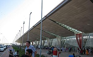
The main airport for Ahmedabad is Sardar Vallabhbhai Patel International Airport. It is operated by the Adani Group. The Dholera International Airport is also being built southwest of Ahmedabad. Its first phase is expected to be finished by 2025.
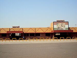
Ahmedabad Junction railway station is the city's main and busiest railway hub. Other important stations include Chandlodiya and Sabarmati Junction.
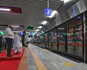
Public transport includes the Ahmedabad Metro. This rapid transit system opened in March 2019. It has 40 kilometers (25 miles) of tracks and two lines. About 90,000 people use it every day. Phase 2 of the Metro, connecting Motera Stadium to Gandhinagar, began construction in February 2021. It is expected to be complete by 2026.
The Ahmedabad Bus Rapid Transit System (BRTS), also called Janmarg, opened in 2009. It has 325 buses on 19 routes. About 190,000 people use it daily. The Ahmedabad Municipal Transport Service (AMTS) also provides bus services.
In December 2019, the city started "AmdaBike." This is a public bicycle sharing system. It helps people travel short distances. MYBYK is the main service provider. It has 300 bicycle stations and 4,000 bicycles.
Roads
National Highway 48 goes through Ahmedabad. It connects the city to New Delhi and Mumbai. National Highway 147 links Ahmedabad to Gandhinagar. The city is also connected to Vadodara by National Expressway 1. This expressway is part of the Golden Quadrilateral project.
In 2001, Ahmedabad was ranked as one of the most polluted cities in India. To reduce pollution, the city encouraged auto rickshaw drivers to switch to cleaner fuel. This helped improve the air quality.
Sports in Ahmedabad
Cricket is very popular in Ahmedabad. The Narendra Modi Stadium (also known as Motera Stadium) is a famous cricket ground. It is the largest stadium in the world. It can hold 132,000 fans! This stadium has hosted many important matches, including the 1987, 1996, 2011, and 2023 Cricket World Cups. It is also the home ground for the Gujarat cricket team. Ahmedabad also has another cricket stadium at the Sports Club of Gujarat. The IPL team Gujarat Titans won its first title in 2022 in front of its home crowd.
Other popular sports include field hockey, badminton, tennis, and golf. Ahmedabad has nine golf courses. The city is developing the Mithakhali Multi Sports Complex for indoor sports. Ahmedabad has also hosted national games for roller skating and table tennis. Kart racing is also becoming popular.
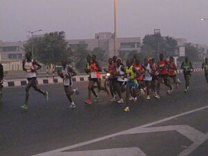
The Sabarmati Marathon is held every year. It has different races, including a full marathon and a fun run. In 2007, Ahmedabad hosted national shooting games. The 2016 Kabaddi World Cup was held here. Geet Sethi, a world champion in billiards, grew up in Ahmedabad.
The Adani Ahmedabad Marathon has been held every year since 2017. It attracts thousands of participants.
Olympic Dreams
Ahmedabad is being considered as a possible host city for the 2036 Summer Olympics. The Gujarat government has found 33 places around Ahmedabad to build sports facilities. The city is working with international experts on its bid. A special group is being set up to manage Ahmedabad's Olympic bid.
International Connections
Sister Cities
Ahmedabad has sister city relationships with other cities around the world:
 Astrakhan, Russia
 Columbus, United States (since 2008)
 Guangzhou, China (since September 2014)
 Jersey City, United States (since 1994)
Images for kids
See also
 In Spanish: Ahmedabad para niños
 | Misty Copeland |
 | Raven Wilkinson |
 | Debra Austin |
 | Aesha Ash |


