Ramanathapuram district facts for kids
Quick facts for kids
Ramanathapuram district
Ramnad District
|
|
|---|---|
|
District
|
|
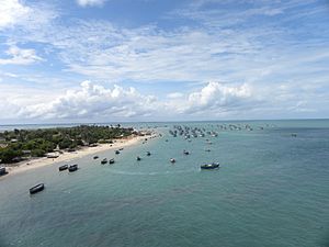
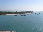
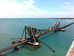
Aerial view of the Rameswaram island from Pamban Bridge
|
|
| Nickname(s):
Mugavai Mavattam
|
|
| Country | |
| State | Tamil Nadu |
| Municipalities | Ramanathapuram Paramakudi Rameswaram Kilakarai |
| 'Largest City By Population' | Paramakudi |
| 'Largest City by Area' | 'Ramanathapuram' |
| Headquarters | Ramanathapuram |
| Talukas | Kadaladi Kamuthi Kilakarai Mudukulathur Paramakudi RajaSingaMangalam - R.S.Mangalam Ramanathapuram Rameswaram Tiruvadanai |
| Population
(2011)
|
|
| • Total | 1,353,445 |
| Languages | |
| • Official | Tamil |
| Time zone | UTC+5:30 (IST) |
| PIN |
623xxx
|
| Telephone code | 04567 |
| Vehicle registration | TN-65 |
| Central location: | 9°16′N 77°26′E / 9.267°N 77.433°E |
Ramanathapuram District, also known as Ramnad District, is a special area in the southern Indian state of Tamil Nadu. Its main town is Ramanathapuram. This district covers about 4,123 square kilometers.
It is surrounded by other districts like Sivaganga and Pudukkottai to the north. To the east, it borders the Palk Strait, and to the south, the Gulf of Mannar. The district also shares borders with Thoothukudi and Virudhunagar districts.
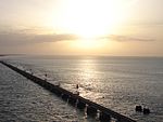
A famous landmark here is the Pamban Bridge. This bridge connects India to the Rameswaram island. The island is part of a chain of small islands and shallow reefs that stretch towards Sri Lanka. This chain separates the Palk Strait from the Gulf of Mannar. The Palk Strait is quite shallow, so only small boats can easily pass through it.
In 2011, Ramanathapuram district had a population of over 1.3 million people. For every 1,000 males, there were 983 females.
Contents
People and Population
| Historical population | ||
|---|---|---|
| Year | Pop. | ±% p.a. |
| 1901 | 442,067 | — |
| 1911 | 477,726 | +0.78% |
| 1921 | 479,202 | +0.03% |
| 1931 | 517,471 | +0.77% |
| 1941 | 577,826 | +1.11% |
| 1951 | 551,125 | −0.47% |
| 1961 | 702,168 | +2.45% |
| 1971 | 822,623 | +1.60% |
| 1981 | 998,295 | +1.95% |
| 1991 | 1,119,153 | +1.15% |
| 2001 | 1,187,604 | +0.60% |
| 2011 | 1,353,445 | +1.32% |
| source: | ||
Based on the 2011 census, Ramanathapuram district had 1,353,445 people. The number of females per 1,000 males was 983. This is higher than the average for India, which was 929.
About 140,644 children were under six years old. This included 71,705 boys and 68,939 girls. The district's average literacy rate was 72.33%. This means that about 72 out of every 100 people could read and write. This was very close to India's national average of 72.99%.
Many people in the district work in different jobs. There were over 600,000 workers in total. Many of them were farmers or agricultural laborers. Others worked in small home-based industries or other types of jobs.
A Look at History
In the early 1400s, the area that is now Ramanathapuram district was part of the Pandyan Dynasty. This included towns like Tiruvadanai, Paramakudi, and Rameswaram. Later, around 1063 AD, King Rajendra Chola I took control of this region for a short time.
By 1520 AD, the Nayaks of Vijayangar ruled the area for about 200 years. During this time, local leaders called Sethupathis, who were loyal to the Pandiyan Kings, governed this part of the land.
In the early 1700s, there were disagreements within the Sethupathi family about who should rule. This led to the division of Ramanathapuram. With help from the King of Thanjavur, one of the leaders became the Raja of Sivaganga in 1730 AD. As the Nayak rulers became weaker, local chieftains, known as Palayakarars, gained independence. The Raja of Sivaganga and the Sethupathy of Ramanathapuram were the most important among them.
In 1730, a ruler named Chand Sahib from Carnatic captured Ramanathapuram. Then, in 1741, the Marattas took control, followed by the Nizam in 1744 AD. The Nawab's rule made the local leaders unhappy. This led them to declare the last Nayak as the ruler of Pandiya Mandalam against the Nawab in 1752 AD.
At this time, there were two rivals for the Carnatic throne: Shanda Sahib and Mohamed Ali. The British supported Mohamed Ali, while the French supported Chanda Sahib. This led to many fights in the southern part of India.
British Rule and Changes
In 1795, the British removed Muthuramalinga Sethupathy from power. They then took over the administration of Ramanathapuram. In 1801, Mangaleswari Nachiyar became the Zamindar (landlord) of Sivagangai. After she passed away, the Marudhu Brothers took charge. They paid regular taxes to the East India Company.
In 1803, the Marudhu Brothers of Sivaganga rebelled against the British. They worked with Kattabomman of Panchalamkurichi. However, Colonel Agnew captured the Marudhu Brothers and hanged them. Gowri Vallbah Periya Udaya Thevar then became the Zamindar of Sivaganga. After Tippu Sultan was defeated, the British took full control and imprisoned the Nawab. In 1892, the Zamindari system was ended, and a British Collector was appointed to manage the district.
In 1910, Ramanathapuram district was officially formed. It was created by combining parts of the Madurai and Tirunelveli districts. Shri J.F. Bryant I.C.S was the first Collector. During the British period, the district was called "Ramnad." This name continued even after India became independent. Later, the district was renamed Ramanathapuram to match its Tamil name.
Land and Rocks
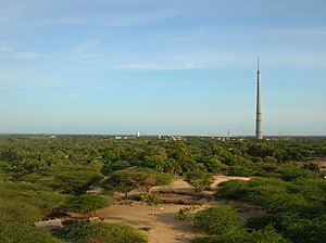
Most of Ramanathapuram district is covered by loose sediments from the Quaternary age. These are the most recent geological deposits. However, in the northwestern part, you can find older rocks. These include very old crystalline rocks and Tertiary sandstone.
The oldest rocks, called Archaeans, are mainly made of types of granite and gneiss. The Tertiary sandstone is often pink, yellow, or reddish. It is made of medium to coarse grains of sand and clay. This sandstone is found north of the Vaigai River.
You can also see patches of laterite soil in the northwestern part of the district.
Most of the district is covered with sediments brought by rivers, winds, and the sea. These include sand, silt, and clay. These deposits are found along the rivers like Vaigai, Gundar, Manimuthar, and Pambar.
In the Vaigai delta, you can find deposits from rivers and the sea. These include sandy plains and old tidal flats with black silty clay. On Rameswaram Island, these deposits include hardened sand and sand dunes.
Wind-blown deposits, called Aeolian deposits, are made of red sands. These are ancient sand dunes that are about 3.2 kilometers wide and 8 kilometers long. They run parallel to the coast. These red sands are separated by marshy areas with black clays.
The marine formations are coastal plain deposits of sand and clay. Hardened marine layers, made of calcium, are found as low terraces and platforms. They contain quartz, limonite, and garnet.
Places to Visit
Ramanathapuram district has many interesting places to explore:
- Ramanathapuram Palace: This palace was built by Kizhavan Sethupathi. He was one of the most famous Sethupathi kings, ruling from 1674 to 1710 CE.
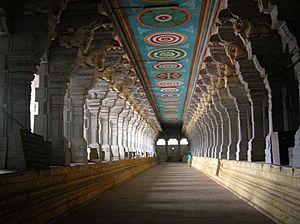
- Rameswaram: A well-known town with the beautiful Sangumaan Beach.
- Thangachimadam: The resting place of Dr. A.P.J. Abdul Kalam, near Peikarumbu.
- Dhanushkodi: A unique and historic place at the very tip of the Indian peninsula.
- Pamban Bridge (Annai Indira Gandhi Bridge): A famous bridge connecting the mainland to Pamban Island.
- Kundhukal: Home to the Vivekananda Memorial.
- R S Madai: Here you can visit the Sea World Aquarium.
- Naagachi: Visit the Naagachi Amman Temple.
- Kamuthi: See the Pasumpon Dever Memorial.
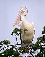
- Bird Sanctuaries: The district is home to several bird sanctuaries, perfect for nature lovers:
* Kanjirankulam Bird Sanctuary * Chitrangudi Bird Sanctuary * Alagankulam Bird Sanctuary * Melselvanur-Keelselvanur Bird Sanctuary
See also
 In Spanish: Distrito de Ramanathapuram para niños
 | Selma Burke |
 | Pauline Powell Burns |
 | Frederick J. Brown |
 | Robert Blackburn |


