Tirunelveli facts for kids
Quick facts for kids
Tirunelveli
Nellai (shortened)
Tinnevely (colonial) |
|
|---|---|

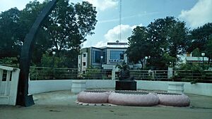
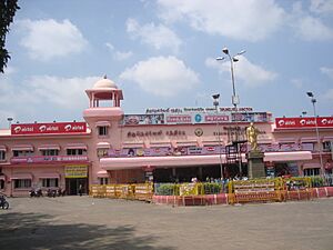
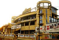
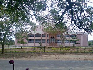
Clockwise from Top Left : Swami Nellaiappar Temple, Tirunelveli Junction Railway Station, Thiruvalluvar Bridge – Aerial view, Town Arch, Speaker Chellapandian Flyover near Vannarapettai at night, Tirunelveli City Skyline, Older side of Sulochana Mudaliar Bridge at night across river Thamirabharani connecting Downtown Tirunelveli and Kokkirakulam, NH 44 cutting through the Reddiyarpatti Hillock, Thamirabarani River passing between Downtown Tirunelveli and Kokkirakulam, Tirunelveli City Municipal Corporation Building
|
|
| Country | |
| State | |
| Region | Pandya Nadu |
| District | Tirunelveli |
| Boroughs | Tirunelveli Town Palayamkottai Melapalayam Pettai Thachanallur |
| Government | |
| • Type | Municipal Corporation |
| • Body | Tirunelveli City Municipal Corporation |
| Area | |
| • Metropolis | 189.9 km2 (73.3 sq mi) |
| Area rank | 3 |
| Elevation | 73 m (240 ft) |
| Population
(2011)
|
|
| • Metropolis | 473,637 |
| • Rank | 8th in Tamil Nadu |
| • Density | 2,494.1/km2 (6,459.8/sq mi) |
| • Metro | 968,874 |
| Demonym(s) | Tirunelvelian, Nellaikaran (Male) and Nellaikari (Female) |
| Languages | |
| • Official | Tamil |
| Time zone | UTC+5:30 (IST) |
| Pin Codes |
627001
627002 627003 627004 627005 627006 627007 627008 627009 627010 627011 627012 627051 627353 627357 627358 |
| Telephone code | 91 (0)462, (0)4633 |
| Vehicle registration | TN 72 |
| Website | https://tirunelveli.nic.in/ |
Tirunelveli (also called Nellai) is a big city in the Indian state of Tamil Nadu. It is the main office for the Tirunelveli District. This city is the fourth largest municipal corporation in Tamil Nadu. It is located about 624 kilometers (388 miles) southwest of Chennai, the state capital.
The city is divided by the Thamirabarani River. The main part of Tirunelveli is on the west side. Its twin city, Palayamkottai, is on the east side. Both cities are known for their many colleges. People sometimes call them the "Oxford of South India."
Tirunelveli is a very old city, more than 2,000 years old. Different rulers have controlled it over time. These include the Pandyas, Cheras, Cholas, Vijayanagara Empire, and the British. A famous war, the Polygar War, happened near the city between 1797 and 1801. This war was between local leaders (Palaiyakkarars) and the British East India Company.
The city is managed by the Tirunelveli Municipal Corporation. This group was started in 1994. Tirunelveli covers an area of 189.9 square kilometers (73.3 square miles). In 2011, it had a population of 473,637 people. The city is well-connected by roads and railways to other parts of India. The closest airport is Thoothukudi Airport.
Tirunelveli has many industries. These include farming trade, tourism, banking, and education. It is an important education center in southern India. It has many colleges like Tirunelveli Medical College and Manonmaniam Sundaranar University.
The city has many old buildings. The Nellaiappar Temple is the most famous one. Tirunelveli is also known for a special sweet called 'Irutu kadai halwa'.
Contents
- What Does the Name Tirunelveli Mean?
- A Look at Tirunelveli's Past
- Where is Tirunelveli Located?
- Who Lives in Tirunelveli?
- How Does Tirunelveli Make Money?
- How is Tirunelveli Governed?
- How Do People Travel in Tirunelveli?
- What is Tirunelveli's Culture Like?
- Learning and Education in Tirunelveli
- City Services in Tirunelveli
- See also
What Does the Name Tirunelveli Mean?
Tirunelveli is a "temple town." Many towns in this state are named after the trees or plants that grow there. These plants often shelter the main god of the temple. This area was once a "Venu forest," which means a bamboo forest. So, it was called Venuvanam.
The name Tirunelveli comes from three Tamil words:
- Thiru means "sacred" or "holy."
- Nel means "paddy" (rice plants).
- Veli means "hedge" or "fence."
So, Tirunelveli means "sacred paddy hedge." A legend says that the god Shiva protected a devotee's rice crop by forming a hedge.
A Look at Tirunelveli's Past
Tirunelveli was once a secondary capital for the Pandya kings. Their main capital was Madurai. The Pandya rule in this area started many centuries before the Christian era. We know this from old writings and inscriptions.
Later, the Cholas took control of the region around 1064 CE. Tirunelveli stayed under Chola rule until the early 1200s. Then, the second Pandyan empire was formed again.
The Nellaiappar Temple was very important to the later Pandyas. They built dams to help the city grow. After the Pandyas, the Vijayanagara rulers and local chiefs called poligars took over in the 1500s. The city was rebuilt around 1560.
In the 1700s, the region came under the rule of the Nawabs of Arcot. However, the real power was with the polygars. These were military leaders who had their own armies. They built forts and sometimes fought among themselves.
The British East India Company became involved in the area. They fought against the polygars. A famous polygar named Veerapandiya Kattabomman fought against the British. He was defeated and executed in 1797. Two years later, another war broke out. After this, the British took full control of the region.
The British created the Tirunelveli District in 1790. They called the city "Tinnevelly." After India became independent, the city went back to its original name, Tirunelveli. Over the years, parts of the district were separated to form new districts. In 2019, Tenkasi was separated to form Tenkasi District.
Where is Tirunelveli Located?
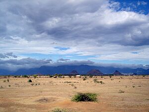
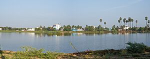
Tirunelveli is located at the very southern tip of the Deccan plateau. It is about 47 meters (154 feet) above sea level. The Thamirabarani River flows through the city, dividing it into two parts. This river and its smaller rivers are the main source of water for farming. They get water from the northeast and southwest monsoons.
The city has several small lakes and ponds called Kulam. The soil in the area is mostly red and sandy. The Agasthiyamalai hills block the southwest monsoon, which creates a dry area around Tirunelveli.
What is Tirunelveli's Climate Like?
Tirunelveli has a hot and humid climate. In summer (March to June), temperatures range from 25°C (77°F) to 41°C (106°F). During the rest of the year, it's between 18°C (64°F) and 29°C (84°F). The city gets about 680 millimeters (27 inches) of rain each year. Most of the rain falls during the northeast monsoon (October–December).
Farming is very important to the area's economy. So, the amount of rain affects how well the local economy does. The main crops grown here are rice and cotton. Other plants like pineapples, chili peppers, and tobacco were brought here later. The most common tree is the palmyra palm. This tree is used to make things in small home industries.
| Climate data for Tirunelveli (located in Palayamkottai) 1981–2010, extremes 1947–2012 | |||||||||||||
|---|---|---|---|---|---|---|---|---|---|---|---|---|---|
| Month | Jan | Feb | Mar | Apr | May | Jun | Jul | Aug | Sep | Oct | Nov | Dec | Year |
| Record high °C (°F) | 36.0 (96.8) |
39.0 (102.2) |
41.7 (107.1) |
42.0 (107.6) |
42.8 (109.0) |
44.9 (112.8) |
41.9 (107.4) |
39.5 (103.1) |
40.5 (104.9) |
41.0 (105.8) |
38.9 (102.0) |
37.0 (98.6) |
44.9 (112.8) |
| Mean daily maximum °C (°F) | 31.4 (88.5) |
33.5 (92.3) |
35.5 (95.9) |
36.7 (98.1) |
37.7 (99.9) |
36.1 (97.0) |
35.2 (95.4) |
35.2 (95.4) |
35.8 (96.4) |
34.0 (93.2) |
31.3 (88.3) |
30.5 (86.9) |
34.4 (93.9) |
| Mean daily minimum °C (°F) | 22.4 (72.3) |
23.0 (73.4) |
24.3 (75.7) |
25.9 (78.6) |
26.7 (80.1) |
26.7 (80.1) |
26.4 (79.5) |
26.2 (79.2) |
25.8 (78.4) |
24.8 (76.6) |
23.7 (74.7) |
22.8 (73.0) |
24.9 (76.8) |
| Record low °C (°F) | 18.0 (64.4) |
18.0 (64.4) |
18.4 (65.1) |
20.3 (68.5) |
16.3 (61.3) |
20.4 (68.7) |
19.3 (66.7) |
21.6 (70.9) |
19.5 (67.1) |
17.9 (64.2) |
16.9 (62.4) |
17.6 (63.7) |
16.9 (62.4) |
| Average rainfall mm (inches) | 24.5 (0.96) |
26.0 (1.02) |
44.0 (1.73) |
59.5 (2.34) |
52.2 (2.06) |
6.6 (0.26) |
13.3 (0.52) |
30.0 (1.18) |
40.3 (1.59) |
156.0 (6.14) |
188.0 (7.40) |
79.9 (3.15) |
720.2 (28.35) |
| Average rainy days | 1.8 | 1.8 | 2.1 | 3.6 | 2.7 | 0.9 | 0.9 | 1.5 | 2.7 | 7.6 | 10.2 | 4.8 | 40.5 |
| Average relative humidity (%) (at 17:30 IST) | 65 | 59 | 55 | 57 | 56 | 55 | 54 | 54 | 54 | 64 | 71 | 70 | 60 |
| Source: India Meteorological Department | |||||||||||||
Who Lives in Tirunelveli?
In 2011, Tirunelveli had a population of 473,637 people. There were more females (1,027) than males (1,000). About 46,624 people were under six years old. The city's average literacy rate (how many people can read and write) was 81.49%. This is higher than the national average.
Most people in Tirunelveli are Hindus (69%). There are also many Muslims (20.02%) and Christians (10.59%). Tamil is the main language spoken. However, English is also commonly used in schools and offices. The Tamil spoken here has its own special sound.
How Does Tirunelveli Make Money?
Tirunelveli has been a center for business for a long time. In the past, it was a key trading spot. It connected the eastern and western parts of the peninsula. It also traded a lot with Sri Lanka and Kerala. Cotton from this region was very popular in British mills in the 1840s.
Today, many people in Tirunelveli work in different areas. These include government services, farming trade, and tourism. Banking, farm machinery, and education are also important. The city is a growing place for religious tourism.
Tirunelveli has factories that make things like cement. There are also companies that work with tobacco. Mills for cotton textiles and weaving are also present. Small businesses like tanneries (where leather is made) and brick kilns also help the economy. The main farm products are rice and cotton.
The city is also a major area for making wind power. Many wind turbines are located in Tirunelveli and Kanyakumari Districts. In 2005, they produced a lot of electricity for the state. There is also an IT park in Gangaikondan. Companies like ATOS and TATA solar have facilities there.
How is Tirunelveli Governed?
| Administrative officials | ||
|---|---|---|
| Collector | K.P. Karthikeyan | |
| Municipality officials | ||
| Mayor | P.M.Saravanan | |
| Commissioner | V.Sivakrishnamurthy | |
| Deputy Mayor | K.R.Raju | |
| Commissioner of Police | Deepak M Damor, IPS | |
| Members of Legislative Assembly | ||
| Tirunelveli | Nainar Nagendran | |
| Palayamkottai | Abdul Wahab | |
| Member of Parliament | ||
| Tirunelveli | S. Gnanathiraviam | |
The Tirunelveli Municipality started in 1866 when the British ruled. In 1994, it became a City Municipal Corporation. This meant that other nearby towns and villages joined the city. The corporation has five main areas: Tirunelveli, Thatchanallur, Palayamkottai, Pettai, and Melapalayam.
The corporation has 55 wards, and each ward has an elected leader called a councillor. A municipal commissioner leads all the city departments. The city's laws are made by 55 members, one from each ward. An elected chairperson leads this group.
Tirunelveli is the main city for the Tirunelveli district. The city is part of two assembly areas: Tirunelveli and Palayamkottai. These areas elect a member to the Tamil Nadu Legislative Assembly every five years. The city is also part of the Tirunelveli Lok Sabha constituency. This area elects a member to the national parliament.
The Tamil Nadu Police keeps law and order in the city. A commissioner leads the Tirunelveli City police division.
How Do People Travel in Tirunelveli?
Tirunelveli has a good transport system. It is well-connected to other big cities by road, rail, and air. The city has many kilometers of roads. A bridge built in 1844 connects Tirunelveli to Palayamkottai across the Tamirabarani River. The city is on National Highway 44 (NH 44).
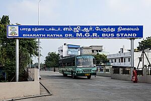
The main bus stand, called the New Bus Stand (now Bharat Ratna Dr. MGR Bus Stand), opened in 2003. It has regular bus services to and from the city. The Tamil Nadu State Transport Corporation runs daily buses to many cities. They also have local buses for travel within the city and to nearby villages.
The Tirunelveli Junction railway station is one of India's oldest railway stations. It connects the city to major cities in all directions. There are daily train services to cities like Chennai, Coimbatore, Bangalore, and Mumbai. The 2nd Vande Bharat Express in Tamil Nadu runs between Tirunelveli and Chennai.
The closest airport is Tuticorin Airport (TCR), about 22 kilometers (14 miles) away. It has daily flights to Chennai and Bangalore. The nearest international airports are Madurai International Airport and Thiruvananthapuram International Airport.
What is Tirunelveli's Culture Like?
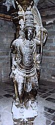
The Nellaiappar Temple is a famous Hindu temple in Tirunelveli. It is dedicated to the god Shiva. This temple was greatly expanded in the 1500s. It has special features like musical pillars. The temple holds many festivals each year. The biggest one is when the temple chariot is pulled through the streets. This temple is one of the Pancha Sabhai temples, which are five special places where Shiva is believed to have performed a cosmic dance.
Tirunelveli is also famous for its halwa, a sweet treat made from wheat, sugar, and ghee. It started in the mid-1800s. A shop called Iruttukadai Halwa, opened in 1900, is very popular. They only sell the sweet during the evening.
The city has many movie theaters that mostly show Tamil films. Tirunelveli also has FM radio stations like Suryan FM and Hello FM.
Sports are popular in Tirunelveli. The VOC grounds and Anna Stadium are well-known places for sports events. Like in most of India, cricket is the most popular sport. Football, volleyball, swimming, and hockey are also played.
The Government Exhibition is a yearly event that brings many visitors to the city. The District Science Center - Tirunelveli is in the city center. It has exhibits, science shows, and a mini-planetarium. Nearby tourist spots include the Manimuthar and Papanasam Dams. There are also bird sanctuaries like Ariakulam and Koonthakulam.
Learning and Education in Tirunelveli
In the 1790s, Christian missionaries started many schools in Tirunelveli. These schools included primary schools, boarding schools, and colleges. The first boarding school for girls opened in 1821.
Today, Tirunelveli city has 80 schools. These include higher secondary schools, high schools, middle schools, and primary schools. The city corporation runs 33 of these schools. The city also has eight arts and science colleges and six professional colleges.
Manonmaniam Sundaranar University is a famous university in the city. It is named after a poet who wrote the state anthem. Many Christian schools and colleges are in the Palayamkottai area.
Anna University of Technology Tirunelveli was started in 2007. It offers many engineering and technology courses. Other important colleges include Tirunelveli Medical College, Government Law College, Tirunelveli, and the Government College of Engineering, Tirunelveli. Sarah Tucker College was the first college for women in South India.
The Indian Institute of Geomagnetism has a research lab here. It studies geomagnetism and space sciences. The city also has a District Science Centre. It offers exhibitions, science shows, and a mini-planetarium.
City Services in Tirunelveli
The Tamil Nadu Electricity Board (TNEB) provides electricity to Tirunelveli. The city is the main office for the TNEB in the Tirunelveli region. The Tirunelveli City Corporation supplies water to the city from the Tamirabarani River.
About 100 metric tonnes of waste are collected from the city every day. The city also has an underground drainage system for sewage. This system covers about 22% of the city. For other areas, sewage is handled by septic tanks.
The city corporation also runs clinics that provide basic health care. There are also private hospitals and clinics.
Tirunelveli is part of the Tirunelveli Telecom District. Bharat Sanchar Nigam Limited (BSNL) provides phone and internet services. Both mobile and broadband internet services are available. The city also has a Passport Seva Kendra, where people can apply for passports.
See also
 In Spanish: Tirunelveli para niños
 | Misty Copeland |
 | Raven Wilkinson |
 | Debra Austin |
 | Aesha Ash |


