Red Rock Pass (Idaho) facts for kids
Quick facts for kids Red Rock Pass |
|
|---|---|

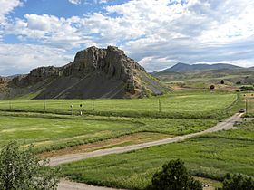
Red Rock Pass, July 2010
|
|
| Elevation | 4,785 ft (1,458 m) |
| Traversed by | |
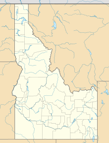
| Location | Bannock County, Idaho, United States |
| Range | Portneuf Range/ Bannock Range Rocky Mountains |
| Coordinates | 42°21′20″N 112°2′40″W / 42.35556°N 112.04444°W |
Red Rock Pass is a low mountain pass located in southern Bannock County, Idaho, United States. It sits south of the town of Downey. This pass is very important to geologists because it was once the natural "spillway" for an ancient, huge lake called Lake Bonneville.
You can find Red Rock Pass along U.S. Route 91. It is about 4,785 feet (or 1,458 meters) above sea level. The pass is nestled between two mountain ranges: the Portneuf Mountains to the east and the Bannock Mountains to the west.
The pass itself was carved through strong rocks like Paleozoic shale, limestone, and dolomite. It forms a narrow gap about 2 miles (3.2 kilometers) long. Long ago, the pass was about 300 feet (91 meters) higher. This higher point was where the shoreline of Lake Bonneville used to be during the Pleistocene Ice Age.
The name "Red Rock Pass" comes from the red limestone cliffs that stand on its sides. The ground here has a layer of chalky, silty soil. The very top layer of soil is a dark grayish-brown silt loam, which is a mix of sand, silt, and clay.
The Great Bonneville Flood
Scientists believe that during the last ice age, lava flows near Pocatello changed the path of the Bear River. This river then started flowing into Lake Thatcher and from there, into Lake Bonneville.
About 14,500 years ago, this sudden extra water caused Lake Bonneville to overflow at Red Rock Pass. This overflow led to a very fast wearing away of the loose soil and rocks on the northern shoreline near the pass. As the ground gave way, the Marsh Creek Valley, which is just downstream, was completely flooded.
The powerful water quickly carved the pass down to its current level. The floodwaters then rushed into the Snake River Plain. They generally followed the path of the modern-day Snake River all the way to the Pacific Northwest.
How Big Was the Flood?
The Bonneville flood was a truly massive event. At its peak, the water flowed out at about 15 million cubic feet per second (420,000 cubic meters per second). To give you an idea, this is about three times the average flow of the Amazon River, which is the world's largest river!
The water moved very fast, around 16 miles per hour (26 kilometers per hour). Even though the highest flow only lasted for a few days, a huge amount of water continued to pour out for at least a year.
 | James B. Knighten |
 | Azellia White |
 | Willa Brown |


