
Remetschwil facts for kids
Quick facts for kids
Remetschwil
|
||
|---|---|---|
 |
||
|
||

Remetschwil
Location in Switzerland

Remetschwil
Location in Canton of Aargau
|
||
| Country | Switzerland | |
| Canton | Aargau | |
| District | Baden | |
| Area | ||
| • Total | 3.88 km2 (1.50 sq mi) | |
| Elevation | 524 m (1,719 ft) | |
| Population
(Dec 2020 )
|
||
| • Total | 2,023 | |
| • Density | 521.4/km2 (1,350.4/sq mi) | |
| Postal code |
5453
|
|
| Surrounded by | Bellikon, Künten, Niederrohrdorf, Oberrohrdorf, Spreitenbach, Stetten | |


Remetschwil is a small municipality located in the Baden district. It is part of the canton of Aargau in Switzerland.
Contents
History of Remetschwil
Remetschwil was first mentioned in official records way back in 1184. At that time, it was known as Reimiswilare. For a long time, Remetschwil was part of a larger area called Rohrdorf. However, in 1854, Rohrdorf split into three separate municipalities: Niederrohrdorf, Oberrohrdorf, and Remetschwil. This is how Remetschwil became its own independent community.
Geography and Landscape
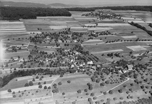
Remetschwil covers an area of about 3.9 square kilometers (about 1.5 square miles). A big part of this land, almost 60%, is used for farming. About a quarter of the area is covered by forests. The rest of the land, around 16%, has buildings and roads. A very small part (0.3%) is made up of rivers or lakes.
The municipality is located in the Baden district, on the southwestern side of a hill range called Heitersberg. Remetschwil includes its main village and two smaller settlements, known as hamlets. These are Busslingen, which is in the Reuss river valley, and Sennhof, which is higher up on the Heitersberg.
What is the Remetschwil Coat of Arms?
The official description of Remetschwil's coat of arms is quite unique. It is split into two parts. The top part is gold and shows a red buck (a male deer) walking and looking back. The bottom part is red and features a gold royal orb. A royal orb is a symbol of power and royalty, often seen in historical art.
Population and People

Remetschwil has a population of about 2,000 people. In recent years, the number of people living here has grown quite a bit, by over 20% in the last decade. Most people in Remetschwil speak German, which is the main language. A smaller number of people speak Italian, and some speak Albanian.
The population includes people of all ages. About 11.5% are young children (0-9 years old), and 13.6% are teenagers (10-19 years old). Adults aged 40-49 make up the largest group, at over 21% of the population. There are also many older adults and seniors living in the municipality.
In 2008, most homes in Remetschwil were single-family houses. The average household had about 2.7 people living in it.
When it comes to politics, the most popular party in the 2007 federal election was the Swiss People's Party (SVP). Other popular parties included the Christian Democratic People's Party (CVP), the Free Democratic Party (FDP), and the Social Democratic Party (SP).
Many adults in Remetschwil have completed higher education, either at a university or a specialized college. In the 2008/2009 school year, 164 students attended primary school in the municipality.
Here's how the population of Remetschwil has changed over time:
| Historical population | ||
|---|---|---|
| Year | Pop. | ±% |
| 1780 | 221 | — |
| 1803 | 290 | +31.2% |
| 1860 | 575 | +98.3% |
| 1900 | 482 | −16.2% |
| 1950 | 490 | +1.7% |
| 2000 | 1,759 | +259.0% |
Economy and Jobs
In 2007, Remetschwil had a low unemployment rate of 2%. This means most people who wanted to work had jobs. The economy of Remetschwil is divided into three main parts:
- Primary sector: This includes jobs related to farming and natural resources. About 43 people work in this sector, with 15 businesses.
- Secondary sector: This involves manufacturing and construction. There are 173 people employed in this area, working for 24 businesses.
- Tertiary sector: This covers services, like shops, offices, and healthcare. This is the largest sector, with 183 people working in 54 businesses.
Many people who live in Remetschwil travel outside the municipality for work. In 2000, about 83% of the residents worked in other towns. However, some people also travel into Remetschwil for their jobs. There were about 391 jobs available within the municipality itself.
Religion in Remetschwil
Based on information from the year 2000, the main religions in Remetschwil are:
- Roman Catholic: About 47% of the population are Roman Catholic.
- Swiss Reformed Church: About 32% of the population belong to the Swiss Reformed Church.
A small number of people also belong to the Christian Catholic faith.
See also
 In Spanish: Remetschwil para niños
