Rhodesia, Nottinghamshire facts for kids
Quick facts for kids Rhodesia |
|
|---|---|
| Village and civil parish | |
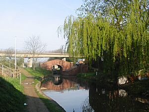
 Haggonfields Lock, on the Chesterfield Canal, located in the village. |
|
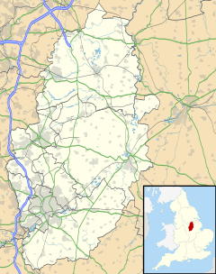
Parish map |
|
| Area | 0.426 sq mi (1.10 km2) |
| Population | 1,173 (2021) |
| • Density | 2,754/sq mi (1,063/km2) |
| OS grid reference | SK 564799 |
| • London | 130 mi (210 km) SSE |
| District |
|
| Shire county | |
| Region | |
| Country | England |
| Sovereign state | United Kingdom |
| Post town | WORKSOP |
| Postcode district | S80 |
| Dialling code | 01909 |
| Police | Nottinghamshire |
| Fire | Nottinghamshire |
| Ambulance | East Midlands |
| EU Parliament | East Midlands |
| UK Parliament |
|
Rhodesia is a small village in Nottinghamshire, England. It is part of the Bassetlaw area. The village is located just west of Worksop and about 20 miles (32 km) southeast of Sheffield. In 2021, the village had a population of 1,173 people.
History of Rhodesia
Rhodesia village was built in 1920. It was created near a smaller settlement called Haggonfields. The main reason for building the village was to provide homes for coal miners. These miners worked in the nearby coal mines, known as the Shireoaks and Steetley pits.
How Rhodesia Got Its Name
The village was named after a person called G. Preston Rhodes. He was the chairman of the Shireoaks Colliery at that time. The main road in the village, Tylden Road, also got its name from someone important. It was named after the first manager of the coal pit. Today, there are no longer any active coal mines in this area.
Village Life and Location
Rhodesia is a small community with just over 300 houses. It has a pub called Woodend, one shop, a school, and a village hall. These places help make Rhodesia a close-knit community.
Transport Links
Part of the village is next to the Chesterfield Canal. This historic canal is a waterway that runs through the area. Rhodesia is also very close to the A57 road, which is a main route for cars. For train travel, Rhodesia is located between Shireoaks and Retford train stations. The Robin Hood Line train route also passes right through the village.
 | May Edward Chinn |
 | Rebecca Cole |
 | Alexa Canady |
 | Dorothy Lavinia Brown |


