Ripley, New York facts for kids
Quick facts for kids
Ripley, New York
|
|
|---|---|

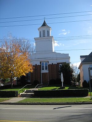
Church in Ripley
|
|
| Motto(s):
"The Gateway to New York State"
|
|

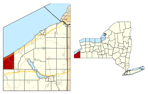
Location in Chautauqua County and the state of New York.
|
|
| Country | United States |
| State | New York |
| County | Chautauqua |
| Government | |
| • Type | Town Council |
| Area | |
| • Total | 48.87 sq mi (126.57 km2) |
| • Land | 48.76 sq mi (126.30 km2) |
| • Water | 0.10 sq mi (0.27 km2) |
| Elevation | 1,299 ft (396 m) |
| Population
(2020)
|
|
| • Total | 2,310 |
| • Estimate
(2021)
|
2,292 |
| • Density | 47.60/sq mi (18.38/km2) |
| Time zone | UTC-5 (Eastern (EST)) |
| • Summer (DST) | UTC-4 (EDT) |
| ZIP code |
14775
|
| Area code(s) | 716 |
| FIPS code | 36-013-61885 |
| GNIS feature ID | 0979424 |
Ripley is a small town located right on the edge of Lake Erie in the western part of Chautauqua County, New York, in the United States. In 2020, about 2,310 people lived there.
The town was named after Eleazer Wheelock Ripley. He was a general who fought in the War of 1812. There are no official villages in Ripley. However, there is a main community called Ripley, which is a census-designated place. Ripley is also known as the starting point of the New York State Thruway in the west.
Contents
History of Ripley
People first started settling in the area around Ripley in the early 1800s, specifically around 1804. The town of Ripley was officially created in 1817. It was formed from a part of the nearby town of Portland.
In more recent years, a big part of Ripley's economy has come from farming. They are especially known for growing fruit, like Concord grapes.
Geography and Location
Ripley covers a total area of about 126.6 square kilometers (or 48.9 square miles). Most of this area is land. Only a small part, about 0.3 square kilometers (0.1 square miles), is water.
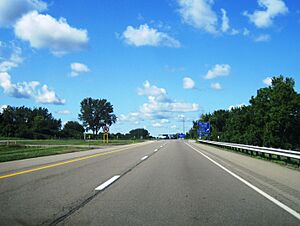
Several important roads pass through the town. These include the New York State Thruway (Interstate 90), US 20, NY 5, and NY 76.
Neighboring Areas
Ripley is surrounded by different places.
- To the north is Lake Erie.
- To the east is the town of Westfield.
- To the south is the town of Mina.
- To the west is North East Township in Erie County, Pennsylvania.
Population Information
| Historical population | |||
|---|---|---|---|
| Census | Pop. | %± | |
| 1820 | 1,111 | — | |
| 1830 | 1,647 | 48.2% | |
| 1840 | 2,197 | 33.4% | |
| 1850 | 1,732 | −21.2% | |
| 1860 | 2,013 | 16.2% | |
| 1870 | 1,946 | −3.3% | |
| 1880 | 1,990 | 2.3% | |
| 1890 | 2,020 | 1.5% | |
| 1900 | 2,256 | 11.7% | |
| 1910 | 2,239 | −0.8% | |
| 1920 | 2,116 | −5.5% | |
| 1930 | 2,254 | 6.5% | |
| 1940 | 2,250 | −0.2% | |
| 1950 | 2,694 | 19.7% | |
| 1960 | 2,848 | 5.7% | |
| 1970 | 2,934 | 3.0% | |
| 1980 | 3,181 | 8.4% | |
| 1990 | 2,967 | −6.7% | |
| 2000 | 2,636 | −11.2% | |
| 2010 | 2,415 | −8.4% | |
| 2020 | 2,310 | −4.3% | |
| 2021 (est.) | 2,292 | −5.1% | |
| U.S. Decennial Census | |||
According to the census from 2000, there were 2,636 people living in Ripley. These people lived in 1,004 households, and 722 of those were families. The population density was about 53.9 people per square mile.
About 33% of the households had children under 18 living with them. The average household had about 2.63 people. The average family had about 3.08 people.
The median age in the town was 38 years old. This means half the people were younger than 38 and half were older. About 26.5% of the population was under 18.
Communities and Places in Ripley
Ripley is made up of several smaller communities and locations.
- East Ripley – A small community on Route 20, located in the northeastern part of the town.
- Forsyth – Another community found on Route 20, also in the northeastern part of the town.
- Minnegar Corners – A community where Greenbush (Route 76) and Noble roads meet, near the eastern edge of town.
- Raters Corners – A spot in the southeastern part of the town, along County Road 22.
- Ripley – This is the main community, located on Route 20 in the north-central part of the town. It used to be called "Quincy."
- Ripley Beach – A place right on the shore of Lake Erie, north of Forsyth.
- Sheldon Corners – Another location in the southeastern part of the town, also on County Road 22.
- Shore Haven – A community on the shore of Lake Erie, right on the eastern town line.
- South Ripley – A community in the southwestern part of the town, on County Road 6.
- State Line – A community located right at the border between Pennsylvania and New York, on Route 20.
- Wattlesburg – A community in the center of the town, just south of the main Ripley community.
Notable People from Ripley
Many interesting people have connections to Ripley.
- William Avery Cochrane – A member of the Wisconsin State Assembly.
- Richard T. Ely – A well-known economist and author.
- Benjamin Goodrich – An important businessman who founded the popular rubber company, B.F. Goodrich.
- Charles Mann Hamilton – A politician who served as a US congressman for New York.
- Bruce Johnstone – A jazz musician from New Zealand, known for playing the baritone saxophone.
- Dudley Marvin – A politician who also served as a US congressman for New York.
- Joseph A. McGinnies – A businessman and politician.
- Edward Orton Sr. – The first president of the Ohio State University.
- William Spencer Newbury – A politician who served as the 23rd mayor of Portland, Oregon.
See also
 In Spanish: Ripley (Nueva York) para niños
 | Calvin Brent |
 | Walter T. Bailey |
 | Martha Cassell Thompson |
 | Alberta Jeannette Cassell |


