River Roach facts for kids
Quick facts for kids Roach |
|
|---|---|
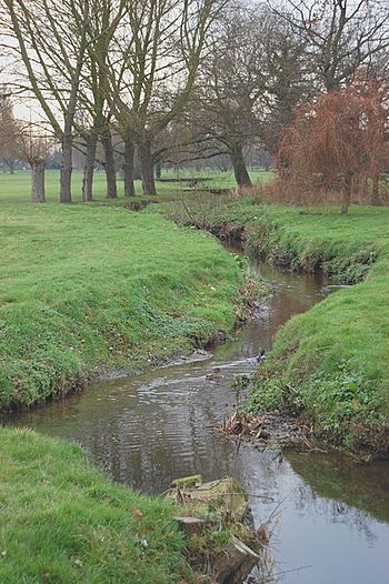
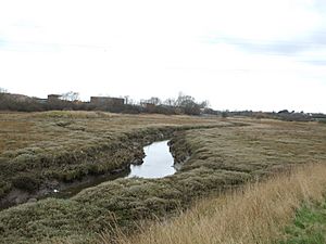
River Roach flowing through Rochford Hundred Golf Course
|
|
|
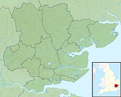
Location of the river mouth within Essex
|
|
| Country | England |
| County | Essex |
| Physical characteristics | |
| Main source | Rayleigh 58 m (190 ft) 51°35′50″N 0°37′56″E / 51.5973°N 0.6322°E |
| River mouth | River Crouch east of Wallasea Island 0 m (0 ft) 51°37′00″N 0°52′18″E / 51.6166°N 0.8718°E |
| Length | 22 km (14 mi) |
| Basin features | |
| River system | River Crouch |
| Designation | |
| Official name: Crouch & Roach Estuaries | |
| Designated: | 24 March 1995 |
| Reference #: | 721 |
The River Roach is a river in the county of Essex, England. It's one of four main streams that start in the Rayleigh Hills and flow east. These streams meet in the middle of the Rochford Basin, a round area that some scientists think might have been made by an asteroid hitting Earth a very long time ago. East of Rochford, the river becomes tidal, meaning its water level changes with the ocean tides. It eventually joins the River Crouch near Wallasea Island and Foulness Island.
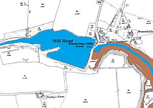
For a long time, people weren't sure which of the four streams was actually the River Roach. At Stambridge, there was a special mill that used the power of the tides to grind grain. This mill was rebuilt in 1809 and worked by letting the incoming tide fill a pond. When the tide went out, the water from the pond was released to turn a large water wheel.
The Environment Agency checks the river's water quality. They say the river channels have been "heavily modified" by human activity. The good news is that the chemical quality of the water has gotten better since 2013. Did you know that Charles Darwin's famous ship, HMS Beagle, was once moored on this river? It was used as a Coast Guard watch ship from 1850. Even though it was sold for scrap, experts believe much of the ship still lies buried in the mud near Paglesham. The Paglesham area is also known for its special native oysters.
Contents
What is the Rochford Basin?
The River Roach flows through a nearly circular area called the Rochford Basin. This basin is surrounded by low hills like Canewdon, Ashingdon, and Rayleigh. The basin is about 3.7 to 4.3 miles (6 to 7 km) wide. Its bottom is made of a type of clay called London Clay, covered by layers of sand, gravel, and river soil.
Four main streams flow from the Rayleigh Hills towards the Rochford Basin. These are the Prittle Brook, Eastwood Brook, Noblesgreen Ditch, and another stream from Hockley Woods. They all flow generally east until they reach the basin, where they turn and meet near Rochford. Scientists like Stratford have suggested that the Rochford Basin might have been formed by an asteroid impact millions of years ago. This idea comes from how the streams change direction and the presence of a small chalk area near Stambridge Mill, which is unusual for this region.
How did the River Roach get its name?
The town of Rochford gets its name from an Old English phrase, "Rochefort," which means "Ford of the Hunting Dogs." People believe the river was originally called the "Walfleet" or "Walflete," meaning "Creek of the foreigners."
It's thought that the river was later renamed the Roach because of a process called "back formation." This is when people assume a place name like Rochford means "ford over the River Roach," so they then rename the river to fit that idea. For a long time, oysters from the River Roach were even called Walfleet Oysters.
It's a bit confusing to know which stream is officially the River Roach before it reaches Rochford. Modern maps don't name the streams west of Rochford. However, the Environment Agency and local flood risk maps often call the stream from Hockley and Hawkwell the Roach, and this is how we'll refer to it here.
Where does the River Roach flow?
The Noblesgreen Ditch starts in the hills near Rayleigh. It flows south, then east, passing behind homes and through the Grove Playing Fields. It goes past the Rayleigh Sewage Works, where cleaned water from a special reed-bed system adds to its flow. The ditch continues through Cherry Orchard Jubilee Country Park and under Cherry Orchard Way. It then flows past Southend Airport and through Rochford Hundred Golf Course, where it meets the Eastwood Brook. Finally, it reaches Rochford.
In Rochford, the stream goes under the railway line and over a small dam. This dam helps fill Rochford Reservoir, which was built in 1904. The Noblesgreen Ditch then joins the main River Roach, and any extra water from the reservoir also flows into it.
The Hawkwell Brook starts near Hockley Woods. It flows east through the woods and under Elmwood Avenue in Hawkwell. From this point, it's considered a main river, managed by the Environment Agency. It passes the Clements Hall Sports Complex and is joined by the Hockley Brook. Now officially called the River Roach, it turns southeast towards Rochford, flowing under Rectory Road and Hall Road, until it meets the Noblesgreen Ditch near Rochford Reservoir.
At Salt Bridge, the River Roach flows under South Street. It then continues east through marshy areas before joining the northern part of the River Roach at Stambridge Mills. Just after this, Sutton Wharf, with its boatyard and moorings, is on the south bank. Here, the Prittle Brook, a major tributary from Leigh-on-Sea and Southend-on-Sea, also joins the river.
The Tidal River Roach
From Stambridge Mills eastward, the River Roach becomes a wide tidal river. It flows past several old farms and halls. Barlinghall Creek joins another creek called Potton Creek, and together they are known as "The Violet" before joining the Roach. At this point, the Roach is about 440 yards (400 meters) wide.
The river passes Paglesham, an important place for native oysters. This is also where Charles Darwin's famous ship, HMS Beagle, was once located. After its Royal Navy service, the Beagle was used by the Coast Guard as a watch ship. It was moved to the river near Paglesham in 1850. Although it was sold for scrap in 1870, a study in 2008 found that much of the ship still lies buried under 21 feet (6.4 meters) of mud near Paglesham.
Further east, Paglesham Pool joins the river from the north. This creek used to separate Wallasea Island from the mainland, but now a road causeway connects them. At Potton Point, another creek called Middleway joins from the south. This creek separates Potton and Foulness islands. The Middleway creek splits around Rushley Island and then becomes Havengore Creek. Small boats can use Havengore Creek to get to the river, but it's tricky because there's a lifting bridge that only opens around high tide. Also, boaters must check that the Shoebury Artillery Range is not active before crossing the nearby Maplin Sands.
The Roach then flows east between Foulness Island and Wallasea Island. It turns north, becoming almost 660 yards (600 meters) wide, until it joins the River Crouch at Wallasea Ness. The combined rivers then flow east into the North Sea.
How did the Stambridge Tide Mill work?
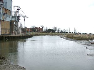
At Stambridge, the river changes from a small channel to a wide tidal area. This was once the location of a tide mill, which used the power of the tides. Records show a mill here as early as 1500. A new four-story wooden mill was built in 1809.
The Rankin family owned and ran the mill from 1824 until 1962. They even built a steam-powered mill in 1872 to help out, but it burned down and was replaced by a brick building. The tide mill continued to operate until about 1951.
The mill had a large pond, about 3 acres (1.2 hectares) in size, called a "tidal pound." When the tide came in, gates would open to fill this pond. As the tide went out, the gates would close, trapping the water. This trapped water was then released through a short channel to turn a large water wheel, about 18 feet (5.5 meters) in diameter. The wheel was connected to three sets of millstones that ground grain.
On very high tides (spring tides), the pond would fill deep enough to run the mill for about 7 hours. However, on lower tides (neap tides), the mill relied more on the water flowing from the upper river. The mill stopped working in 1951 due to damage, and the building burned down in 1964.
Who manages the River Roach?
The River Roach is part of a larger tidal river system that includes the River Crouch and all the creeks around islands like Wallasea Island and Foulness Island. The way the tides flow through these creeks helps create a good environment for growing oysters and for fish to lay their eggs.
The River Roach is managed by the Crouch Harbour Authority. This organization was set up in 1974 and is a non-profit group based in Burnham-on-Crouch. They oversee all boating activities on the rivers and own parts of the riverbed. The river also benefits from a lifeboat service and a fire service boat, both based at Burnham.
How clean is the River Roach's water?
The Environment Agency checks the water quality of rivers in England. They give each river an overall "ecological status" (how healthy the environment is) and a "chemical status" (how clean the water is from chemicals). The ecological status can be high, good, moderate, poor, or bad. The chemical status is either good or fail.
Most of the streams that feed into the Roach above Rochford are called "heavily modified." This means their channels have been changed by human activities.
In 2015, the water quality for the Roach system was generally "moderate" for ecological status and "good" for chemical status in most parts. This was an improvement since 2013, when some streams had a "fail" for chemical status.
In 2015, there was a temporary ban on catching shellfish in part of the river because of high levels of a type of bacteria called E. coli. This problem was caused by faulty plumbing at some homes, which allowed raw sewage to get into the river. The issue was fixed, and the fishing ban was lifted in 2017 when the water became safe again.
Points of interest
| Point | Coordinates (Links to map resources) |
OS Grid Ref | Notes |
|---|---|---|---|
| Source of Hawkwell Brook | 51°35′50″N 0°37′56″E / 51.5973°N 0.6322°E | TQ824919 | |
| Source of Hockley Brook | 51°36′18″N 0°40′22″E / 51.6050°N 0.6729°E | TQ851929 | |
| Hockley Brook joins Hawkwell Brook | 51°35′41″N 0°40′50″E / 51.5946°N 0.6805°E | TQ857918 | |
| Rochford Reservoir | 51°34′49″N 0°42′20″E / 51.5802°N 0.7056°E | TQ875902 | |
| Source of Noblesgreen Ditch | 51°35′13″N 0°37′28″E / 51.5869°N 0.6245°E | TQ819908 | |
| Source of Eastwood Brook | 51°34′04″N 0°39′26″E / 51.5679°N 0.6573°E | TQ842887 | |
| Eastwood Brook joins Noblesgreen Ditch | 51°34′40″N 0°41′52″E / 51.5779°N 0.6978°E | TQ870900 | |
| Stambridge Millpond | 51°34′47″N 0°43′18″E / 51.5798°N 0.7217°E | TQ886902 | |
| Source of Prittlewell Brook | 51°33′49″N 0°36′04″E / 51.5636°N 0.6011°E | TQ803881 | |
| Prittlewell Brook joins tidal Roach | 51°34′23″N 0°42′50″E / 51.5730°N 0.7138°E | TQ881895 | |
| Junction with Paglesham Pool | 51°35′50″N 0°49′17″E / 51.5972°N 0.8215°E | TQ955924 | |
| River Roach joins River Crouch | 51°36′58″N 0°52′15″E / 51.6160°N 0.8709°E | TQ988946 | Mouth |
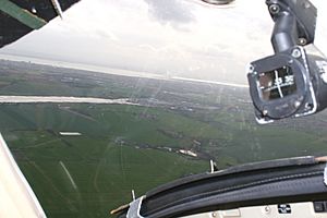
Pilots flying small planes into Southend Airport often use the River Roach as a guide. When pilots fly by looking out the window (called visual flight), it's not always clear enough to see far away. So, they use natural features like rivers to check their position on their maps.
The Roach flows very close to the start of Runway 24 at Southend Airport. Pilots coming from the northeast of the airport can follow the river to help them line up correctly with the runway for landing.
In the photo, you can see the Roach on the left side. The runway is just visible to the left of the compass. This picture was taken about 2.25 miles (3.6 km) from the start of the runway.
 | Stephanie Wilson |
 | Charles Bolden |
 | Ronald McNair |
 | Frederick D. Gregory |


