
Foulness Island facts for kids
Quick facts for kids Foulness Island |
|
|---|---|

Foulness Island
|
|
| Population | 151 (2011 census) |
| Civil parish |
|
| District |
|
| Shire county | |
| Region | |
| Country | England |
| Sovereign state | United Kingdom |
| Post town | Southend-on-Sea |
| Postcode district | SS3 |
| Dialling code | 01702 |
| Police | Essex |
| Fire | Essex |
| Ambulance | East of England |
| EU Parliament | East of England |
Foulness Island is an island located on the east coast of Essex in England. It is separated from the mainland by narrow waterways called creeks. In 2011, about 151 people lived on the island, mainly in the small villages of Churchend and Courtsend at the northern end.
Foulness Island is mostly farmland. It is protected from the sea by a strong sea wall. The island's interesting name comes from an old English phrase meaning "bird headland." This is because it's a very important place for many kinds of wildfowl, especially migrating and breeding birds like pied avocets.
Before 1922, the only way to reach the island was by boat or by crossing the Maplin Sands using the Broomway. This was a special path that could only be used at low tide. Today, a military road connects the island to the mainland. The island is now managed by QinetiQ for the Ministry of Defence. This means that visitors can only access the island at certain times and with special permission.
Contents
Island Government
Foulness Island is part of a larger voting area called Foulness and Great Wakering. In 2011, about 5,738 people lived in this whole area.
Island Geography

Foulness Island covers about 9.2 square miles (23.8 square kilometers). Most of this land is used for farming, especially for growing crops like wheat, oats, and barley. There are also areas of pasture land for animals.
The island also has many ponds and drainage ditches, which are important for managing water. Buildings, roads, and the sea walls make up the rest of the land.
Protecting the Island from the Sea
The land on Foulness Island, like much of southeast England, has been slowly sinking since the last Ice Age. This means the sea level seems to be rising compared to the land.
People have been building defences against the sea for a very long time. The first sea walls were probably built around the late 1100s. These early walls were made of earth and covered with brushwood and rushes.
The island was originally divided into many smaller areas, each with its own wall. This meant that at high tide, Foulness would look like several smaller islands. Over time, new walls were built to enclose more land, adding to the size of the island.
How Land is Added: Inning
The island has grown bigger over the years through a process called "inning." This happens when silt and mud carried by rivers build up along the shore. Special plants that like salt then grow in this mud, trapping more sediment. Slowly, the land gets higher until it stays above most tides.
Then, a new sea wall is built around this raised area. Rain washes the salt out of the soil, making it fertile and ready for freshwater plants and crops to grow. This process has added a lot of new land to Foulness Island over the centuries.
Future Ideas for the Island
Over the years, there have been several big ideas for Foulness Island and the nearby areas.
Airport Plans
About 100 years after some early land reclamation ideas, there was a major plan to build a third airport for London on the nearby Maplin Sands. This project was called the Maplin Development.
The idea was not just to build a huge airport, but also a deep-water port for large cargo ships. There would also be new high-speed train lines and motorways to London. A new town for 600,000 people was also planned to house all the workers.
This project was going to be very expensive, costing about £825 million in 1973. Many people thought this was too much money. The Maplin project was eventually stopped in 1974 because of economic problems at the time.
The Great Flood of 1953
Most of Foulness Island was flooded in 1953. This happened because of very unusual weather conditions that caused huge tides and strong winds along the east coast of England and the Netherlands.
The sea level rose much higher than expected, and strong waves crashed over the sea walls. Even though the walls had been made stronger, the waves washed away parts of the earth banks. Two sections of the wall broke, and by 6:00 AM, most of the island was underwater. Gas, electricity, and phone lines were cut off.
Rescue Efforts
Rescue teams, including the army and lifeboat services, worked hard to reach the stranded people. They used small boats, barges, and even special amphibious trucks called DUKWs to evacuate people to safety.
Some people refused to leave because they were worried about their farm animals. Rescuing the animals was very difficult because the main road was flooded. The only way to get to the island was across the sands at low tide.
Soldiers and sailors were brought in to help repair the sea walls quickly before the next high tides. They worked tirelessly to fix the damage. Many people returned to their homes on the island to start the difficult task of cleaning up the mess.
Wildlife and Conservation

Foulness Island's name, meaning "bird headland," truly fits! It's an incredibly important place for birds. The area around Foulness Point is a special protected zone called a Site of Special Scientific Interest (SSSI).
This area has vast mud flats and sand flats that are covered by the tides twice a day. It also has salt marshes, shingle banks, and grassy areas. These different habitats are perfect for many kinds of birds and other wildlife.
Important Bird Species
Foulness Island is internationally important for six bird species. Thousands of dark-bellied brent geese fly all the way from Russia to spend the winter here. Other important birds include bar-tailed godwits, grey plovers, red knots, oystercatchers, and redshanks.
In winter, you might even see hen harriers hunting for food. The island is also a national hotspot for curlews, dunlins, and shelducks.
Many birds also use the island for breeding, such as avocets, common terns, little terns, Sandwich terns, and ringed plovers. The avocet population on Foulness is the second largest in the entire United Kingdom! Because of its importance as a wetland for birds, Foulness Island is also a Special Protection Area and a Ramsar site.
Images for kids
-
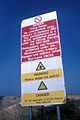
Official Secrets Acts 1911 to 1939 warning sign, taken in 1988.

