Rivière du Milieu (Normandin River tributary) facts for kids
Quick facts for kids Du Milieu |
|
|---|---|

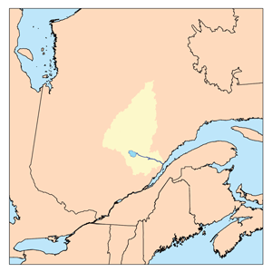
Watershed of Saguenay River
|
|
| Country | Canada |
| Province | Quebec |
| Region | Saguenay-Lac-Saint-Jean |
| Physical characteristics | |
| Main source | Frontenac Lake (Milieu River) Lac-Ashuapmushuan, Quebec, Le Domaine-du-Roy (RCM), Saguenay-Lac-Saint-Jean, Quebec 460 m (1,510 ft) 48°52′19″N 74°06′41″W / 48.87194°N 74.11139°W |
| River mouth | Nicabau Lake Lac-Ashuapmushuan, Quebec, Le Domaine-du-Roy (RCM), Saguenay-Lac-Saint-Jean, Quebec 392 m (1,286 ft) 49°05′19″N 74°06′36″W / 49.08861°N 74.11000°W |
| Length | 17.8 km (11.1 mi) |
| Basin features | |
| Tributaries |
|
The Rivière du Milieu (which means "River of the Middle") is a river in Quebec, Canada. It flows into Poutrincourt Lake. This lake is located in a large, mostly wild area called Lac-Ashuapmushuan, Quebec. This area is part of the Le Domaine-du-Roy region in Saguenay-Lac-Saint-Jean.
The Milieu River flows through two areas known as Buade and Poutrincourt. The main activity here is forestry, which means growing and cutting down trees for wood. After forestry, the next most popular activity is recreational tourism, like fishing or hiking.
A forest road called R0212 crosses the middle of the river. Another road, R0223, runs along the west side of Poutrincourt Lake. This road connects to Highway 167, which links the towns of Chibougamau and Saint-Félicien, Quebec. The Canadian National Railway also runs near this road.
The Milieu River usually freezes over in early November. It stays frozen until mid-May. However, it's generally safe to walk or travel on the ice from mid-November to mid-April.
Contents
Where Does the Milieu River Flow?
The Milieu River is surrounded by other rivers and lakes.
- To the north, you'll find Poutrincourt Lake, Nicabau Lake, and the Normandin River.
- To the east, there's the Marquette River West, Marquette River, and Ashuapmushuan Lake.
- To the south, it's near Frontenac Lake (Milieu River), the Normandin River, and the Gouin Reservoir.
- To the west, you'll see the Normandin River, the Gouin Reservoir, and Magnan Lake.
The River's Beginning
The Milieu River starts at Frontenac Lake (Milieu River). This lake is about 6.6 kilometers (4.1 miles) long and 1.9 kilometers (1.2 miles) wide. It sits at an elevation of 427 meters (1,401 feet). The Maskoskanaw River mainly feeds Frontenac Lake.
The start of the Milieu River is:
- 13.2 kilometers (8.2 miles) south of where the Milieu River joins Poutrincourt Lake.
- 28.1 kilometers (17.5 miles) south of the mouth of Poutrincourt Lake. The Normandin River flows through Poutrincourt Lake to the north.
- 42.3 kilometers (26.3 miles) south of the mouth of Nicabau Lake. The Normandin River also crosses the southern part of Nicabau Lake.
- 34.3 kilometers (21.3 miles) southwest of where the Normandin River meets Ashuapmushuan Lake.
The River's Journey
From Frontenac Lake (Milieu River), the Milieu River flows for about 17.8 kilometers (11.1 miles). It passes through many marshy areas. Here's how it flows:
- It goes 0.9 kilometers (0.6 miles) north, passing through Florence Lake.
- Then, it flows 1.5 kilometers (0.9 miles) northwest, crossing Ressaut Lake.
- Next, it travels 8.9 kilometers (5.5 miles) north, reaching the outlet of Giffard Lake and other lakes.
- It then turns northeast for 3.0 kilometers (1.9 miles), making a loop.
- Finally, it flows 3.5 kilometers (2.2 miles) north until it reaches its end.
Where the River Ends
The Milieu River flows into a bay on the south side of Poutrincourt Lake. This lake is 19.7 kilometers (12.2 miles) long and up to 6.7 kilometers (4.2 miles) wide. It is 392 meters (1,286 feet) high. The Milieu River's current flows north through Poutrincourt Lake, as does the Normandin River.
The meeting point of the Milieu River and Poutrincourt Lake is:
- 14.8 kilometers (9.2 miles) south of where Poutrincourt Lake empties into the Normandin River.
- 43.6 kilometers (27.1 miles) northeast of a bay in the Gouin Reservoir. The Gouin Reservoir is where the Saint-Maurice River begins.
- 29.2 kilometers (18.1 miles) southwest of the mouth of Nicabau Lake.
- 26.2 kilometers (16.3 miles) southwest of where the Normandin River meets Ashuapmushuan Lake.
- 137.2 kilometers (85.3 miles) west of the mouth of the Ashuapmushuan River, which flows into Lac Saint-Jean.
After Poutrincourt Lake, the river's current continues north for 15.6 kilometers (9.7 miles). It then makes a 2.0-kilometer (1.2-mile) hook to the east, leading to the south bay of Nicabau Lake. From there, it flows 5.3 kilometers (3.3 miles), first north for 1.8 kilometers (1.1 miles), then east, crossing the southern part of Nicabau Lake (which is 386 meters or 1,266 feet high). From Nicabau Lake, the current flows southeast into the Normandin River.
What's in a Name?
The name "Rivière du milieu" was officially recognized on March 28, 1972. This was done by the Commission de toponymie du Québec, which is the group in charge of naming places in Quebec.
 | DeHart Hubbard |
 | Wilma Rudolph |
 | Jesse Owens |
 | Jackie Joyner-Kersee |
 | Major Taylor |

