Rock Creek (Palouse River tributary) facts for kids
Quick facts for kids Rock Creek |
|
|---|---|

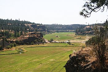
Rock Creek flows through Hole in the Ground Coulee between Bonnie Lake and Rock Lake.
|
|
|
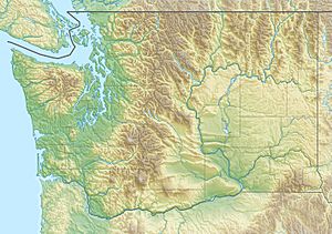
Location of the mouth of Rock Creek in Washington
|
|
| Country | United States |
| State | Washington |
| County | Spokane, Adams, Whitman |
| Physical characteristics | |
| Main source | Turnbull National Wildlife Refuge Pine Lakes, Spokane County 2,226 ft (678 m) 47°23′55″N 117°32′41″W / 47.39861°N 117.54472°W |
| River mouth | Palouse River near Winona, Whitman County 1,280 ft (390 m) 46°54′45″N 117°55′41″W / 46.91250°N 117.92806°W |
| Length | 52 mi (84 km) |
| Basin features | |
| Basin size | 430 sq mi (1,100 km2) |
Rock Creek is a cool stream in the state of Washington, United States. It's like a smaller river that flows into a bigger one. Rock Creek flows into the Palouse River.
The creek starts from some lakes called Pine Lakes. These lakes are found in the Turnbull National Wildlife Refuge. Rock Creek flows through this wildlife area. It then joins the Palouse River about 6 miles (10 km) away from a small place called Winona, Washington.
Rock Creek collects water from a large area of land. This area is called its drainage basin. The basin for Rock Creek is about 430 square miles (1,100 km2). This is about 13 percent of the entire Palouse River basin.
Contents
Lakes and Water
Rock Creek gets water from Rock Lake and Bonnie Lake. Rock Lake is very deep! It can be up to 350 feet (110 m) deep. Its average depth is about 170 feet (52 m).
Some lakes in the Rock Creek area are managed for fishing. These include Rock Lake, Bonnie Lake, and Chapman Lake. Many smaller lakes in this area don't have outlets. This means their water can dry up completely when the weather is hot and dry.
Rock Creek's Amazing History
Rock Creek flows across a huge flat area called the Columbia Plateau. This area has a very interesting past!
Giant Floods of the Past
As Rock Creek flows, it goes through a special landscape called the Channeled Scablands. These scablands were made by enormous floods. These floods are known as the Missoula Floods. They happened a very long time ago, during the Pleistocene Ice Age.
The Missoula Floods were so powerful. They swept across eastern Washington. They carved out deep channels in the hard rock. Rock Creek now follows one of these paths that the floods created. The floods cut through layers of rock called the Columbia River Basalt Group.
Cool Rock Features
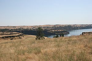
Some of the most interesting natural features in the Rock Creek area are the scablands themselves and Rock Lake. The creek flows next to another scabland area called Cow Creek. Rock Creek joins the Palouse River just before the Palouse River leaves a large, empty flood channel called Washtucna Coulee.
Exploring Rock Creek
You can explore parts of Rock Creek! The Palouse to Cascades State Park Trail follows the creek for some distance. This trail used to be a railway. It gives you a great way to see the area, especially Rock Lake.
 | Emma Amos |
 | Edward Mitchell Bannister |
 | Larry D. Alexander |
 | Ernie Barnes |


