Roosevelt, Seattle facts for kids
Quick facts for kids
Roosevelt
|
|
|---|---|
|
Neighborhood
|
|

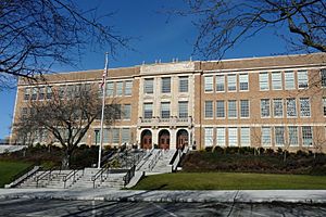
Roosevelt High School
|
|

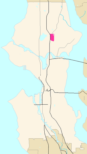
General location of Roosevelt (highlighted in pink) within Seattle
|
|
| Country | United States |
| State | Washington |
| County | King |
| City | Seattle |
| Named for | Theodore Roosevelt |
| ZIP Code |
98115
|
| Area code | 206 |
Roosevelt is a neighborhood located in northern Seattle, Washington. It was named after Theodore Roosevelt, who was a former President of the United States. The main road in the area, originally called 10th Avenue, was renamed Roosevelt Way in 1919 after his death. The neighborhood officially got its name in 1927 after a community contest.
The main roads in Roosevelt include Roosevelt Way (which goes south) and 12th Avenue NE (which goes north). Other important roads are Lake City Way (SR 522), 15th Avenue NE, and NE 65th and 75th Streets.
Roosevelt is bordered by several other areas. To the west, you'll find Interstate 5 and the Green Lake neighborhood. To the south, it borders the University District. On the east side, it's next to Ravenna, and to the north, you'll find Maple Leaf.
Contents
Education in Roosevelt
Roosevelt High School
The Roosevelt area is home to Roosevelt High School (RHS). This school opened in 1922 and is one of the older schools in the Seattle Public Schools system. Just like the street, the high school is named after President Theodore Roosevelt. It is not named after Franklin D. Roosevelt.
For many years, Roosevelt High School and Garfield High School were known for their strong academic and sports programs. Many talented students have attended Roosevelt High.
Famous Alumni of Roosevelt High
Some notable people who went to Roosevelt High School include:
- Mark Pattison, who played football for the University of Washington Huskies. He was later drafted by the Oakland Raiders in the NFL.
- Actress Rose McGowan.
- Nobel laureates Linda B. Buck and Robert Lucas Jr.. A Nobel laureate is someone who has won a Nobel Prize, which is a very important award for achievements in different fields.
Shopping and Businesses
Local Shops and Restaurants
While Roosevelt is mostly a place where people live, it has also had some interesting shops over the years. From 1928 to 1980, there was a large Sears department store here. After it closed, the area was redeveloped into Roosevelt Square. This shopping center now has a supermarket called Whole Foods Market and a pet store called Mud Bay, along with other businesses.
Just a short walk from Roosevelt Way, you can find Sunlight Cafe. This is Seattle's oldest vegetarian restaurant, and it opened in 1978. Many other small businesses are located along 65th Street and Roosevelt Way. Teddy's is a well-known local bar that attracts people from different groups.
Roosevelt's "Audio Row"
For a while, Roosevelt Way between 62nd and 64th Streets was known as "audio row." This was because many stores selling high-quality audio and video systems were located there. Today, only a couple of these specialized stores remain.
Parks and Green Spaces
The neighborhood has two parks where people can relax and play:
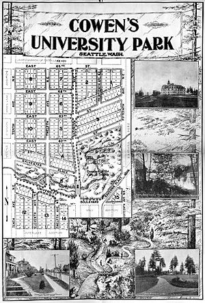
- Cowen Park: This park is in the southeast part of Roosevelt. It is connected to the larger Ravenna Park in the nearby Ravenna neighborhood.
- Froula Playground: This playground is in the northeast corner of Roosevelt, close to the Green Lake Reservoir.
The Ravenna Creek used to flow through a larger area, but its source is now mainly within Cowen Park. In 2006, part of the creek was uncovered and reconnected to Lake Washington. This process is called daylighting.
Transportation in Roosevelt
Roosevelt Link Light Rail Station
The Roosevelt Link light rail station is an underground train station. It is located at NE 65th Street and 12th Avenue NE. This station opened on October 2, 2021. It connects Roosevelt to downtown Seattle and to the Northgate neighborhood further north.
Growth Around the Station
The new light rail station has brought a lot of changes and growth to the Roosevelt area. During the nine years it took to build the station, the neighborhood saw many single-family homes replaced by taller apartment buildings. Between 2016 and the station's opening in 2021, the number of housing units in Roosevelt increased by 95%. This means 1,626 new homes were built in that time.
 | Tommie Smith |
 | Simone Manuel |
 | Shani Davis |
 | Simone Biles |
 | Alice Coachman |


