Rosewater, South Australia facts for kids
Quick facts for kids RosewaterAdelaide, South Australia |
|||||||||||||||
|---|---|---|---|---|---|---|---|---|---|---|---|---|---|---|---|

Eric Sutton Oval
|
|||||||||||||||
| Established | 1855 | ||||||||||||||
| Postcode(s) | 5013 | ||||||||||||||
| Area | 1.4 km2 (0.5 sq mi) | ||||||||||||||
| Time zone | ACST (UTC+9:30) | ||||||||||||||
| • Summer (DST) | ACST (UTC+10:30) | ||||||||||||||
| Location | 12 km (7 mi) NW of Adelaide city centre | ||||||||||||||
| LGA(s) |
|
||||||||||||||
| Region | Western Adelaide | ||||||||||||||
| County | Adelaide | ||||||||||||||
| State electorate(s) | Cheltenham Port Adelaide |
||||||||||||||
| Federal Division(s) | Hindmarsh | ||||||||||||||
|
|||||||||||||||
| Footnotes | Adjoining suburbs | ||||||||||||||
Rosewater is a suburb located in the western part of Adelaide, Australia. It is about 10 kilometers north-west of Adelaide's main city center.
Even though Rosewater is mostly a place where people live, it has many shops along Grand Junction Road. An old railway line, called the Rosewater Loop, also runs through the area. Grand Junction Road divides Rosewater in half. The suburb is bordered by Addison Road to the east and Torrens Road to the south.
Long ago, this area was mostly used for farms, growing vegetables and raising dairy cows. As railway lines and Grand Junction Road were built, and as Port Adelaide grew, Rosewater became more residential. It was also home to a special maritime radio station called AdelaideRadio (VIA) from 1912 to 1963.
Contents
Exploring Rosewater's Past
Before Europeans settled here, the land belonged to the Kaurna people. They called the area north of the Torrens River Yatala. This name is still used today in some land divisions. Further north, the area was known as Yertabulti or Yerta Boldingga. This means 'land of sleep or death'.
How Rosewater Got Its Name
The suburb of Rosewater was first created in 1855 by a man named Philip Levi. He divided a piece of land into smaller parts. The area just south of this, between Grand Junction and Torrens Roads, was laid out by Osmond Gilles in 1847. It was known as "Yatala". West of Levi's land was farmland owned by William Henry Gray, called Graytown. After Gray passed away, Graytown was also divided into residential plots in 1898. Many streets there are named after Gray and his family, like Rosetta, Edith, Alice, and Jennifer Street (formerly Jane).
There are two main stories about how Rosewater got its name. One story says Philip Levi named it. He supposedly said the area was a swamp, and the bad smells made him think "Rosewater" would help make it sound better.
Another story came out in 1945. A police report mentioned a woman named Mrs. J. Ward. She said her father arrived 100 years earlier and used water from a well on their property to make bricks. The water was so pure that they called it "rose water," and her father often said the district got its name from that well.
Growing into a Community
As more people moved in, the area became crowded with many small land divisions. Areas north and east of Levi's original "Rosewater" were called Rosewater North and Rosewater East. Other areas had names like Dockville, Kingsnorth, Brookesville, and Ottaway. Many of these are now part of Ottaway or Pennington.
The Rosewater Post Office opened around July 1877. In the same year, the District Council of Rosewater was formed. This council was later joined with the Corporate Town of Port Adelaide in 1899. The original post office closed in 1982. A new Rosewater East Post Office opened in 1947. It officially closed in 2020 but now operates as a service inside a local business.
In 1945, the Port Adelaide Council decided to simplify things. They combined 13 smaller land divisions into what we now know as the suburb of Rosewater. These included Bayswater, Dockville, Graytown, and others.
Between the 1880s and 1980s, Rosewater grew into a good-sized town. It had two hotels, a police station, a fire station, churches, and many shops along Grand Junction Road. The Rosewater Gasworks was the biggest local business. Many residents worked in timber mills, rail yards, and woolsheds near Port Adelaide.
Rosewater was also home to the AdelaideRadio (VIA) maritime radio station. This was the sixth such station built in Australia. It opened on October 1, 1912, and operated daily. It was one of the first places ships sailing from Hong Kong and Japan would contact. Besides listening for ship messages, it also handled messages to and from the state telegraph system. It even broadcast time signals to ships. By 1963, the area around Rosewater became very industrial. This caused too much electrical interference for the radio station. So, it moved to McLaren Vale, where it operated until 1993.
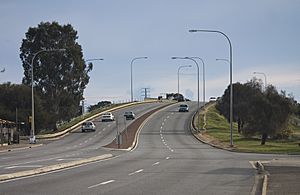
In the 1980s, Grand Junction Road was made wider, and the Redhill Bridge was built over the Outer Harbor railway line. This led to many small shops closing, and property values went down. However, since the early 2000s, with new developments in and around Port Adelaide, property values in Rosewater have started to rise again. Rosewater had its own railway station from 1916 to 1988. The railway line continued to be used for freight trains until 2008. A new rail line is being built in 2023. It will connect to the Outer Harbor line and end at a new station near the South Australia Rail Museum.
Rosewater's Geography
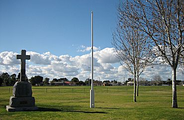
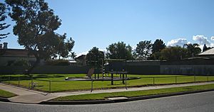
Before European settlement, the Rosewater area was mostly swampy marshlands. Today, most of the area is developed with buildings and roads. Only a small swamp area remains near the Redhill Bridge. Rosewater has two main recreational areas: Eric Sutton Oval and Duffield Playground.
Who Lives in Rosewater?
According to the 2001 Census, Rosewater had a population of 3,274 people. The number of males and females was almost equal. About 66% of the people living there were born in Australia, and 90% were Australian citizens. The Indigenous population made up 2.7% of the total.
In 2001, the average Rosewater resident was 38 years old. The average weekly income for an individual was between $200 and $299. For families, the average weekly income was between $600 and $699. The average household had 2.2 people.
About 67.8% of people in Rosewater reported having a religious affiliation. Christians made up 59.2% of the total population. The most common Christian groups were Catholic, Anglican, and Uniting Church. Other religions included Buddhism, Orthodox, Pentecostal, Lutheran, Baptist, and Islam.
Industries in Rosewater
In April 1975, a company called Clyde Engineering opened a factory in Rosewater. This factory built locomotives, which are engines for trains. Production moved here from Sydney. The factory closed in April 1986.
Places to Visit in Rosewater
- Rosewater Bowling Club
- Rosewater Football Club
- Rosewater Social Sports Club
- Eric Sutton Oval
- Duffield Playground
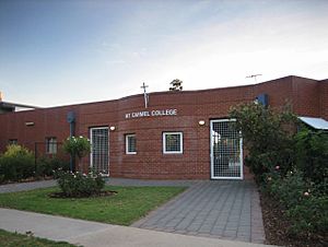
- Mount Carmel College
- Rosewater Hotel
- Rosewater Uniting Church
 | Sharif Bey |
 | Hale Woodruff |
 | Richmond Barthé |
 | Purvis Young |


