
St. John the Baptist Parish, Louisiana facts for kids
Quick facts for kids
St. John the Baptist Parish
|
|
|---|---|
| Parish of St. John the Baptist | |

|
|
| Motto(s):
"Heart of the River Parishes"
|
|

Location within the U.S. state of Louisiana
|
|
 Louisiana's location within the U.S. |
|
| Country | |
| State | |
| Founded | 1807 |
| Named for | St. John the Baptist Catholic Church in Edgard, built 1772 |
| Seat | Edgard |
| Largest community | LaPlace |
| Area | |
| • Total | 348 sq mi (900 km2) |
| • Land | 213 sq mi (550 km2) |
| • Water | 135 sq mi (350 km2) 39% |
| Population
(2020)
|
|
| • Total | 42,477 |
| • Density | 199.42/sq mi (77.00/km2) |
| Time zone | UTC−6 (Central) |
| • Summer (DST) | UTC−5 (CDT) |
| Congressional districts | 2nd, 6th |
St. John the Baptist Parish (SJBP, French: Paroisse de Saint-Jean-Baptiste) is a parish located in the U.S. state of Louisiana. At the 2020 census, the population was 42,477. The parish seat is Edgard, an unincorporated area, and the largest city is LaPlace, which is also unincorporated.
St. John the Baptist Parish was established in 1807 as one of the original 19 parishes of the Territory of Orleans, which became the state of Louisiana.
St. John the Baptist Parish is part of the New Orleans–Metairie metropolitan statistical area.
This was considered part of the German Coast in the 18th and 19th centuries, named for numerous German immigrants who settled along the Mississippi River here in the 1720s. On January 8, 1811, the largest slave insurrection in US history, known as the German Coast Uprising, started here. It was short-lived, but more than 200 slaves gathered from plantations along the river and marched through St. Charles Parish toward New Orleans. This is part of the Sugarland or sugar parishes, which were devoted to sugar cane cultivation. Planters used large numbers of enslaved African-American workers before the war, and numerous freedmen stayed in the area to work on these plantations afterward.
The parish includes three nationally significant examples of 19th-century plantation architecture: Evergreen Plantation, Whitney Plantation Historic District, and San Francisco Plantation House.
Demographics
| Historical population | |||
|---|---|---|---|
| Census | Pop. | %± | |
| 1820 | 3,854 | — | |
| 1830 | 5,677 | 47.3% | |
| 1840 | 5,776 | 1.7% | |
| 1850 | 7,317 | 26.7% | |
| 1860 | 7,930 | 8.4% | |
| 1870 | 6,762 | −14.7% | |
| 1880 | 9,686 | 43.2% | |
| 1890 | 11,359 | 17.3% | |
| 1900 | 12,330 | 8.5% | |
| 1910 | 14,338 | 16.3% | |
| 1920 | 11,896 | −17.0% | |
| 1930 | 14,078 | 18.3% | |
| 1940 | 14,766 | 4.9% | |
| 1950 | 14,861 | 0.6% | |
| 1960 | 18,439 | 24.1% | |
| 1970 | 23,813 | 29.1% | |
| 1980 | 31,924 | 34.1% | |
| 1990 | 39,996 | 25.3% | |
| 2000 | 43,044 | 7.6% | |
| 2010 | 45,924 | 6.7% | |
| 2020 | 42,477 | −7.5% | |
| U.S. Decennial Census 1790-1960 1900-1990 1990-2000 2010-2013 |
|||
| Race | Number | Percentage |
|---|---|---|
| White (non-Hispanic) | 13,348 | 31.42% |
| Black or African American (non-Hispanic) | 24,076 | 56.68% |
| Native American | 105 | 0.25% |
| Asian | 314 | 0.74% |
| Pacific Islander | 7 | 0.02% |
| Other/Mixed | 1,336 | 3.15% |
| Hispanic or Latino | 3,291 | 7.75% |
The 2019 census estimates determined 42,242 people lived in the parish. The racial and ethnic makeup of the parish was 56.5% Black and African American, 38.2% non-Hispanic white, 1.1% Asian, 2.7% some other race, and 1.5% multiracial; of the population, 6.1% were Hispanic and Latin American of any race. Among the population, Spanish was the second most-spoken language as of 2019; approximately 4.0% of the parish population were foreign-born. French ancestry was the largest heritage among the parish population (9.7%).
In 2019, there were 15,720 households living in 17,778 housing units. There were also 3,758 businesses operating in the parish, with the majority being minority-owned. The parish had an employment rate of 56.2% in 2019, and 78.5% of the population lived in owner-occupied units. The median home value was $153,900, and median gross rent was $933. The median household income was $57,429; males had a median income of $53,849 versus $36,476 for females. An estimated 24.8% of the population lived at or below the poverty line.
By the publication of the 2020 United States census, there were 42,477 people, 15,270 households, and 11,104 families residing in the parish. Among the parish population, 56.68% of the population were Black and African American, 31.42% non-Hispanic white, 0.25% Native American, 0.74% Asian, 0.02% Pacific Islander, 3.15% multiracial or some other race, and 7.75% Hispanic or Latin American of any race. The increase in Hispanic or Latinos and other non-White Americans has been attributed to a nationwide demographic shift.
Education
The St. John the Baptist Parish School Board operates 10 public schools within the parish, the Archdiocese of New Orleans oversees 5 religious schools within the parish and there are 2 privately run schools within the parish.
| Public Schools | City/Town | 2013-2014 Letter Grade (SPS) | Change from 2012 to 2013 grade |
|---|---|---|---|
| Laplace Elementary/Middle School | LaPlace | B (89.0) | +2.90 |
| Garyville-Mt. Airy Math and Science Magnet School | Garyville/Mt. Airy | C (73.7) | -0.50 |
| Fifth Ward Elementary School | Reserve | C (71.5) | +3.50 |
| East St. John Elementary/Middle School | Reserve | C (79.4) | +3.20 |
| Emily C. Watkins Elementary/Middle School | LaPlace | C (80.6) | +14.30 |
| John L. Ory Communications Magnet School | LaPlace | A (106.7) | -2.50 |
| Lake Pontchartrain Elementary/Middle School | LaPlace | D (61.3) | -11.30 |
| West St. John Elementary/Middle School | Edgard | D (62.8) | +1.90 |
| East St. John High School | Reserve | C (75.8) | N/A |
| West St. John High School | Edgard | B (98.6) | +6.90 |
http://www.louisianabelieves.com/data/reportcards/2013/
| Religious Schools | City/Town |
|---|---|
| Ascension of Our Lord Catholic Elementary/Middle School | LaPlace |
| St. Joan of Arc Catholic Elementary/Middle School | LaPlace |
| St. Peter's Catholic Elementary/Middle School | Reserve |
| Our Lady of Grace Catholic Elementary/Middle School | Reserve |
| St. Charles Catholic High School | LaPlace |
| St. Timothy's Episcopal School | LaPlace |
| Private Schools | City/Town |
|---|---|
| Reserve Christian Elementary/Middle School | Reserve |
| Riverside Academy K-12 | Reserve |
It is in the service area of Delgado Community College.
Transportation
Major highways
 Interstate 10
 Interstate 55
 U.S. Highway 51
 U.S. Highway 61
 Louisiana Highway 18
 Louisiana Highway 44
 Louisiana Highway 3127
 Louisiana Highway 3188
 Louisiana Highway 3213
East Bank - The primary artery on the east bank of St. John Parish is Airline Highway (U.S. Highway 61). This five-lane, asphalt-paved road was once the predominant route linking Baton Rouge and New Orleans. Though it is still heavily traveled, much of the New Orleans-Baton Rouge traffic has been diverted to Interstate 10, located in the northern part of the parish. Interstate 10, a divided, controlled-access highway, has two interchanges in St. John Parish; one at Belle Terre Boulevard and the second at U.S. Highway 51/Interstate 55, both in LaPlace. Both Belle Terre Boulevard and Highway 51 intersect Airline Highway approximately 3.5 miles (5.6 km) south of Interstate 10.
Interstate 55, a north–south route leading to Jackson, Mississippi, and beyond, intersects Interstate 10 in the northeastern sector of LaPlace. A third Interstate 10 interchange exists just west of the St. John Parish line near Gramercy (St. James Parish).
River Road, also known as Jefferson Highway or Louisiana Highway 44, is a two-lane, asphalt-paved, winding highway which parallels the Mississippi River. Most of the heavy industry in the parish fronts on this road.
West Bank - Most of the development on the west bank lies along Louisiana Highway 18 (the Great River Road), a two-lane, asphalt-paved highway which parallels the Mississippi River similarly to Highway 44 on the east bank. In addition to Louisiana 18, the west bank has Louisiana Highway 3127 or the River Parishes Highway, which is roughly equivalent to the east bank's Airline Highway in that it follows the Mississippi. It is not as winding nor as populated as River Road. Highway 3127 leads to Donaldsonville upriver from St. John Parish. It is home of the "Sunshine Bridge" over the Mississippi River in Ascension Parish. This road has little development on either side and is generally surrounded by wetlands in St. John Parish.
Veterans Memorial Bridge or Gramercy Bridge - (Louisiana Highway 3213) This bridge originates on the east bank of St. James Parish near Gramercy/Lutcher and has access to I-10 and Airline Highway via Louisiana Highway 641. The foot of the bridge on the west bank is in St. John Parish near Wallace, with a tie-in to Louisiana Highway 3127 that opened June 18, 2008. The opening of this bridge has spurred the development hoped for along the west bank of St. John Parish. (The bridge is known as the "Bridge to Nowhere.")
Access to the west bank of St. John Parish is also provided by a ferry crossing at Reserve/Edgard and by the Hale Boggs Bridge over the Mississippi in St. Charles Parish.
Images for kids
-
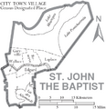
Map of St. John the Baptist Parish, Louisiana With Municipal Labels

See also
 In Spanish: Parroquia de St. John the Baptist para niños
