San Benito, Texas facts for kids
Quick facts for kids
San Benito, Texas
|
|
|---|---|
| City of San Benito | |

San Benito in 1937
|
|
| Nickname(s):
"The Resaca City"
|
|

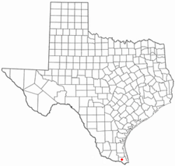
Location of San Benito, Texas
|
|
 |
|
| Country | United States |
| State | Texas |
| County | Cameron |
| Government | |
| • Type | Council-Manager |
| Area | |
| • Total | 16.13 sq mi (41.79 km2) |
| • Land | 15.79 sq mi (40.90 km2) |
| • Water | 0.34 sq mi (0.89 km2) |
| Elevation | 36 ft (11 m) |
| Population
(2010)
|
|
| • Total | 24,861 |
| • Density | 1,541.3/sq mi (594.90/km2) |
| Time zone | UTC-6 (Central (CST)) |
| • Summer (DST) | UTC-5 (CDT) |
| ZIP code |
78586
|
| Area code(s) | 956 |
| FIPS code | 48-65036 |
| GNIS feature ID | 1375956 |
San Benito is a city located in Cameron County, Texas, in the United States. In 2020, about 24,861 people lived there. The city celebrated its 100th birthday on April 3, 2007.
San Benito is part of two larger city areas: the Brownsville–Harlingen–Raymondville area and the Matamoros–Brownsville area. This means it's connected to many nearby towns and cities.
Contents
History of San Benito
San Benito is often called "The Resaca City." This is because the Resaca de los Fresnos, a wide waterway, flows through the city. A resaca is actually an old riverbed that used to be part of the Rio Grande. Now, it's a main canal for a big irrigation system.
How San Benito Got Its Name
The area was first called "Diaz" in April 1907. This name honored Porfirio Díaz, who was the President of Mexico at that time. Most of the people living there were of Mexican heritage.
Later, in July 1904, the first passenger train arrived. To celebrate the new railroad, the community changed the station's name to "Bessie." This was in honor of Bessie Yoakum, whose father, Benjamin Franklin Yoakum, helped build the railroad.
When the town was officially planned, its name changed again to "San Benito." This name honored Benjamin Hicks, a kind rancher. A 90-year-old cook named Rafael Moreno suggested the name. He called Benjamin Hicks his "Saint Benjamin," which in Spanish is "San Benito."
Early Days and Growth
San Benito was a small village with homes, shops, churches, and schools even before it became an official city in 1911. The first map of the town was made on April 28, 1907.
The first school opened in 1907 with 48 students. The post office also started that year. A boy named San Benito Montalvo was born on September 20, 1907. The city was celebrating its new name that night. A man named Col. Sam Robertson suggested naming the baby "San Benito" after the city.
In 1927, the city started using a "commission form of government." This is a way of organizing how the city is run.
Population Changes Over Time
When the U.S. Census first counted San Benito in 1920, it had 4,070 people. By 1950, the population grew to 13,271. In 1960, it reached 16,422. The population continued to grow, reaching 24,861 by 2020.
Farming and Tourism
An irrigation system was set up in 1906. This system brought water to the dry land. Because of this water, farming became very important in San Benito and the whole Lower Rio Grande Valley.
The city's mild winter weather also helped it grow. Crops can grow all year, and flowers bloom even in winter. This makes San Benito a popular place for winter visitors and retired people. They help the local economy by buying things in the community.
Geography of San Benito
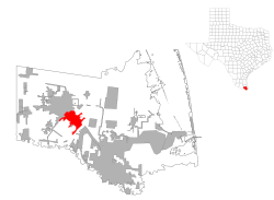
San Benito is located in the western part of Cameron County. It sits at coordinates 26.136603 degrees North and 97.635878 degrees West. Interstate 69E goes through the city. This highway leads northwest about 6 miles to Harlingen and southeast about 19 miles to Brownsville.
The city covers a total area of about 41.8 square kilometers (16.13 square miles). About 0.9 square kilometers (0.34 square miles) of this area is water.
Climate in San Benito
The weather in San Benito has hot, dry summers. Winters are generally warm. The climate is described as a semiarid, borderline tropical savannah climate. This means it's often dry but can also have warm, humid periods.
Population Facts
| Historical population | |||
|---|---|---|---|
| Census | Pop. | %± | |
| 1920 | 5,070 | — | |
| 1930 | 10,753 | 112.1% | |
| 1940 | 9,501 | −11.6% | |
| 1950 | 13,271 | 39.7% | |
| 1960 | 16,422 | 23.7% | |
| 1970 | 15,176 | −7.6% | |
| 1980 | 17,988 | 18.5% | |
| 1990 | 20,125 | 11.9% | |
| 2000 | 23,444 | 16.5% | |
| 2010 | 24,250 | 3.4% | |
| 2020 | 24,861 | 2.5% | |
| U.S. Decennial Census 1850–1900 1910 1920 1930 1940 1950 1960 1970 1980 1990 2000 2010 |
|||
2020 Census Information
In 2020, the city of San Benito had 24,861 people. There were 7,535 households and 5,472 families living in the city.
| Race | Number | Percentage |
|---|---|---|
| White (NH) | 1,731 | 6.96% |
| Black or African American (NH) | 71 | 0.29% |
| Native American or Alaska Native (NH) | 33 | 0.13% |
| Asian (NH) | 68 | 0.27% |
| Pacific Islander (NH) | 2 | 0.01% |
| Some Other Race (NH) | 52 | 0.21% |
| Mixed/Multi-Racial (NH) | 109 | 0.44% |
| Hispanic or Latino | 22,795 | 91.69% |
| Total | 24,861 |
Education in San Benito
The San Benito Consolidated Independent School District serves the city of San Benito.
- It has two high schools: Veterans Memorial Academy and San Benito High School.
- It also has three middle schools: Riverside, Berta Cabaza, and Miller Jordan.
The South Texas Independent School District also helps students in San Benito. It offers special magnet schools. One of these, South Texas Academy of Medical Technology (Med Tech), is located right in San Benito.
The city also has its own library, the San Benito Public Library. IDEA Public Schools also has a school in San Benito.
Notable People from San Benito
Many interesting people have come from San Benito, including:
- Charley Crockett, a musician
- T. R. Fehrenbach, an author
- Freddy Fender (born Baldemar Huerta), a famous musician
- Charles Pugsley Fincher, a cartoonist and lawyer
- Narciso Martínez, a conjunto musician
- Bobby Morrow, who won three gold medals in the 1956 Summer Olympics
- Col. Sam A. Robertson, a founder of the city and railroad pioneer
- Charles M. Robinson III, an author and history expert
- Robert Salaburu, a professional poker player
- Armando Torres III, a former U.S. Marine
- Wilma Vinsant, a combat flight nurse
Images for kids
See also
 In Spanish: San Benito (Texas) para niños


