San Luis Peak facts for kids
Quick facts for kids San Luis Peak |
|
|---|---|

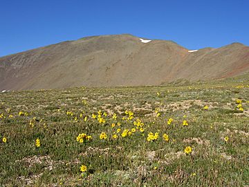
San Luis Peak viewed from the northeast
|
|
| Highest point | |
| Elevation | 14,014 ft (4273.8 m) NAVD88 |
| Prominence | 3113 ft (949 m) |
| Isolation | 26.9 mi (43.4 km) |
| Listing |
|
| Geography | |
| Location | Saguache County, Colorado, United States |
| Parent range | San Juan Mountains, Highest summit of the La Garita Mountains |
| Topo map | USGS 7.5' topographic map San Luis Peak, Colorado |
| Climbing | |
| First ascent | 1874 by Franklin Rhoda and A. D. Wilson |
| Easiest route | South Ridge or East Flank: Hike |
San Luis Peak is a very tall mountain in Colorado, United States. It is the highest point in the La Garita Mountains, which are part of the larger Rocky Mountains in North America. This mountain is special because it is a "fourteener." This means its top is more than 14,000 feet (about 4,270 meters) above sea level. San Luis Peak stands at 14,014 feet (4,273.8 meters) tall.
The mountain is located in Saguache County, about 10 miles (16 kilometers) north of Creede. It is found within the Gunnison National Forest and the La Garita Wilderness. This area feels very wild and natural, more so than some other tall mountains in the region.
Climbing San Luis Peak
Climbing San Luis Peak is considered fairly easy for a mountain of its size. There are two main paths, or routes, that hikers can take to reach the top. Both routes are hiking trails, meaning you don't need special climbing gear.
Northeast Ridge Route
This path starts at the Stewart Creek Trailhead. It is a round trip of about 13.5 miles (21.7 kilometers). This route follows a ridge, which is like a long, narrow hilltop.
South Ridge Route
The South Ridge route begins at the West Willow Creek Trailhead. This trailhead is located north of Creede. This path is about 12.3 miles (19.8 kilometers) long, round trip. Most of this route is above the treeline. The treeline is the elevation where trees stop growing because it's too cold or windy.
 | Selma Burke |
 | Pauline Powell Burns |
 | Frederick J. Brown |
 | Robert Blackburn |


