La Garita Mountains facts for kids
Quick facts for kids La Garita Mountains |
|
|---|---|

San Luis Peak
|
|
| Highest point | |
| Peak | San Luis Peak |
| Elevation | 14,014 ft (4,271 m) |
| Geography | |
| Country | United States |
| State | Colorado |
| Counties | Saguache and Mineral |
| Parent range | San Juan Mountains, Rocky Mountains |
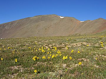
The La Garita Mountains are a tall mountain range in Colorado. They are part of the larger San Juan Mountains. These mountains are also a smaller part of the huge Rocky Mountains. You can find them in southwestern Colorado. Specifically, they are in Saguache and Mineral counties.
Most of this area is public land. It is managed by the Gunnison National Forest and the Rio Grande National Forest.
The La Garita Mountains are inside the La Garita Wilderness. This is a beautiful, wild area in Colorado. "La Garita" means "the lookout" in Spanish. The name fits perfectly! From the top of San Luis Peak, which is 14,014 feet high, you can see far and wide. You can look across the Rio Grande Valley and down the San Luis Valley.
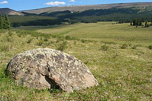
About 35 miles of the Continental Divide runs through these mountains. This area has large forests. These forests are perfect homes for many elk and mule deer.
How the La Garita Mountains Formed
The La Garita Mountains were formed by ancient volcanoes. This happened millions of years ago. During a time called the Oligocene epoch, huge volcanic eruptions occurred. These eruptions were incredibly powerful. Some were as strong as a VEI-8. This is the highest level on the Volcanic Explosivity Index.
One of these eruptions was from the La Garita Caldera. This was a "supervolcano." Its eruption created a massive amount of ash and rock. Scientists believe it was the largest eruption ever known. It produced about 5,000 cubic kilometers of material! Don't worry, though. This volcanic area has been inactive for millions of years. It is completely safe today.
Important Peaks in the La Garita Mountains
The United States Geological Survey (USGS) lists several peaks as part of the La Garita Mountains. Here are some of the main ones:
| Peak | GNIS Feature ID | Location |
|---|---|---|
| Stewart Peak | 190154 | 38°01′24″N 106°55′24″W / 38.02333°N 106.92338°W |
| San Luis Peak | 190463 | 37°59′13″N 106°55′53″W / 37.98694°N 106.93143°W |
| Mesa Mountain | 189506 | 37°54′16″N 106°38′05″W / 37.90444°N 106.63476°W |
| Pool Table Mountain | 189570 | 37°49′47″N 106°41′31″W / 37.82972°N 106.69199°W |
| Bowers Peak | 189511 | 37°57′03″N 106°35′22″W / 37.95083°N 106.58948°W |
| Lookout Mountain | 189525 | 37°59′13″N 106°28′46″W / 37.98694°N 106.47948°W |
| Lake Mountain | 190194 | 38°00′37″N 106°23′56″W / 38.01028°N 106.39892°W |
See also
 In Spanish: Sierra de La Garita para niños
 | Jackie Robinson |
 | Jack Johnson |
 | Althea Gibson |
 | Arthur Ashe |
 | Muhammad Ali |


