
San Mateo Ixtatán facts for kids
Quick facts for kids
San Mateo Ixtatán
|
|
|---|---|
|
Municipality
|
|

View of San Mateo Ixtatán
|
|

San Mateo Ixtatán
Location in Guatemala
|
|
| Country | |
| Department | |
| Municipality | San Mateo Ixtatán |
| Government | |
| • Type | Municipal |
| Area | |
| • Municipality | 619 km2 (239 sq mi) |
| Elevation | 2,540 m (8,330 ft) |
| Population
(2018 census)
|
|
| • Municipality | 43,810 |
| • Density | 70.78/km2 (183.31/sq mi) |
| • Urban | 15,090 |
| • Ethnicities | Chuj Ladino |
| • Religions | Roman Catholicism Evangelicalism Maya |
| Climate | Cfb |
| Website | http://sanmateoixtatan.gob.gt |
San Mateo Ixtatán is a town in Guatemala, located in the Huehuetenango area. It sits high up in the Cuchumatanes mountains, about 2,540 metres (8,330 ft) above sea level. The area is about 560 square kilometers (220 sq mi) and has a cool climate. It is part of a cloud forest, where temperatures usually stay between 0.5 and 20 °C (32.9 and 68.0 °F). The coldest months are from November to January, and the warmest are April and May.
The town itself has about 15,090 people (2018 census). Many more people, around 28,000, live in the mountain villages nearby. San Mateo Ixtatán has a market every Thursday and Sunday. The town celebrates its annual festival from September 19 to September 21, honoring its patron Saint Matthew. Most people in San Mateo Ixtatán are from the Chuj Maya group and speak the Chuj language.
Contents
What's in a Name?
The name "Ixtatán" has a few possible meanings. In the Chuj language, Ixta means "toy" or "doll," and Ta'anh means "lime." So, one idea is "toy or doll of lime." You can even see lime dolls on the old Catholic church building.
Another idea comes from historian Francisco Antonio de Fuentes y Guzmán (1690). He thought the name meant "Land of the Salt," from the words Ystat (salt) and teail (land). A different historian, Jorge Luis Areola, believed "Ixtatán" came from the Nahuatl language, where Ixtat means "salt" and tlan means "close" or "nearby."
A Look Back in Time
Early History
After the Spanish took over Huehuetenango in 1529, San Mateo Ixtatán was given to a Spanish leader named Gonzalo de Ovalle. In 1549, Dominican missionaries started to organize the native people into new towns, including San Mateo Ixtatán.
In the late 1600s, a Spanish missionary named Fray Alonso De León reported that many families in San Mateo Ixtatán were not following Spanish rules or attending Catholic mass. He said they had built a special place in the hills to practice their old traditions. They would burn incense and make offerings there.
In 1686, the governor of Guatemala, Enrique Enriquez de Guzmán, visited San Mateo Ixtatán. He wanted to stop the people from helping others in the nearby Lacandon region who were still fighting the Spanish. He ordered some local leaders to be taken to prison. Later, Spanish soldiers and missionaries used San Mateo Ixtatán as a base to explore the Lacandon region.
The Dominican Order built the Catholic church in San Mateo.
Modern Times
In 1876, San Mateo Ixtatán had to give up some of its land to create a new town called Nentón. This caused problems for the community.
In the early 1900s, a new law in Guatemala meant that mayors and town leaders had to be ladinos (people of mixed Spanish and Indigenous heritage). This caused more tension.
During the time of President Justo Rufino Barrios, many people in northern Huehuetenango, including San Mateo Ixtatán, faced extreme poverty. They were sometimes forced to move to work on large farms on the southern coast. These farms often used unfair contracts, which made it very hard for people to leave.
Special Salt
San Mateo Ixtatán is famous for its salt. Highly salty water comes from the ground in several special wells. Historically, many people traveled here just to get this salt. Some people still pray in front of these wells to the goddess of salt, Atz’am.
Women carry the salty water up the mountainside in plastic jugs. They either use it as it is or boil it to make white salt. The most famous type is called K'ik' Atz'am, or black salt. A few women in town make this by adding a secret ingredient to the boiling salt water. Black salt is very tasty and is believed to help with stomach aches and headaches.
The town hall manages the salt well. It is open from Monday to Saturday, from 1 PM to 5 PM.
Ancient Sites

San Mateo Ixtatán has ancient sites that are protected but not yet fully dug up by archaeologists. The largest one is called Yol K'u, which means "within the Sun," or Wajxaklajun, meaning "eighteen." It is located on a high point and is surrounded by four large mounds. People believe it was once an astronomical temple.
Another site, K'atepan, can be seen from Yol K'u. Its name means "old temple" in the Chuj language. It is just north of San Mateo. The archaeological site of Curvao, also in San Mateo Ixtatán, dates back to the Classic Period of ancient Maya history.
Traditional Clothing
People in San Mateo Ixtatán still wear traditional clothing. Men often wear a woollen capixay. This is a coat made from two pieces of brown or black sheep's wool sewn together.
Women traditionally wear a corte, which is a long, wrap-around skirt. It is usually bright red with white, yellow, and green stripes. They also tie cotton scarves in their hair. The women's huipil (top) is a colorful, hand-woven cotton poncho with a lacy collar. It is said that making a full-size huipil from San Mateo Ixtatán can take about 9 months to a year!
Climate
San Mateo Ixtatán has an oceanic climate (Cfb in the Köppen system). This means it has mild temperatures all year round with rainfall spread throughout the year.
| Climate data for San Mateo Ixtatán | |||||||||||||
|---|---|---|---|---|---|---|---|---|---|---|---|---|---|
| Month | Jan | Feb | Mar | Apr | May | Jun | Jul | Aug | Sep | Oct | Nov | Dec | Year |
| Daily mean °C (°F) | 12.8 (55.0) |
12.9 (55.2) |
14.4 (57.9) |
14.9 (58.8) |
14.5 (58.1) |
14.6 (58.3) |
14.1 (57.4) |
14.0 (57.2) |
14.3 (57.7) |
13.5 (56.3) |
13.5 (56.3) |
13.6 (56.5) |
13.9 (57.0) |
| Average precipitation mm (inches) | 38 (1.5) |
27 (1.1) |
37 (1.5) |
77 (3.0) |
118 (4.6) |
260 (10.2) |
172 (6.8) |
171 (6.7) |
214 (8.4) |
179 (7.0) |
82 (3.2) |
36 (1.4) |
1,411 (55.4) |
| Source: Climate-Data.org | |||||||||||||
Where is San Mateo Ixtatán?
 |
Chiapas, |
|
||
| Nentón, Huehuetenango municipality | Santa Cruz Barillas, Huehuetenango municipality | |||
| Santa Eulalia and San Sebastián Coatán, Huehuetenango municipalities |
Images for kids
-
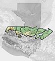
Location of San Mateo Ixtatán in Franja Transversal del Norte

See also
 In Spanish: San Mateo Ixtatán para niños
