Sarah Parcak facts for kids
Quick facts for kids
Sarah Parcak
|
|
|---|---|

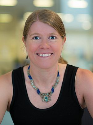
Parcak in 2014
|
|
| Born |
Sarah Helen Parcak
1978 (age 47–48) |
| Occupation | Professor at the University of Alabama at Birmingham, Archaeologist, Egyptologist, Remote Sensing Archaeologist |
| Spouse(s) | Greg Mumford |
| Children | son, born 2012 |
Sarah Helen Parcak is a famous American archaeologist and Egyptologist. She uses special tools like satellite imagery to find ancient places. She has found many possible archaeological sites in countries like Egypt and Rome. She also looks for sites in other areas that were once part of the Roman Empire.
Sarah Parcak is a professor of Anthropology at the University of Alabama at Birmingham. She also leads the Laboratory for Global Observation there. With her husband, Greg Mumford, she directs projects to explore and dig up sites. These projects are in places like the Faiyum, Sinai, and the East Delta region of Egypt.
Contents
Learning and Early Work
Sarah Parcak was born in Bangor, Maine, in 1978. She studied Egyptology and Archaeology at Yale University. She earned her first degree in 2001. Later, she received her advanced degree (Ph.D.) from the University of Cambridge.
Before becoming a professor at the University of Alabama at Birmingham (UAB), she taught about Egyptian art and history. She taught at the University of Wales, Swansea. While at Yale, Sarah Parcak went on her first archaeological digs in Egypt. She also took a course on remote sensing, which uses technology to study things from a distance.
Using Satellites for Discovery
Sarah Parcak is known for using satellites to find hidden ancient sites. From 2003 to 2004, she used satellite images and ground surveys. This helped her find interesting archaeological sites. Some of these sites were from as far back as 3,000 B.C.
How Satellite Archaeology Works
Parcak's work involves looking for tiny differences in the land. She studies the shape of the land (topography), the types of rocks (geology), and the plants growing there. Satellites can record special light waves called infrared. These waves help show differences in a plant's chlorophyll. Plants growing over buried structures often look less healthy. This difference can point to ancient buildings or walls hidden underground.
Teamwork in Egypt
Sarah Parcak works with her husband, Dr. Greg Mumford. They lead projects in the Faiyum, Sinai, and Egypt's East Delta. They use satellite images to find water sources and archaeological sites. This method saves time and money. It is much faster than searching for sites only on the ground.
In 2007, Sarah Parcak started the Laboratory for Global Observation at UAB. This lab helps with her satellite research.
Watching for Looting
In 2009, satellite images showed holes in the ground in Egypt. This was evidence that looting of ancient sites had increased. Satellites can help monitor and protect these important historical places. The Egyptian government has started its own satellite project. This project helps them watch archaeological sites from space. It protects them from looting and illegal building.
Awards and Other Projects
In 2015, Sarah Parcak won the $1 million TED Prize. This award is given to people with great ideas. In 2016, she received the American Ingenuity Award from Smithsonian magazine.
Searching for Vikings
In 2016, Parcak and her team used satellite images to look for Viking sites. They thought they found a second Viking site in North America. It was located in Newfoundland. However, when people dug there, they found it was not a Viking site. It also had no other important archaeological meaning.
Other Global Projects
Her team also found a large ceremonial platform in Petra. Petra is an ancient city. Parcak also worked on a project called GlobalXplorer. This project used satellites to map all of Peru. It was a crowdsourcing project, meaning many people helped by looking at images online.
In 2020, she received a fellowship from the John Simon Guggenheim Memorial Foundation.
TV Documentaries
Sarah Parcak's work has been featured in several TV documentaries. These shows help share her discoveries with a wider audience.
Egypt's Lost Cities
In May 2011, the BBC aired a documentary called Egypt's Lost Cities. This show described research by Parcak's team at UAB. They used infrared satellite imaging from commercial and NASA satellites. The team announced they had "discovered" 17 pyramids, over 1,000 tombs, and 3,000 ancient settlements near Sa el-Hagar, Egypt. However, the Minister of State for Antiquities, Zahi Hawass, said this information was not correct.
Other Shows
In May 2012, Sarah Parcak was featured on CNN's The Next List. This program highlights people who are making progress in different fields.
She was also the main focus of "Rome's Lost Empire." This TV documentary by Dan Snow first aired in December 2012. In the show, she identified possible ancient Roman sites in places like Romania, Tunisia, and Italy.
A BBC and PBS show called Vikings Unearthed aired in April 2016. It showed her use of satellite images to find possible remains of a Norse or Viking presence. This was at Point Rosee, Newfoundland. In 2015, Parcak thought she found a "turf wall" and roasted iron ore. But in 2016, an excavation showed these were natural formations, not ancient structures.
See also
 In Spanish: Sarah Parcak para niños
 | Kyle Baker |
 | Joseph Yoakum |
 | Laura Wheeler Waring |
 | Henry Ossawa Tanner |

